
by Michael R. Allen
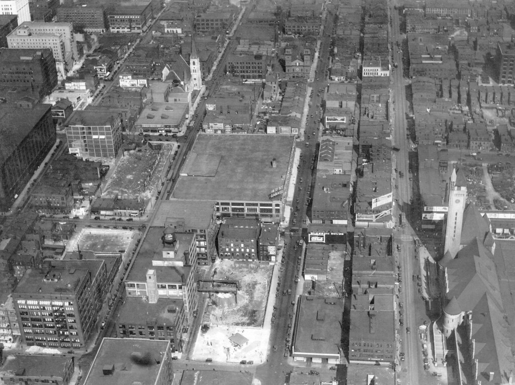 Following up on Monday’s article about the Railton Residence, here is an aerial photograph of the area of downtown around the Railton site from 1926. This photograph is from the collection of the City Plan Commission. At right, one sees the tower of Union Station. At center is the full-block-sized 18th Street Garage, designed by Klipstein & Rathmann and completed in 1924. The cleared site for the Robert E. Lee Hotel (now the Railton) is just diagonally down to the left of the large parking garage. (A larger cleared site is on the block east, or up from this perspective.)
Beside Union Station, the 18th Street Garage and a few wholesale buildings, most of the buildings in this image are two to three stories and more typical of St. Louis’ neighborhood vernacular forms than our modern downtown architecture. This area was an eastern extension of Mill Creek Valley, with a largely African-American and exclusively poor and working-class population. City leaders took aim at this “slum” as early as the 1890s. Starting in 1928, using money from the $87 million raised in a 1923 multi-part bond issue, the city would clear the block across the street from Union Station for a large plaza (now Aloe Plaza). The new post office and Municipal (later Kiel) Auditorium east of Union Station would claim more of the western downtown area’s small buildings. By 1961, the city would have obliterated over 75% of the building stock seen in this view.