by Michael R. Allen
Versions of this article were published in Common Ground, Spring 2003 and the already-missed Creative St. Louis, March 2010.
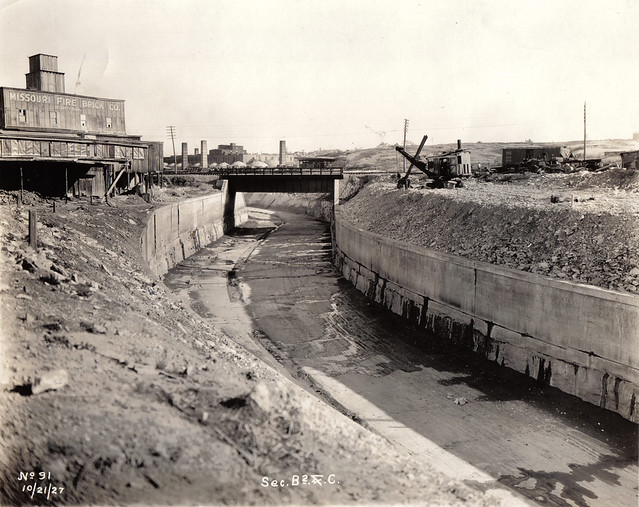
Along the southwest edge of the city of St. Louis, Missouri runs a six-mile curve of what appears to be a river with paved banks. This river is usually dry and rarely filled to even half its capacity. Covered in rip-rap and white stones along this six miles, the banks form a visual boundary of the city limits — although the actual city line is several hundred yards west. Still, the moat-like river creates an effective border between the middle-class parts of the county and city that occupy either side of it. Yet this river actually unites them, because it carries away all of their wasted water and, deep below its channel, their sewage. The river is the River Des Peres, a harnessed channel that was transformed from a natural waterway into a massive civil engineering project in the early twentieth century.
Of course, the River Des Peres is not simply a deep gorge that carries away waste water from the city and its inner suburbs. In fact, it now lies almost completely underground and is not visible at all. In a 1988 booklet published by the Metropolitan Sewer District (MSD), the quasi-governmental agency that has controlled the river since 1956, an anonymous author writes that “the rocky banks of the River Des Peres form a landmark which nearly every St. Louisan recognizes, but few understand.” Few Saint Louisans realize that its 18 miles extend along over half of the city’s western edge, covering a drainage area of 115 square miles and serving a population of over 535,000 people. It enters the city at Skinker Boulevard and Vernon Avenue at the University City limits and then winds its way through Forest Park and into the familiar open section that drains into the Mississippi River. Along the way, it carries both storm water and sewage in separate pipes with connections to most major city and inner-suburban trunk sewers. It is the backbone of the St. Louis sewer system.
Very few residents recognize that the River Des Peres became the backbone of the St. Louis sewer system by having its natural state completely rebuilt so that none of its original features remain. No living person likely remembers the days when all of it was an open and wild, albeit polluted, waterway that St. Louisans happened to dump sewage into. And few accounts describe its earlier incarnation as a pure waterway far from the French settlements on the Mississippi River. In those days, the idea of the River Des Peres becoming one of the largest regional civil engineering projects in the Midwest would have seemed strange. Yet St. Louisans slowly converted the small river into their largest sewer over the course of more than a hundred years, so most of the changes were hardly noticed until the river was already irreversibly controlled by engineers looking to drain unwanted materials from the young city of St. Louis.