 Preservation Research Office
by Michael R. Allen
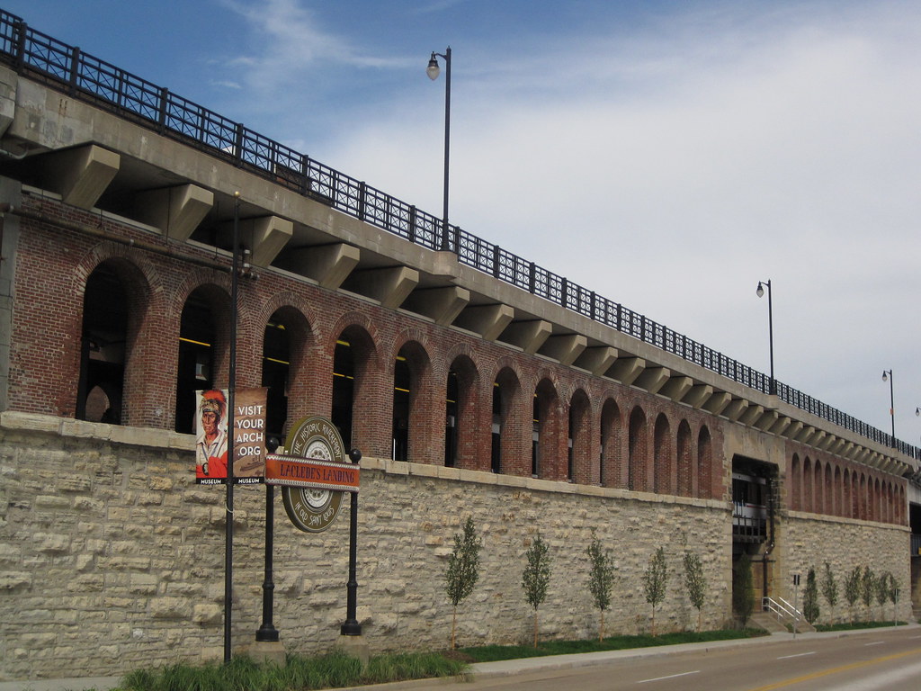
The southern flank of the mighty Eads Bridge has received a major landscape upgrade, due to the efforts of Metro, the Jefferson National Expansion Memorial and the Laclede’s Landing Redevelopment Corporation. That is to say, the strip between the bridge approach and Washington Avenue actually now is landscaped! The difference between the formerly part-mulch, part-dirt terrain and the new verdant tree-planted, grassy, flowery setting could not be more stark.
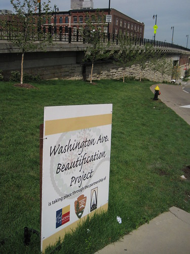 For years, this area was a disgraceful disarray in an area marred by many such urban design problems, including the intrusive elevated section of I-70, the parking garage barrier on the northern edge of the Memorial and the lackluster riverfront itself. The “Washington Avenue Beautification Project” does not resolve these larger issues, but vanquishes the terrible appearance of a very-visible area. Pedestrians on the Eads Bridge can now look out at the Gateway Arch and grounds, and look down and see an extension of that inviting park setting.
I do have a quibble with the project concerning the lack of sidewalk on most of this side of Washington. (The other side of the street has a continuous sidewalk.) The photograph on the left shows the sidewalk running east from Second Street to First Street, while that on the right shows the strip running west.
 |
 |
Addition of metered parking here — something that Metro, operator of the garage, would likely oppose — would be desirable. Meters would relieve parking problems on the Landing and calm traffic. However, a continuous sidewalk would be needed. Perhaps this issue can be explored in any design competition that the National Park Service (NPS) undertakes for the Memorial. NPS’ draft general management plan for the Memorial identifies the parking garage site as potentially worth repurposing, so this corridor could be transformed at some point.
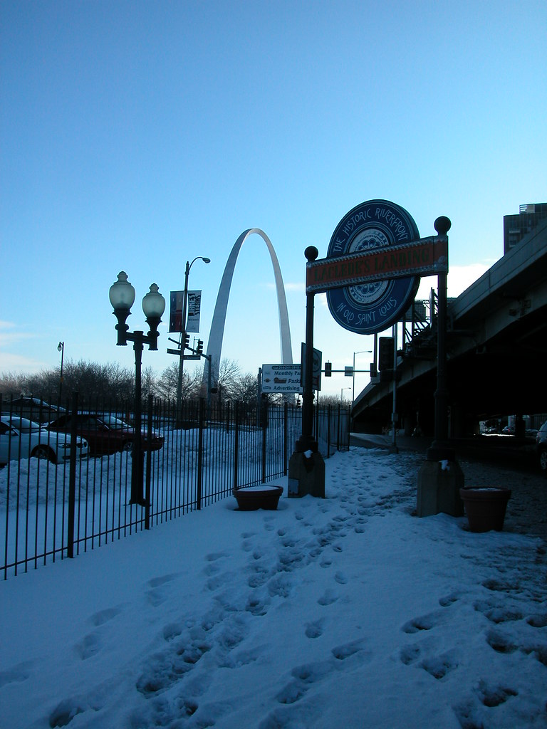
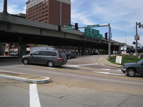 Of course, the sidewalk would lead westward walkers out into the morass of the Eads Bridge/Memorial Drive/Washington Avenue intersection. This intersection may be the most confusing in the city! Hopefully any design competition will lead to resolution of this problem, which plagues one of the Memorial’s key entry points. Removal of the interstate is the most direct way to clarify traffic issues here, but that removal is probably on a slower track than the design competition timeline. Who knows? Perhaps the design competition will be the impetus for grad civic thinking on urban design, and our political leaders will embrace a visionary change downtown like those who laid out the Memorial did so long ago.
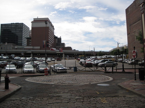
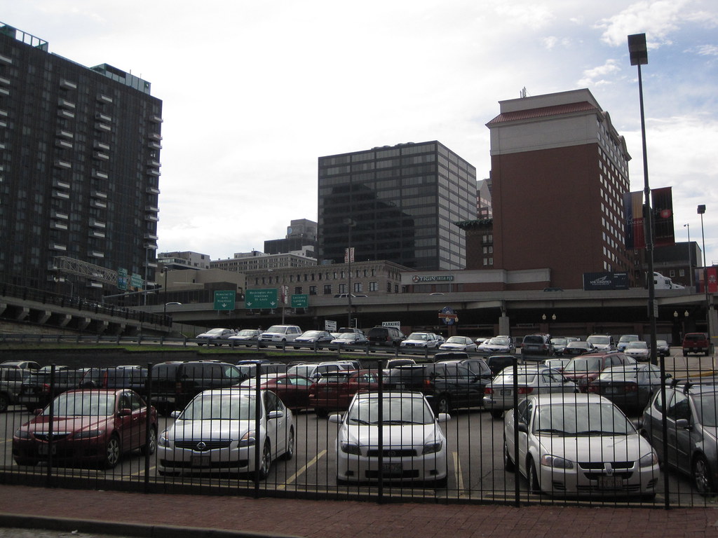
For now, the most-traveled pedestrian path between downtown and the Landing is right here. Can’t see the path? Well, look carefully. There is a gate-sized opening in the fence of this parking lot on Second Street. People walk back and forth across this lot all day long, because it remains the most direct link between the Landing and downtown. It does not require much imagination to recognize that there is a major connectivity issue here. A sidewalk on Washington would have helped, although the larger disconnect between the riverfront and downtown remains the big problem.
The Washington Avenue Beautification Project points the way to a realistic way to implement changes to the riverfront that will add up to transformative action. While we need visionary leadership on the riverfront design challenge, we also need resolution of glaring quality of experience problems whose resolution is obvious. This space on Washington needed landscaping, and now it is landscaped. Laclede’s Landing needs a better pedestrian connection to downtown. Perhaps a sidewalk on the north side of Washington is the way to go — narrow the street, build a sidewalk along the new plantings. Perhaps the path already being used could be formalized through reconstruction of Lucas Avenue west through the parking lot. Let’s follow one change with another and keep the momentum rolling.
by Michael R. Allen
Robert W. Duffy’s article “To connect the Arch to the city (and the river), find the middle” in the Beacon broadcasts the good news from this weekend: a group of concerned citizens forged a coalition to address the issue of reconnecting downtown St. Louis to the Arch grounds and the riverfront, and vice versa.
The meeting and consensus for forward movement potentially could tie together many disparate strands of thinking:
All of these ideas and plans are in various stages of reality. Most have yet to move beyond talking points and renderings. Isn’t the moment ripe to link these plans together through a master vision for the central St. Louis riverfront? The people who came together on Saturday think so, and will spend the next few months trying to link the many ideas for making the city’s front entrance a beautiful one.
Two demolition updates from guys named Paul H.:
At Vanishing St. Louis, Paul Hohmann reports that the gasometer at Laclede Gas Light Company Pumping Station G has fallen.
In today’s St. Louis Post-Dispatch, Paul Hampel reports on the confusion surrounding the salvage of the cast iron storefront of the Switzer Building.


Tuesday night.
by Michael R. Allen
On the first night of wrecking the Switzer Building on Laclede’s Landing, the going was slow. The crane operator knocked loose a few columns and triggered one small collapse, but stopped wrecking by midnight. There are many nights ahead this week before the memorable painted Switzer signs on the south and north elevations disappear, and more time before the primary elevation on 1st Street is gone forever.
Several people gathered on the upper level of the riverfront parking garage to watch the wrecking.
by Michael R. Allen
Demolition of the Switzer Building begins on Monday. Supposedly the wrecking ball will make its first strike at 10:00 p.m. that day. More information is available in this post on MayorSlay.com. Demolition will not include the three adjacent historic buildings to the north also owned by Clarinet LLC. Clarinet is salvaging the cast iron storefront and much of the decorative limestone from the front elevation for potential reuse.
by Michael R. Allen
Walking to Laclede’s Landing today on business, I wondered when exactly was the last time that I was there to do anything other than photograph a building or lead a tour group. I was drawing a blank until I remembered an art opening there recently and shows at the shuttered Missisippi Nights, the one venue that seemed to bring any locals not looking for straight-ahead drinking to the Landing.
I’m sure that others have similar difficulty remembering when they have been to Laclede’s Landing. The disconnect between the charming, historic and architecturally splendid district and the rest of downtown is huge, and not simply physical. The longer that disconnect perpetuates, the more missed opportunities for the city to celebrate its waterfront heritage and the related great architecture.
In many cities, this would be a premiere residential district. The proximity to the river and the iconic Gateway Arch create commanding views that — unlike most here — include the Mississippi River. How much more unique character could one find here? Laclede’s Landing is a cultural asset whose fortunes seem lost — for now.
by Michael R. Allen
According to records on Geo St. Louis, on Clarinet LLC applied for a demolition permit for the Switzer Building on March 6. The Switzer Building, located at 612 N. 1st Street on Laclede’s Landing, sustained major damage, including the collapse of its eastern wall, during a fierce storm on July 21, 2006. Emergency stabilization work commenced after the storm, but rehabilitation work in progress at the time never resumed.