Categories
National Register North St. Louis O'Fallon

O’Fallon Neighborhood to Become a Historic District

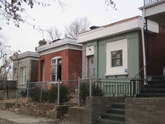
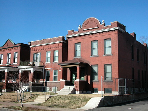
Houses on the 4500 block of Fair Avenue, just south of West Florissant Avenue.

by Starr Meek and Lynn Josse

This article first appeared in The Northsider.

The buildings found in the entire O’Fallon neighborhood and in O’Fallon Park should be an official historic district in early 2012. Over the next year, historians from the Preservation Research Office will be found in every part of the O’Fallon neighborhood and in archives all over town. They will be putting together the story of the neighborhood in order to nominate it to the National Register of Historic Places. Alderman Antonio French funded the project for The Acts Partnership in order to increase investment within the neighborhood by enabling property owners to benefit from historic preservation tax credits.

This work takes place at the same time that a similar project is taking place in Penrose, meaning that almost all of the 21st Ward could be included in historic districts in the next year. Currently, Holly Place — the 4500 block of Holly Avenue — is the only historic district in the ward.
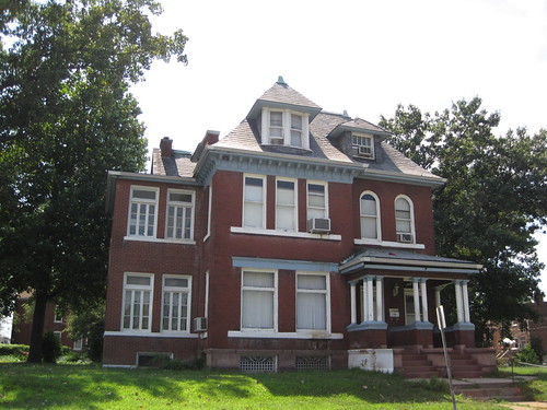
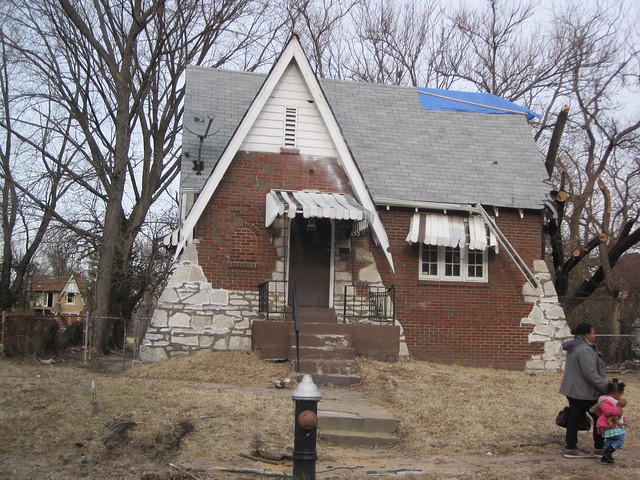
A house on Algernon Street facing O'Fallon Park.

“National Register historic districts lead to tremendous benefits for urban neighborhoods,” said team leader and Preservation Research Office Director Michael Allen. “They contribute to a sense of community pride, build identity, and can bring resources and investment.” Unlike local historic districts, the proposed National Register district will not involve any additional restrictions on properties — just benefits such as Missouri’s 25% historic rehabilitation tax credit.
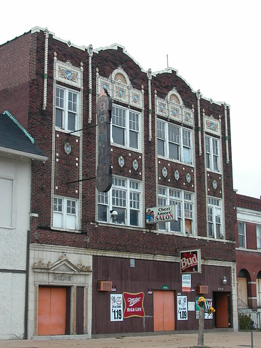
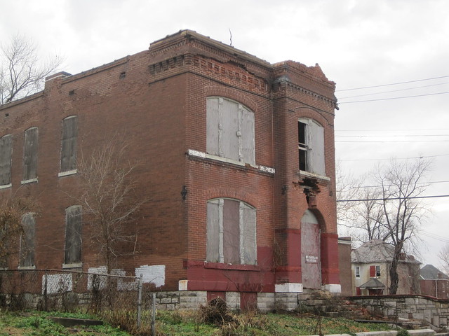
This three-story commercial building on Warne Avenue once housed an upstaird bowling alley.

The O’Fallon neighborhood has a long and interesting history. Subdivision development began as early as 1859 with the subdivision of the White family’s farm. Other major landholders in the area are now familiar names, including Shreve, Vandeventer, Carter, and of course O’Fallon. In 1875, the city purchased portions of John O’Fallon’s estate, dedicating 158 acres as O’Fallon Park in 1875. Amenities were added with the lake in the 1890s and the boat house in 1908.
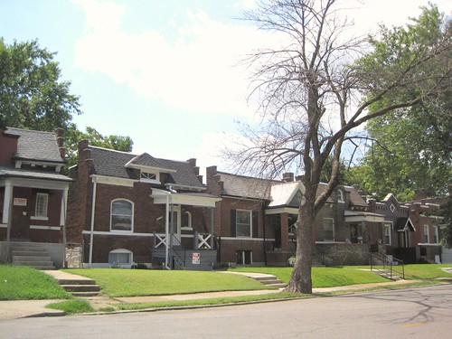
Houses on Carter Avenue.

The development of O’Fallon Park led to development of the area just south through the O’Fallon Heights, Plymouth Park and Wanstrath Place subdivisions. Early transit lines to the area were limited to parts of Natural Bridge in the 19th century. Streetcar service was later added on Florissant, Lee, Newstead and Fair/Harris avenues. These subdivisions generally were developed between 1890 and 1930 with buildings using prevalent locally-sourced materials like decorative and standard brick, limestone, and clay roof tile. Major buildings include the Boathouse in O’Fallon Park, Holy Rosary Church and Full Gospel Apostolic Church.

To be listed in the National Register of Historic Places, a neighborhood must have significant architecture or history. O’Fallon retains a consistent density and use of common building materials that unites the neighborhood. The entire process will take a little more than a year from project beginning in February to its end next spring.
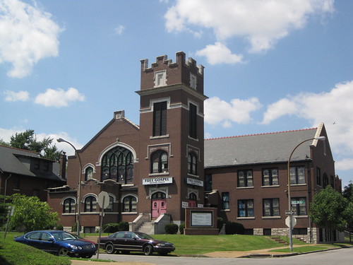
The Full Gospel Apostolic Church, built in 1913, at Rosalie and Red Bud avenues. Currently The Acts Partnership is raising funding to acquire the church for reuse as a community center.

Oral History Project

As part of the survey and historic district project, the Preservation Research Office is conducting interviews with O’Fallon residents. Our intern Christian Frommelt, a senior anthropology major at Washington University in St. Louis, has a special interest in oral history that we are utilizing this spring. The historians especially want to get stories from long-time residents. Since much of the neighborhood was built a long time ago, the team wants to make sure that current residents are also part of the recorded history of O’Fallon. Team members will collect residents’ stories about the neighborhood at the Acts Partnership office at 4202 Natural Bridge throughout the spring.

Categories
Events Lewis Place North St. Louis

Rehabbers Club Tour of Lewis Place Tomorrow

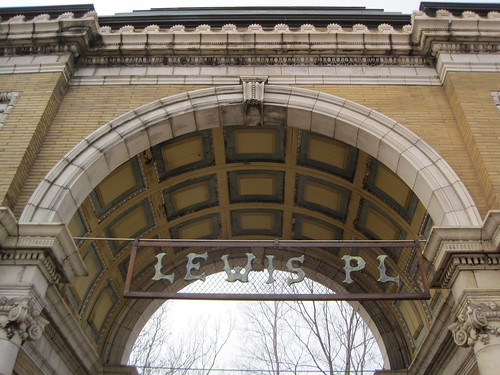
Detail of the Lewis Place gate at Taylor Avenue, designed by Barnett, Haynes & Barnett and completed in 1894.

St. Louis Rehabbers Club Tour of Lewis Place
Saturday, February 19, 2011
9:30 – 11:30 a.m.
Location: 4535 Lewis Place, St. Louis, MO 63113

The St. Louis Rehabbers Club will feature Lewis Place. The neighborhood is immediately north of the Central West End and was recently in the news for extensive tornado damage. Our tour will not only look at rehabs, but will also view the tornado damage to these historic properties.

Our first stop of the day is 4535 Lewis Place. The new home owner and rehabber has lots to show on the work completed. With a setback from the tornado, the property owner is eager to move forward on other projects around the house.

Next, we will move to #50 Lewis Place. This young family purchased her grandparents’ home several years ago and have done an excellent job fixing it up.

We’ll look at the damage on Enright and Newberry Terrace before visiting 4604 Newberry. This gentleman inherited this home almost two years after his 90 year old dad passed away. He has been working on this house since then and is happy to show his rehab progress.

Lastly, we’ll ride and view the damage on Page, Martin Luther King Dr, Aldine, Cote Brillian, and Evans. If time permits we will visit 4530 Evans. Work has been done on the living room, dining room and kitchen though it too sustained some tornado damage.

For more information on Lewis Place, please visit Lewis Place Historical Preservation.

We look forward to seeing you on Saturday morning. Call Scott McIntosh, St. Louis Rehabbers Club Vice-President at 314-719-6507 with questions.

St. Louis Rehabbers Club tours are FREE and are open to anyone interested in the City of St. Louis. St. Louis Rehabbers Club is program of ReVitalize St. Louis, a registered 501c3 nonprofit organization. For more information, please visit www.rvstl.org.

Categories
Brick Theft JeffVanderLou North St. Louis Northside Regeneration

Brick Theft Before/After

We recently gave Bill Streeter, director and producer of Brick By Chance and Fortune, some 60 before and after images of north St. Louis buildings struck by brick thieves since 2005. Our photographs illustrate perhaps as little as one third of the buildings in the city destroyed through theft in that period.

Here’s a sample. For the rest, you won’t wait long: Brick by Chance and Fortune will be released this spring.
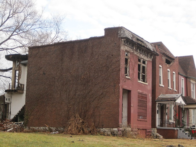
The building at 3114 Glasgow Avenue in JeffVanderLou, May 2009. Owner: Northside Regeneration LLC.

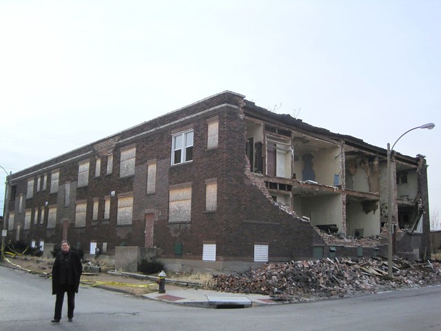
The building at 3114 Glasgow Avenue, December 2010. The building has collapsed further but the wreckage remains.
Categories
Infrastructure North St. Louis St. Louis Place

St. Louis Place: Sidewalk Plaques and Brick Alleys

by Michael R. Allen

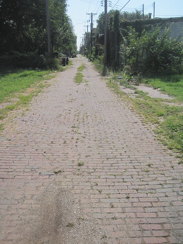
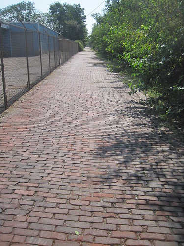
Strengthening the historic setting of the St. Louis Place neighborhood’s dense core, now nominated to the National Register of Historic Places as a historic district by the Preservation Research Office, are remaining parts of the built environment beyond buildings. There are several remaining brick alleys and historic granitoid sidewalks on and around St. Louis Avenue between 20th Street and Parnell Avenue.

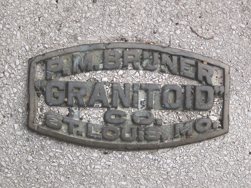
If the word “granitoid” is not familiar, the appearance probably is. Granitoid sidewalks included crushed aggregate rock in the cement to create a speckled walk with the surface appearance similar to granite. Granitoid paving dates to the 1890s and was common through the early part of the 20th century. Contractors often left a metal plaque embedded in the pavement to identify their work. St. Louis Place is fortunate to not only have these plaques left, but to have hundreds of feet of historic sidewalk paving largely in good repair.

A Frank J. Sullivan sidewalk plaque on St. Louis Avenue, with the date of paving.
A P.M. Bruner Granitoid sidewalk plaque on St. Louis Avenue.
The alley between University Street and St. Louis Avenue on the north and south, and 25th and Parnell on the east and west.
The alley between St. Louis Avenue and Montgomery Street on the north and south and 25th Street and Parnell Avenue on the east and west.
Categories
National Register North St. Louis St. Louis Place

St. Louis Place Nominated for Historic District Designation

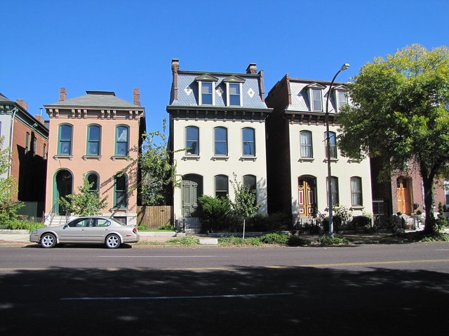
There are several stone-faced houses in the Second Empire and Italianate styles on the north side of the 2200 block of St. Louis Avenue.

In July, the Preservation Research Office embarked upon an architectural survey of the St. Louis Place neighborhood funded by Alderwoman April Ford-Griffin and overseen by Community Renewal and Development, Inc. By October, we selected boundaries for a historic district and began drafting a National Register of Historic Places nomination for a core area of the neighborhood. That nomination will be submitted to the Missouri State Historic Preservation Office on Monday.

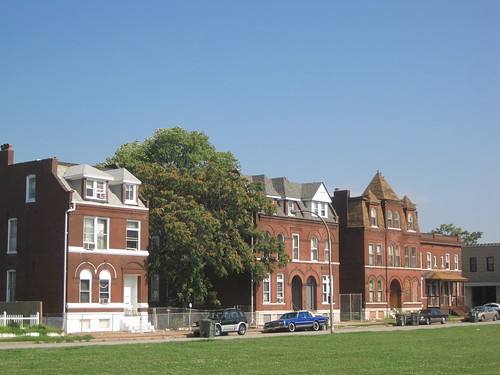
The west side of the 1800 block of Rauschenbach Avenue, facing St. Louis Place Park.
Until recectly home of the Youth and Family Center, the oldest section of the former Freie Gemeinde at 2930 N. 21st Street dates to 1869.

After submission, we will be sharing more of our research and findings here. For now, we are posting a handout we used at last night’s public meeting on the project. The document shows the boundaries and briefly explains the process and benefits of the historic district designation. That document is online here.

After the historic district nomination is completed, Preservation Research Office will be working with Alderwoman Ford-Griffin and Community Renewal and Development to develop a public history component to the project. We have learned a lot about the heritage of the neighborhood’s built and social environment that belongs to its people, and we will share what we know through publications, tours and events.

We Still Need Your Help

If you are a current or former resident or property owner in St. Louis Place, or just someone who has spent time there, you may have information that can aid us as we continue our work. Photographs, especially those taken before 2000, will help us. Your stories about your house, neighborhood businesses and churches and other aspects of St. Louis Place’s past are needed. If you want to share photographs or information with us, contact Michael Allen at michael@preservationresearch.com or 314-920-5680.

Categories
Brick Theft North St. Louis Vandeventer

More Depletion, West Evans Avenue

by Michael R. Allen

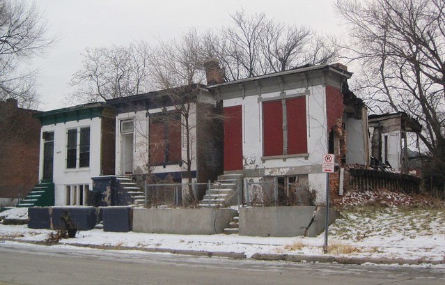
There is a certain charm to the row of three stone-faced houses on the south side of the 4200 block of West Evans Avenue. The bracketed wooden cornices and stone sills with carved consoles add elements of the Italianate style prevalent in the United States in the middle-to-late 19th century. The carved moldings around the tops of the window and door openings provide stylistic flair and craftsman’s expression to the front walls. Although two are vacant, the group — which probably dates to around 1888 –seems to be in great shape.

Great shape except for the stolen side walls, of course. Brick thieves have stripped away the most valuable parts of the westernmost house at 4258 West Evans — and the lovely carved stone pieces and articulated cornices are not what has street value now. Red brick does.  Not surprising, perhaps, is that these houses are just a half-block west and across the street from a “doll house” that I photographed in December 2009 (see “Depletion, West Evans Avenue” from December 3, 2009).

The battered house is owned by Laverne Henley of Compton, California, and has been condemned for demolition since January 25, 2010. The other two houses are privately owned, and thankfully one is occupied. At least two of these houses should survive into the near future.  Perhaps also in the near future will come laws that will curtail brick theft once and for all.

Categories
Hyde Park Lewis Place North St. Louis Severe Weather The Ville

North St. Louis Tornadoes Past and Present

by Michael R. Allen

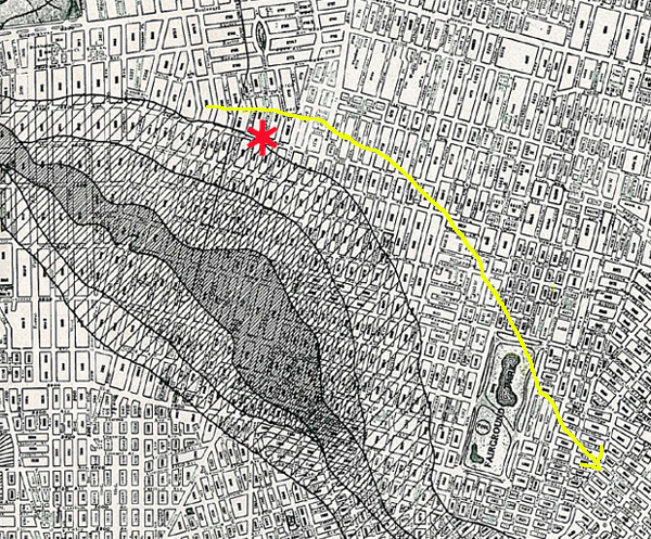
The map of the 1927 tornado produced by the Engineer's Club and the St. Louis Chapter of the American Institute of Architects. Click for large version.

On September 29, 1927, a massive tornado made its way across the city on a northeasterly track. The path of destruction widened in a part of north St. Louis stretching from Fountain Park to Hyde Park.  The worst damage was just west of Grand Avenue between Delmar Boulevard and St. Louis Avenue, but every place in the path was wrecked badly. The Report on the St. Louis Tornado of September 27, 1927 by the Joint Committee of the Engineers’ Club and St. Louis Chapter, American Institute of Architects displayed the staggering destruction of the built environment, chronicled the human loss and called for upgrades in construction techniques. A subsequent major tornado in 1959 spared north St. Louis but left major damage in the Dogtown and Central West End neighborhoods.

Compared to the 1927 and 1959 tornadoes, as well as the famous 1896 “Cyclone,” the tornado that struck the city on December 31, 2010 was mercifully weak. Still, the track of the officially-declared EF1 tornado is longer than the damage suggests. The National Weather Service has published track maps of the recent St. Louis area tornadoes that shows the north St. Louis tornado to have left a 2.1-mile track starting around Lewis Place and moving northeast toward Fairground Park before lifting. The tornado touched down at 12:08 a.m. and lasted for three minutes.

The paths of the 1927 and 2010 tornadoes compared. The Lewis Place gate at Taylor Avenue is marked with a red asterisk.

The track of the 2010 tornado is notably similar to the 1927 track. Although the tracks and damage areas do not overlap, they follow a similar shape. The origin of the 2010 tornado is slightly west of the outer path of tornado damage in September 1927, although it is still farther from the actual tornado track.  Another difference is that the 1927 tornado did not lift until it reached the river.

While the city was spared a major disaster on New Year’s, it endured a tornado that caused severe property damage and left at least a dozen households homeless.  History shows worse could have happened, but also that north St. Louis has been hit by a tornado before.  Disaster preparedness, urged in 1927 by leading engineers and architects, remains a crucial matter for the city.

Categories
Lewis Place North St. Louis

Lewis Place Day

by Michael R. Allen

Today Lewis Place, still dealing with damage caused by a New Year’s Eve tornado, received some powerful assistance. The day started when the St. Louis Post-Dispatch published its annual Dr. Martin Luther King. Jr. Day editorial on the need for the region to get behind Lewis Place. (Read the editorial,“Dreams in the Wind”.) The eloquent call for action was written by editorial writer Eddie Roth.

Residents gathered today to listen to announcements by Mayor Francis Slay, Alderman Terry Kennedy and United Way CEO Gary Dollar.

At 10:30 a.m., big news was delivered directly to the residents of Lewis Place. Mayor Francis Slay, Alderman Terry Kennedy (D-18th) and United Way Chief Executive Officer Gary Dollar arrived at the 4500 block of Lewis Place to announce that the United Way has created a tornado assistance fund for Lewis Place. Mayor Slay also officially proclaimed today Lewis Place Day and presented a framed proclamation to Lewis Place Historical Preservation President Pam Talley.

Pam Talley talked to reporters about what the neighborhood has gone through between the tornado strike on December 31 and today. Here’s a clip.

A declaration of major disaster in pending at the federal level. Missouri Governor Jay Nixon requested the declaration Friday so that Federal Emergency Management relief funds can be made available to residents of Lewis Place and other areas of the state affected by the tornadoes.

Still the residents of Lewis Place rejoiced today that the region’s largest charitable organization was standing behind them.

Mayor Francis Slay presents his proclamation to Pam Talley.

Today’s announcement is an amazing show of support, but it’s only the start of the effort to rebuild. I urge my readers to contribute to the United Way fund to lend financial support, and to contact me to donate construction, architectural or engineering services. Even after the last storm damage is repaired there will be work to do — the work that the residents were doing before this interruption.

Categories
Lewis Place North St. Louis Severe Weather

Two Weeks Later, Lewis Place Still Suffering from Storm Damage

by Michael R. Allen

Today we are two weeks away from the day when a severe squall line moved through St. Louis, but for some people that is not a lot of time. On the north side, several neighborhoods are still dealing with widespread property damage and the looming uncertainty of whether homes will remain homes. Some owners lack insurance, while others may have policies with deductibles above the costs of repairing damage. Those costs may still be prohibitive for elderly and poor residents.

Yesterday this blog showed scenes from the Ville (see “Ville Area Still Recovering from New Year’s Eve Storm”). Today let us turn our attention to the Lewis Place neighborhood to the southwest of the Ville, where damage to the historic buildings there is even more widespread. Lewis Place has made it through the ravages of demolition, abandonment and disinvestment and has been on the upswing in recent years. Disaster was the last thing Lewis Place needed.

On Sunday, Lewis Place Historical Preservation, Inc. President Pam Talley showed myself and Lynn Josse the damage that compels our assistance — and yours. What we saw demands St. Louis’ full attention.

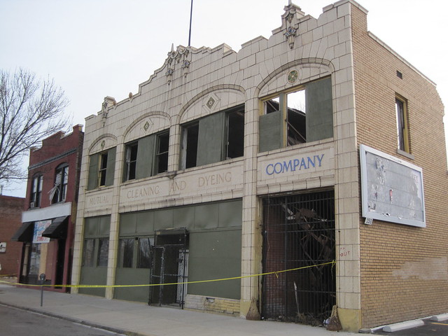
The storm pummeled the rear of the ornate former dry cleaning plant at 4536-38 Dr. Martin Luther King Drive.

Just one block south of the apartment building at Deer and Aldine avenues that suffered a collapse is an ornate two-story, terra-cotta clad building on Dr. Martin Luther King Drive. The former dry cleaning plant, with its baroque facade, is little more than a front wall after New Year’s Eve.  The one story rear wing collapsed completely and much of the two-story front section fell in on itself.  Demolition of the privately-owned vacant building is next, no doubt, but the front elevation ought to be salvaged.

The metal porch at right was destroyed on this house in the 4500 block of Evans Avenue.
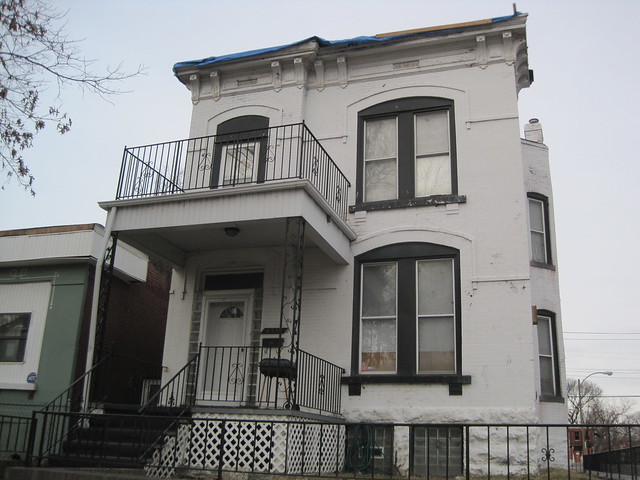
A blue tarp is keeping water out of the house at Evans and Deer avenues, which lost parts of its rolled asphalt roof.

One block south, damage is intense in the 4500 and 4600 blocks of Evans Avenue. Few houses escaped broken windows, many lost or small large parts of their roof and some even lost their wooden or metal porches.

These three houses on Evans Avenue have missing roofing and broken windows.
This house on Evans Avenue is being rehabilitated. The roof was blown off and new windows destroyed in the storm.

Lewis Place storm damage was not limited to historic buildings. New houses on Page Boulevard lost siding and shingles and suffered broken windows. However, like most neighborhoods in north city, Lewis Place’s housing stock is mostly composed of historic buildings. That means most damage affects older homes that are more difficult to insure adequately and that already have maintenance problems that often drive up repair costs.

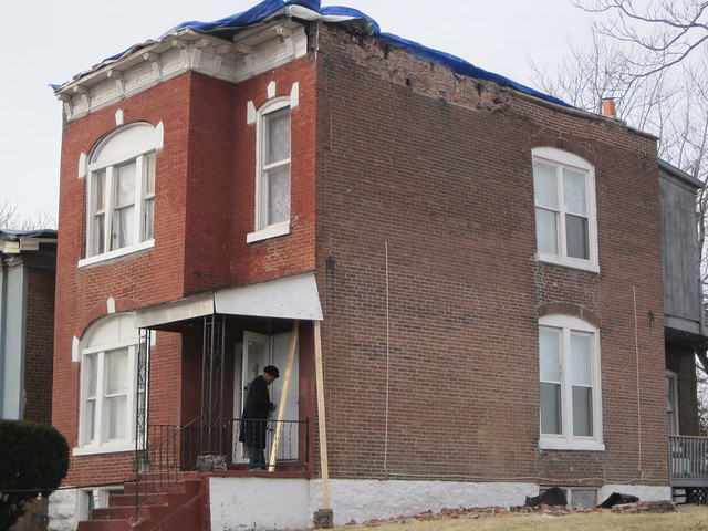
This house in the 4500 block of Enright Avenue was hit hard by the storm on December 31. Last weekend the owner was working diligently to make repairs ahead of the snow that fell Monday.

We saw damage on streets throughout Lewis Place, including Vernon Avenue, Newberry Terrace, McMillan Avenue, Kensington Place and Enright Avenue. Pam reported that the city’s Forestry Division — usually not a timely factor in Lewis Place events — swept in quickly after the storm and worked throughout New Year’s weekend to clean up the large amount of tree debris generated by the storm. Still, such debris was piled everywhere. Most of all, at every turn we saw boarded windows, asphalt roofing material on the grounds, brick bats from chimneys and parapets, sagging porches, maimed fences and signs that something terrible had happened. Simply, we were tracking the path of a disaster.

These houses in the 4500 block of Lewis Place was hit hard by the storm on December 31.

When Pam took us to Lewis Place itself, our hearts sunk. The houses that were so essential to the civil rights struggle that made what we now call St. Louis possible stood with yellow caution tape in front. Some had collapsed front parapet walls. Others had boarded up windows, missing roofing and — in one particularly unnerving instance — a frozen waterfall under a window on a vacant house. Even #10 Lewis Place was ailing with its front porch collapsed. Dr. Robert and Fredda Witherspoon, who in the 1940s organized fair-skinned African-Americans to purchase homes on Lewis Place to break down restrictive covenants, called this house home for decades.

The front porch is damaged at #10 Lewis Place.

Pam told us that the Building Division rushed in after the storm, and had condemned houses the day of the storm. This is standard operating procedure following a disaster, because unsafe buildings must be vacated, but it still seemed insensitive to residents. Lewis Place Historical Preservation raised the money to hire a structural engineer for one resident who is being threatened with condemnation and eviction. Others face potential fines for code violations due to storm damage. This is a sad state for a street that has been a National Register of Historic Places historic district since 1980 and whose residents care deeply about both their neighborhood’s past and future.

At least six house son the north side of the 4500 block of Lewis Place have extensive damage, including masonry failure.

While the Building and Forestry divisions of the city treated the storm in Lewis Place like a disaster, other entities have not been so swift. While state officials and mayoral chief of staff Jeff Rainford visited the day after the storm, government assistance has not arrived yet. Pam says that the Salvation Army took eight days to send volunteers. Still Pam has not let the lack of response down — she has secured tarps, blankets and other items for needy residents. By the snow fall on Monday, only three houses with roof damage lacked tarp protection. Pam and her neighbors are used to doing things for themselves, and really are quite good at it. Still, they can’t do it alone — nor should they.

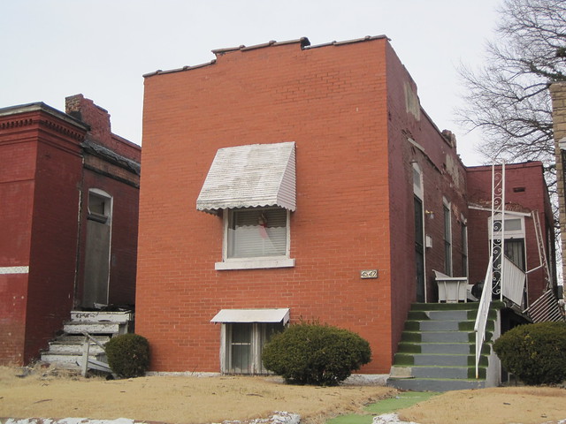
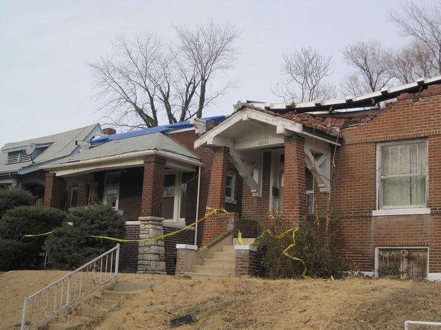
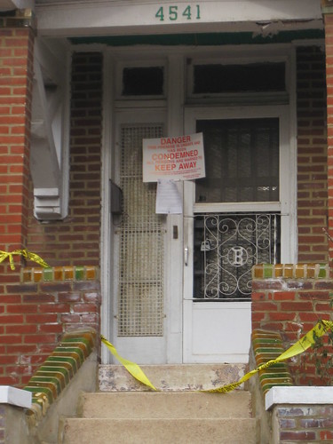
The bungalow at 4541 Lewis Place is condemned after its front parapet wall collapsed.

What You Can Do

Lewis Place needs our help! This historic neighborhood is part of our collective heritage, and we need to shoulder it through this rough moment. Consider helping by making a donation.

Assistance for the residents — a high percentage of them senior citizens — is welcome. Items needed are:
• Food items, both perishable and non-perishable, water, juice
• Blankets, toiletries such as toothpaste, tissue, mouthwash and soap
• Clothing such as gloves, caps, scarves, socks and underwear
• Trash bags

Donations can be made at Centennial Christian Church, 4950 Fountain Avenue, St. Louis 63108 between 9 a.m. – 2 p.m. The contact at the church is Cheryl Poynter at 314.367.1818.

Financial donations are needed, too, to assist homeowners with repairs and rebuilding. Checks can be made out to Lewis Place Historical Preservation, 3920 Lindell Blvd., Suite 206, St. Louis, MO 63108, and Attention Pam Talley. For information about how you can help, contact Talley at 314.535.1354.

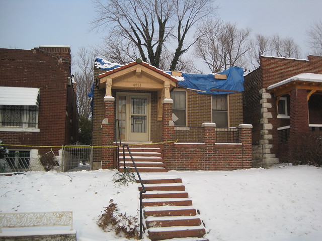
This week's snow compounded problems. This is 4551 Lewis Place.
Categories
LRA North St. Louis Severe Weather The Ville Urban Assets LLC

Ville Area Still Recovering from New Year’s Eve Storm

by Michael R. Allen

Severe storms that hit the city on December 31st have left lasting destruction in parts of north St. Louis. In the Ville and Greater Ville area, winds of over 70 miles per hour struck after noon and left blocks of houses with damage ranging from missing fascia cladding to entire collapses. Nearly two weeks later, building owners struggle to get damage repaired amid snowfall, cold weather and — in a few tragic cases — lack of insurance. And some of the buildings hit hard are owned by the city’s Land Reutilization Authority.

The storms on December 31 tracked just east of the path of the devastating tornado that hit St. Louis on September 29, 1927 — a disaster that struck coincidentally at 1:00 p.m. during the week. Over 75 people perished then. Luckily, no one died in the city on New Year’s Eve. However the face of neighborhoods may be changed socially and physically as families are forced to leave their homes and neighborhood landmarks are demolished.

In the last decade, Ville has been hard hit by waves of demolition, arson, brick theft and disinvestment. The storm’s path sadly cuts through the heart of a fragile neighborhood. Some solace can be taken in the fact that not only did the storm just barely avoid Dick Gregory Place — where a $9.5 million redevelopment is taking place — but also did not disrupt work. Workers worked through the storm inside of the 15 historic and two new buildings that comprise the project.

Here are some images of the damage that struck the Ville.

This multi-family building in the 1800 block of North Taylor Avenue at lost most of its roof.
A tree fell on this house in the 4500 block of Cote Brilliante Avenue.
This vacant LRA-owned residential building at 4596 Garfield Avenue suffered some masonry damage.
Damage was concentrated in the east end 4500 block of Garfield Avenue. The building at left had been hit by brick thieves before the storm but suffered a collapse during the storm. The occupied house next door suffered severe damage to the front parapet, showing that the wind blew at both north and south facing elevations.
The north elevation of a vacant apartment building at the southwest corner of Aldine and Deer avenues collapsed. The building is owned by shadowy speculator Urban Assets LLC.