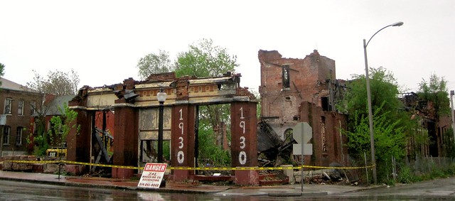
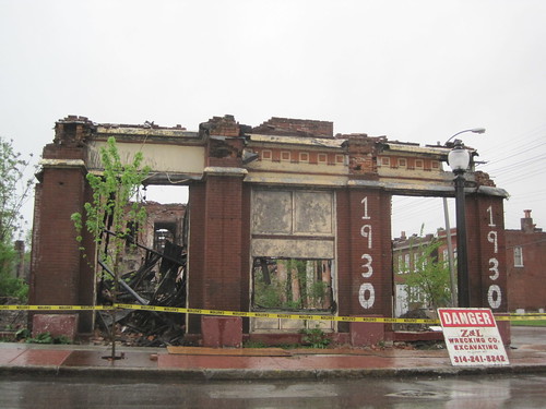
Yesterday a crew from Z & L Wrecking started taking down the ruinous northern portion of the Nord St. Louis Turnverein. This was deja vu to those who recalled the day when Z & L arrived to take down the buildings after the devastating fire on July 6, 2006 that destroyed the northern section. This time, the failing structural state led to the Building Division’s issuance of an emergency demolition permit on March 29, 2011.
The same view nearly five years ago in February 2006.
Developer Peter George stopped demolition and valiantly tried to find financing to rebuild the Hyde Park landmark. With the southern gymnasium addition of 1898 largely intact, rebuilding seemed like a reasonable path. Five years later, an imbalance of time and money has led to a more conservative approach. George came along late in the life of the building, purchasing it after the fire.
The remaining section of the front elevation.
The fateful decisions came earlier when the remaining Turners rejected the membership applications of a contingent of new members (including many leaders of Metropolis) in 1999, and when the group sold the buildings to a future felon named Doug Hartmann in 2004. Even before the fire on July 5, 2006, heavy winds had destroyed the roof of the older north building on April 2, 2006. The loss of a building can take time, and the loss of a community anchor can tragically drag out for years.
How is it that a city that has been labeled “the most distressed small in city in America†has also been home to some of the most amazing artists and talents in American life? And despite devastating population and job losses, how is it that East St. Louis has manifested such community resiliency and resolve? The Making of an All-America City: East St. Louis at 150 examines these paradoxes as it chronicles the rich history of this so-called failed industrial suburb. A collection of fifteen essays and one prose poem, The Making of an All-America City explores East St. Louis’ life as a river city, its complex experience with race, its challenges of deindustrialization, and the political choices that it has made from a wide range of perspectives.
Edited by prominent regional historian Mark Abbott, Harris-Stowe State University, The Making of an All-America City is a must-read for anyone who is interested in this fascinating city and what it says about America. This book is the first in the East St. Louis Sesquicentennial Series from Southern Illinois University Edwardsville, which aims to examine the city’s influence, document and preserve its history, and provide meaningful reference for historians to come. The book is available for purchase through Virginia Publishing at www.stl-books.com and soon should be available in area book stores.
The book includes a chapter by Preservation Research Office Director Michael R. Allen entitled “The Second Skyline: Downtown East St. Louis’ Unique Architecture.” Last week, Allen joined fellow authors Debra Moore, Billie Turner and Andrew Theising on St. Louis Public Radio’s “St. Louis on The Air” with host Don Marsh. The authors discussed their chapters and the future of St. Louis’ urban neighbor to the east. You can listen to that program here.
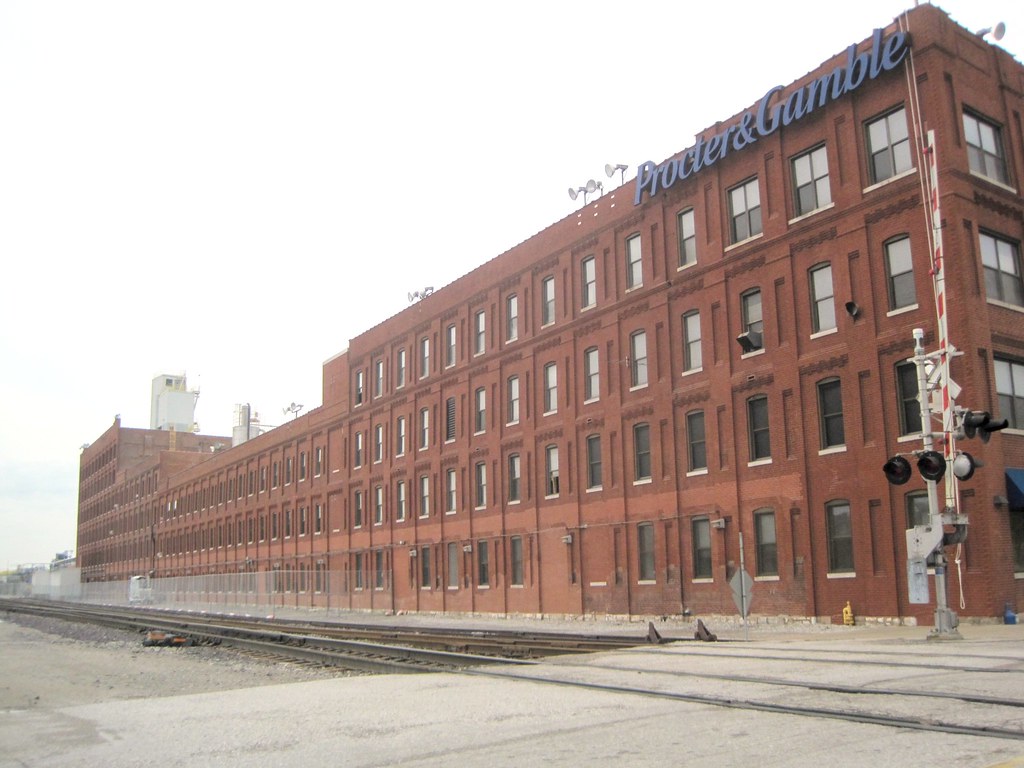
The west elevation of the massive Procter & Gamble plant.
On Monday, the Preservation Board will consider an application by Procter & Gamble to demolish 16 buildings at its landmark north riverfront plant (official address, 169 East Grand Avenue). There are no immediate plans for reuse of the cleared land, but Procter & Gamble claims that it needs a “shovel ready” site for expansion. (“Shovel ready” gets thrown about a lot, but not often is the phrase applied to creating vacant land.) Cultural Resources Office Director Betsy Bradley is recommending approval of the application; read more in the meeting agenda.
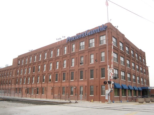
This section would be left standing.
The demolition plan does not affect the southernmost building in the long, multi-height row of buildings that give the plant its recognizable form on the city skyline. This portion, which meets Grand Avenue at the sidewalk, is in use as offices and will stay in use. The rest of the buildings are already being gutted, with many windows removed. Even earlier today demolition workers were loading scrap metal dumpsters. According to Bradley’s report, the plant was built between 1903 and 1924 as the William Waltke & Company Soap Factory.
UPDATE: The Preservation Board approved all of the demolition application by a vote of 3-2. Members David Visintainer and Anthony Robinson voted “aye,” and members Mike Killeen and Melanie Fathman voted “nay.” Chairman Richard Callow cast a tie-breaking “aye” vote.
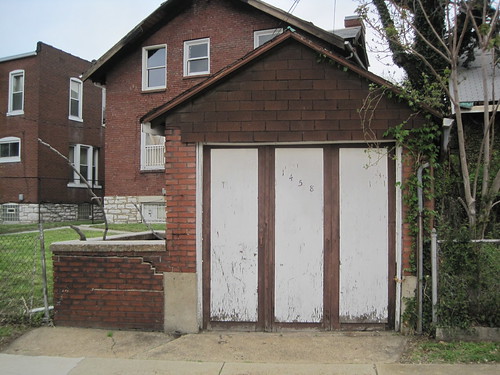
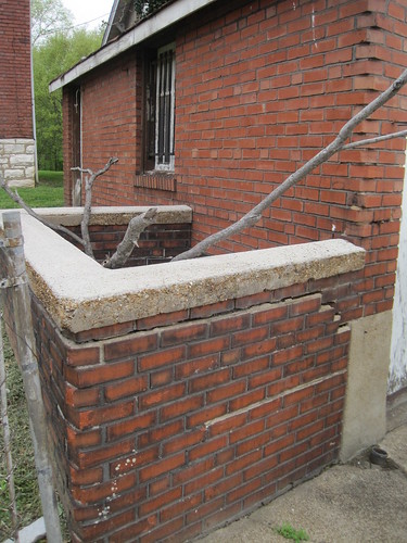
Amid our ongoing architectural survey of the city’s O’Fallon neighborhood, we came across an amazing ash pit adjacent to the garage behind the house at 1458 Adelaide Avenue. Due to the convergence of Adelaide and Warne avenues, the garage actually faces Warne across the street from the Mt. Grace Convent, better known as the home of the “Pink Sisters”.
Ash pits were a common part of the residential landscapes of the 19th and early 20th century city. These boxes, sometimes open on the alley-facing or rear side, contained the ash created by residents’ burning their trash and cleaning their fireplaces of coal ash. Smoke regulations passed in 1940 by the Board of Aldermen essentially ended residential trash burning and the use of cheap, soft coal for household fuel. Thus, the ash pit was no longer used and many have disappeared from the city’s alleys. Some, like the one here, remain. This one is particularly well-built in red brick matching the garage as well as concrete coping. (A side note: Check out the neat corner bond on the garage itself; the rear wall follows the diagonal street, so the garage does not have square corners at Warne.)
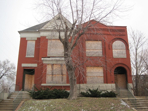
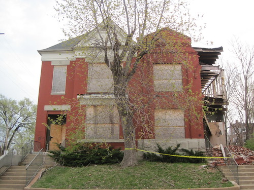
Two pairs of houses had stood on the east side of Bacon Street just south of North Market Street since before the turn of the last century. Now, three of the four are reduced to ruins by brick thieves in St. Louis’ ongoing brick theft crisis, removing more of the JeffVanderLou neighborhood’s unique architectural character and housing units that were occupied until just three years ago. Some count three buildings lost, and shrug, while others count these among over 100 lost to brick theft across north St. Louis in the last decade, and wonder when it will end.
1920 and 1924 Bacon Street
These unusual houses were both built in 1897 by the same builder. Unusual for the surrounding area of JeffvanderLou, the houses share a party wall. However their front elevations show differences in execution of essentially two identical (but flipped) same floorplans. The northern house, at 1924 Bacon Street, uses flat limestone lintels and a triangular pediment that put it in the Greek Revival. The other house employs rounded arches with ornamental label courses as well as a cornice of ornamental brick,traits that put it in the Romanesque Revival that was very popular in St. Louis during the 1890s.
The houses at 1920 and 1924 Bacon Street in December 2009.There is significant damage to 1920 Bacon Street in April 2011.
The Pleasure of the Landscape: Placemaking and Identity in the St. Louis Place Neighborhood
Thursday, April 28, 2011, 2-3 p.m.
Lewis Room, Library Basement
Fontbonne University
Michael R. Allen offers a critical examination of efforts to reframe the identity of the St. Louis Place neighborhood on the city’s near north side. St. Louis Place lost over 50% of its built environment between 1960 and 2010, but it retains sections of nearly untouched historic quality. The polarities of the landscape are frightening to some, sublime to others and reality to all. The current challenge is how to preserve and interpret what remains with joy and hope.
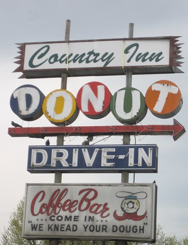
Those who love vintage neon signs, good donuts AND puns really love the Country Inn Donut Drive-In sign at 9426 Lewis and Clark Boulevard (just north of Jennings Station Road).
by Lindsey Derrington
This article is adapted from a National Register of Historic Places Eligibility Assessment that the Preservation Research Office submitted to the Missouri State Historic Preservation Office. The response from the State Historic Preservation Office is emphatic: “What a waste it would be if this lovely schoolhouse were to be demolished. Hodgen Elementary School is clearly eligible for listing in the National Register of Historic Places under Criterion C for Architecture, and may be eligible under Criterion A for Education as well,” states the response dated March 23, 2011.
Historic View of Hodgen School. Source: St. Louis Post-Dispatch, 1884.
History of Hodgen School
Hodgen Elementary School is located on the southeast corner of Henrietta and California Streets in the Eads Park neighborhood of St. Louis’ Gate District, bounded by Jefferson and South Grand avenues to the east and west and Chouteau Avenue and Interstate 44 to the north and south. Characterized by middle class row houses and multiple-family flats, this area developed in the early 1880s and 1890s as part of the Compton Hill District, today known as the Compton Heights and Fox Park neighborhoods.
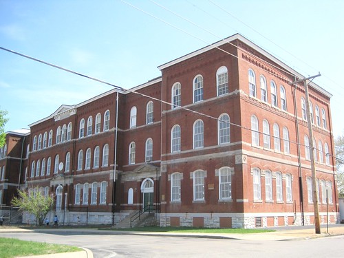
View of Hodgen School today, looking southeast from the intersection of California and Henrietta avenues.
Plans for Hodgen Elementary were drawn during the summer of 1883 at the behest of local residents to accommodate the rapidly-growing area’s needs. Otto Wilhelmi, elected Architect and Superintendent of Repairs by the city’s school board earlier that year, was responsible for its design. Hodgen was his first, if not only, design for a new school building for the district, and was named for nationally-renowned surgeon and educator Dr. John Thompson Hodgen who had died in 1882.
Hodgen Elementary was completed for $32,330 in mid-1884. It stood three stories tall with a full basement and contained fourteen rooms, each with access to four large windows to provide students with the maximum amount of light. The school was well-received by the school board and the community. Soon the neighborhood’s burgeoning population necessitated a six room addition that added three bays to both the school’s east and west facades. H. William Kirchner, who had served as school board architect during the term prior to Wilhelmi’s and was elected again in 1886, designed the addition. His brother August H. Kirchner served as school board architect from 1893 to 1897 and in 1894 designed another three-story addition to Hodgen to bring it to its present appearance. This addition added a four bay wing to the building’s east façade and a three bay wing to its west façade at a cost of $15,000. William B. Ittner almost certainly oversaw $103,948 worth of alterations to the school in 1909, though the nature of this work is unknown.
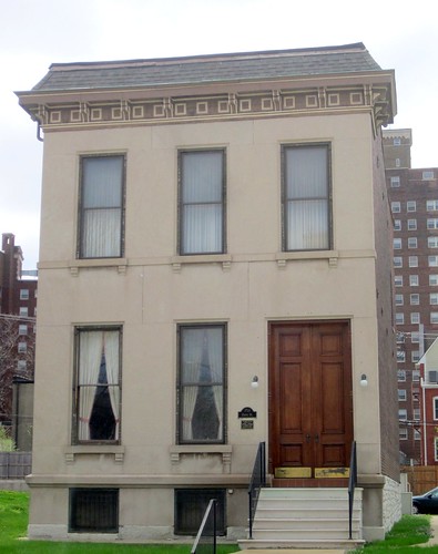
The William Cuthbert Jones House, located at 3724 Olive Street, is a rare example of a 19th century town house that not only survived the decline of Midtown but has also retained substantially its historic character with few alterations. The limestone-faced two-story brick house in the Italianate style was designed by architect Jerome Bibb Legg in 1886 for William Cuthbert Jones, a prominent attorney and criminal court judge.
The house is a good representative example of both Legg’s many client-driven house designs and of the sort of residences that were built on Olive Street in the 1880s. Compared to larger houses on more prominent streets in the Midtown neighborhood, houses on Olive were relatively smaller and less ornate. The house is also noteworthy as one of a handful of extant local works by Legg, who took on much work elsewhere.
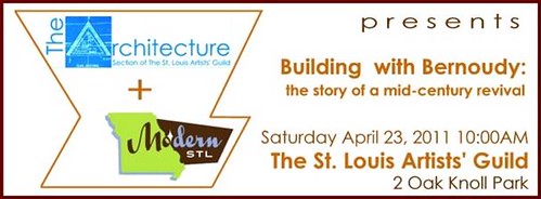
Modern STL and the Architecture Section of the St. Louis Artists’ Guild present a free lecture, “Building With Bernoudy.”
The story of working with and adding to a William Bernoudy-designed house becomes a lesson of “complexity and contradiction in architecture” on a very local and personal level. Builder and designer Richard Reilly will share the story of renovating and updating the 1953 Simms House (located at #3 Sumac Lane in Ladue) with his drawings and photos of the project.


 How is it that a city that has been labeled “the most distressed small in city in America†has also been home to some of the most amazing artists and talents in American life? And despite devastating population and job losses, how is it that East St. Louis has manifested such community resiliency and resolve? The Making of an All-America City: East St. Louis at 150 examines these paradoxes as it chronicles the rich history of this so-called failed industrial suburb. A collection of fifteen essays and one prose poem, The Making of an All-America City explores East St. Louis’ life as a river city, its complex experience with race, its challenges of deindustrialization, and the political choices that it has made from a wide range of perspectives.