Categories
Abandonment Demolition Flounder House Historic Preservation North St. Louis St. Louis Place

Two Blocks of Florissant Avenue in 1985

by Michael R. Allen

While demolition permit numbers show that the peak decade for material building loss in the Old North St. Louis and St. Louis Place neighborhoods was 1970-1980, a substantial slower loss has transpired since then. The cumulative result is that streetscapes recognizable as urban places twenty-five years ago now form desolate landscapes lacking architectural definition.

Two photographs of the west side of Florissant Avenue in 1985 taken by Mary M. Stiritz for Landmarks Association of St. Louis depict the absurd reality that in the near past, the eastern edge of St. Louis Place was marked by the familiar nineteenth century vernacular masonry buildings that typify other sections to this day.

Nowadays, Florissant Avenue is a confused corridor notable for its many vacant lots and the needless wide expanse of roadway that awaits MetroLink expansion. This area was once a vital part of a beautiful neighborhood. In 1985, Landmarks was preparing a survey leading to expansion of the Clemens House-Columbia Brewery Historic District; sufficient physical stock existed here to allow major expansion of a national historic district. Today, further expansion remains a fantasy at best due to continued loss.

Behold the northwest corner of Warren Street and Florissant Avenue, today a sun-scorched vacant lot:

While the architectural context is visibly diminished, the important corner site is occupied by a building that becomes a landmark heralding the site as one for human comfort and exchange. As we rebuild St. Louis Place, we should ensure we have good corners, and not drive-through lanes, curb cuts and fences where the marks of human settlement should be.

The second photograph shows the block of Florissant between North Market Street on the south and Benton Street on the north:

Here was a hybrid row of commercial and residential buildings, all brick but differing somewhat on setback, height and style. There are a few side-gabled buildings, with a mansard-roofed store second in from the corner adjacent to a flounder house with a generous side gallery porch. Dormers abound. There’s even a modern Payless Shoe Store at the right of the image. This is a resolutely urban group, friendly to the pedestrian and attractive to the eye.

All of these buildings are now gone.

Categories
Abandonment Collapse Historic Preservation James Clemens House North St. Louis Northside Regeneration St. Louis Place

Clemens House Chapel Suffers Localized Collapse

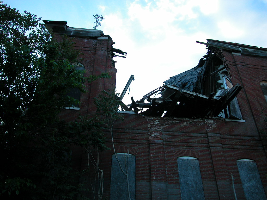
In a move unsurprising to long-time observers, a section of the roof and the eastern wall of the chapel wing at the James Clemens House collapsed in heavy rains yesterday. The collapse took down a section of roof that was sagging severely in recent months and three bays of the east wall above the first floor. The section that collapsed ran between two interior partitions that prevented further roof damage by supporting additional weight and tying the side walls together.

The roof had demonstrated severe local failure, and the western wall had substantially bowed outward in just the least year under pressure from the failing roof trusses. Recent observation showed imminent failure.

However, the chapel shows few signs of further immediate danger. The Building Division may swoop in soon to demolish the chapel, but that would be hasty. Here’s why:

  • The collapse was localized. The roof trusses run the width of the chapel, not the length, so the loss of those that fell yesterday does not necessarily mean others will fail.
  • Adjacent wall and roof sections seem fair. While the roof is in poor condition, the worst parts were those lost. The masonry walls and foundation, on the other hand, show excellent pointing and soundness. The wall section that collapsed did so because the roof pushed it out, not because the wall itself was inherently deficient.

    Built in 1896, the chapel was designed by Carondelet resident Aloysius Gillick, architect of several other Archdiocese buildings including the 1889 St. Mary’s Infirmary. The Sisters of St. Joseph built the chapel after taking ownership of the Clemens House earlier, in 1888. The front-gabled brick building features red sandstone ornament and sills, an ornate front porch and a high body visible from long distances to the east and north. The chapel itself is located on the second floor, and featured a suspended vaulted ceiling (mostly collapsed). The ornate marble altar and stained glass windows are both nearly completely missing.

    Still, preservation of the chapel is important in retaining the historic integrity of the complex. The current configuration reflects the House’s years of religious service rather than its original mansion life, and any restoration should retain the evolved form to show the layers of historic presence.

    Now is the time for the owner of the Clemens House, Paul McKee, to come forward and announce his intention. Inaction will mean certain loss of the chapel and further deterioration of the Clemens House buildings. Immediate stabilization should commence. If McKee is unwilling to do that, he should say so and offer others a chance.

    Television stations KSDK and KTVI (oddly speculating that the chapel was a cathedral) covered the collapse.

  • Categories
    Abandonment Demolition Historic Preservation LRA

    Just Couldn’t Make It

    by Michael R. Allen

    Until last month, this modest storefront building stood at the southeast corner of Delmar and Leffingwell avenues. According to city building permits, the building dates to 1881 and was originally four stories tall. Looking carefully at the building, I detected evidence of infill of the third floor sills and window openings just below the parapet wall, which lacks a creasing course. The shortened height and partly-filled windows are obvious, marring the building’s appearance. Still, handsome details like the iron storefront and arched side windows remained evident.

    Once part of a robust, dense urban neighborhood just north of Mill Creek Valley, the building and an alley house behind it fell into the hands of the city’s Land Reutilization Authority. All of its neighbors were gone. Across Leffingwell stands a large housing project, while adjacent to the east is a lot owned by N & G Ventures LC, a holding company controlled by Paul McKee. South of here is the hulking campus of Wachovia Securities, formerly A.G. Edwards & Sons. Any semblance of the historic walking neighborhood in which this building played a commercial role was long gone. The city itself lost the mometum needed to keep even diminished buildings in use.

    Befitting, the building’s east wall partly collapsed in December. On February 6, the Building Division approved a demolition permit and wrecking commenced. The neighborhood could have used a corner anchor, even as one small representation of its old form. Yet the building just couldn’t make it. Besides, would the time have ever come again for this lopped-off old building?

    Categories
    Abandonment Churches Historic Preservation North St. Louis Old North

    Fourth Baptist Church Secured

    by Michael R. Allen

    In the midst of discussion on this blog about a partly un-boarded broken window on the vacant Fourth Baptist Church at 13th and Sullivan in Old North St. Louis, a new board went up (at right in the photo above). This simple act will prevent vandalism and trespass on the building, ensuring its survival as it awaits reuse.

    Categories
    Abandonment Churches Illinois land use Urbanism

    Kaskaskia Remains

    by Michael R. Allen

    The villages of Dozaville (once Goshen) and Kaskaskia, Illinois remain as vestiges of settlement on Kaskasia Island. Dozaville is a complete ghost town, at least officially — it has been legally dissolved for decades. Kaskaskia remains incorporated, although with less than a dozen residents in four households within its boundaries has no real need for civil government. Kaskaskia is one of those places that has achieved zero population growth according to the US Census — a bizarre stasis for a town once of great importance.


    Although part of Randolph County in Illinois, the island is west of the Mississippi and accessible only via a bridge from St., Mary’s, Missouri. A shallow channel barely recognizable as a river separates St. Mary’s from the island, suggesting that the land nearly is part of Missouri. On maps, the land seems fully engulfed by Missouri. Most maps don’t even note the channel with water, but merely include a political boundary line. Kaskaskia seems an improbable location for Illinois’s first state capital. Now remote, plagued by low land that constantly floods, and insular, Kaskaskia was once a vital part of early French settlement of the Mississippi River valley. The island was once an attached Illinois peninsula.

    In 1673, Louis Joliet and Father Jacques Marquette claimed the Mississippi River valley in this area. In 1675, Marquette visited the site of Kaskaskia and established the mission of the Immaculate Conception. The mission became a church, and the settlement around the mission grew into a village with fur trading and farming as prevalent economic activities. In 1703, Kaskaskia was founded as the second village of European settlers in Illinois. By 1752, the population stood at a relatively robust number of 671 residents.

    At the advent of the French and Indian War in 1756, French townspeople built Fort Kaskaskia on a hill east of the town, now across the Mississippi River. Residents destroyed the fort to prevent it from falling into British control when the British won. Many residents fled to Ste. Genevieve after the war. Later, the British built Fort Gage in Kaskaskia but lost the fort to Revolutionary General George Rogers Clark in 1778.

    Kaskaskia became Illinois territorial capital in 1804. In 1818, the newly-created State of Illinois chose to retain Kaskaskia for the first state capital, although for only two years. The Emigrant’s Guide of 1818 states that there were 150 houses standing in the village. Growth would not arrive, however, as the village quickly lost the capital to more centrally-located Vandalia. One notable event happened after the loss of the capital: the establishment of the convent and school for the female school Visitation Academy in 1833.

    However, the biggest blows to the village’s fortune came with terrible floods in 1844 and 1881. Located at a narrow spot between the Kaskaskia and Mississippi Rivers, the site was vulnerable to the Mississippi’s eastward shift. Eventually, that river pushed over the narrow neck of the peninsula to create the present island. The first flood caused great population loss, and the second flood created the river channel that made the land around Kaskaskia into an island. During the period between the floods, Visitation Academy relocated to the city of St. Louis in 1844. After an 1893 flood, the town relocated to its present location.

    In 1993, flood waters again submerged the island and caused residents to flee. Nowadays, the population of Kaskaskia is about 9 and the population of the island is about 93 people. Kaskaskia still retains its street grid, which carves out blocks punctuated by the few remaining buildings.

    One of those remaining buildings is the Church of the Immaculate Conception, built in 1882 and moved to its current site in 1894 after the devastating 1893 flood. A church founded by Marquette now meets only on Saturday afternoons — strangely diminished in human size but awesome in the length of its existence. The brick building has managed to survive several floods with its Gothic Revival architecture intact.


    A long-time parishioner is profiled in the article found here.

    A newer building is the home of the church’s historic bell, gifted by the King of France in 1741 and known as the “Liberty Bell of the West” since the townspeople rang it on July 4, 1778 to celebrate liberation from British rule.

    The old school house is interesting, although badly damaged by flooding and alterations to its fenestration. Boarded up, the brick building is missing much of its interior structure although it has gained a new roof since the 1993 flood. Reuse seems unlikely, although someone is performing enough continued maintenance to ensure survival of the old building.

    A few frame and brick homes comprise the rest of Kaskaskia. The wide sight lines of the island ensure views of the church spire and school house framed by expanses of fields. Settlement has come full circle for Kaskaskia, but somehow it endures.

    Categories
    Abandonment Architecture North St. Louis Northside Regeneration Old North

    How Not to Board Up a Broken Window

    by Michael R. Allen

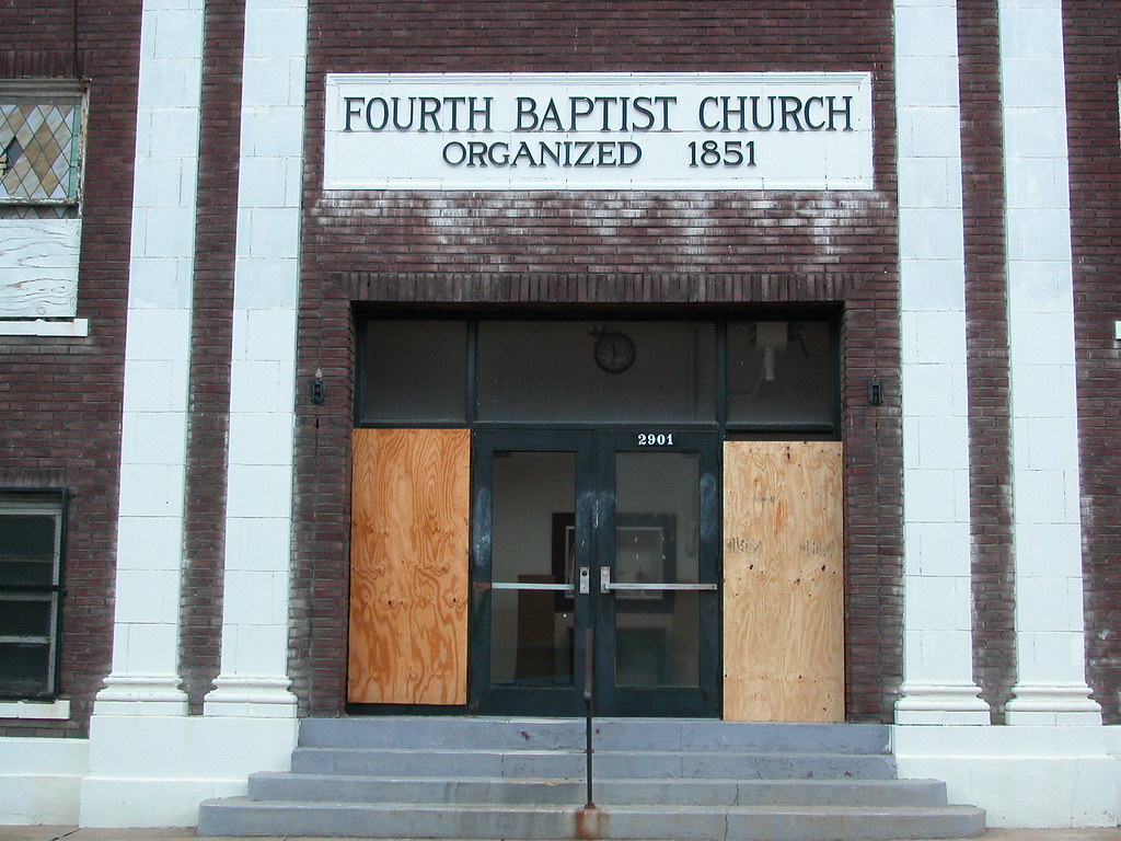
    Here is the entrance to the Fourth Baptist Church at 13th and Sullivan in Old North St. Louis. You can see that someone has broken the window at right, and that someone has very poorly attempted to board over the damage. Hint: If the broken area still shows, you haven’t boarded over the damage.

    In August 2007, someone threw a rock at the window and caused the spider-web-like broken lines. Neighbors tried to get the owner, a nearly-defunct congregation, to board up the broken window. I cut my hand taping the damage to stabilize the glass. Several Citizens’ Service Bureau complaints led to the congregation’s finally boarding up the broken glass. Then, this December, the other side of the doorway gets the same treatment — from vandal and owner. Neighbors still haven’t seen a full repair.

    The church building itself is an important landmark, and deserves better treatment. The congregation does not have the funds to maintain the building; they vacated in 2002. Meanwhile, the building has become a nuisance to neighbors as the congregation refuses to commit to selling and won’t make even small efforts to stay abreast of vandalism.  Hopefully Fourth Baptist will board up the broken window and sell their church to someone who will invest in the future of the church and the neighborhood.

    Categories
    Abandonment Grafitti South St. Louis

    "Be Good to One Another"

    by Michael R. Allen

    This work by prolific graffiti creator Ed Boxx can be found down near the eastern terminus of Espenschied Street, by the former Carondelet Coke plant. Who can disagree with the message? Admittedly, few will see it but perhaps those who do need the instruction more than those who won’t. Such work raises questions: What does one make of positive messages inscribed on private property not being used and not likely to be reused? This “graf” graces the side of a damaged box trailer on the old St. Louis Ship property, which no doubt will be scrapped if its owner ever does anything more than let it sit and rust. Why not let one person’s scrap become another’s momentary canvas?

    Categories
    Abandonment Art Metro East

    Take a Trip With Cindy Tower

    by Michael R. Allen

    Those who frequently haunt abandoned places around St. Louis may have run into painter Cindy Tower, a dynamo who paints scenes from abandoned places — on site, not from photographs! This video shows here in action.

    Categories
    Abandonment Architecture Gate District Historic Preservation South St. Louis Storefront Addition

    Just Another Vacant Building?

    by Michael R. Allen

    I don’t think there is such a thing as an average run-of-the-mill vacant building in St. Louis. For instance, look at this building located at 2831 Lafayette Avenue:


    On first glance, the yellow-toned plywood sheets and blue awning jump out from a nearly all-white building. Looking at the building longer, details emerge. Behind that projecting storefront is a different, older building. The building appears to be an old house. A close look brings out clues.

    This two-story building has a pretty sandstone front; the large filled-in window openings must have been gorgeous when they were glazed. Underneath white paint and stucco repairs are fine carved details around the windows. The sunbursts centered over each window are impressive and typical of the finely detailed nineteenth century stone masonry we have in St. Louis. Right at the top are sill brackets, showing that the building once stood another story taller. The presence of such fine details, the use of sandstone and the style of the facade suggest a construction date in the 1880s. In fact, building permits show that this block face was built out with houses (mostly single-family and many with significant construction costs) between 1880 and 1895. There are three permits for three-story houses: in 1880, 1889 and 1894.

    Owners added the storefront addition at 2831 Lafayette by the 1930s, although fire insurance maps show that the building retained its third story into the 1960s. The first floor of the building was in use a dry cleaners as soon as the storefront was finished. Apartments were above. Essentially, the building joined many others in the city located in well-to-do walking neighborhoods that changed dramatically in the early twentieth century as the upper and middle classes migrated west to quieter streets farther from downtown. The large houses of the migrating residents often were divided into rental housing or businesses; many were expanded, and altered and some were eventually demolished as new commercial uses moved into once-genteel neighborhoods. One under appreciated result of these changes was that population density increased. This building is a frank reminder of twentieth century changes in use and demographics on the near south side.

    Deed research could clear up which one corresponds to this house. For now, I am glad to have given it a long look and learned that the old building tells an unexpected story. While the house has lost its third story and its original appearance, the remaining traces still provide beauty. There is no reason that future reuse of the building could not highlight the remaining traces and incorporate them into a new design. While the building is rendered ineligible for any landmark designation through loss of historic appearance, there are many futures for it beyond simply tearing it down.


    All over our city are similar old houses — many with storefront additions, missing floors, mangled entrances and strange alterations. These are the buildings that cannot be considered contributing to historic districts but who still lend historic character to our streets. Historic rehabilitation tax credits will never be available for these buildings. Some would knock them over, because of the financial problems of rehabbing them without tax credits. Hopefully others will see that, however twisted or obscured, these buildings still have architectural potential — and still tell the stories of their construction and show the scars of changing use. This stretch of Lafayette Avenue gains far more character from 2831 Lafayette in its current state than from the new homes of the Gate District, or the Holiday Inn.

    Categories
    Abandonment Cleveland Urbanism

    Foreclosure, Crime and Neighborhood Disintegration

    by Michael R. Allen

    According to an article on the CNN website entitled “Crime scene: foreclosure”, Cleveland’s historic Slavic Village neighborhood is in the nation’s top ZIP code for foreclosures. An estimated 800 buildings sit vacant there. The neighborhood has out-of-control crime, correlated to the foreclosure rate. Houses get stripped within 72 hours of being vacated, and aren’ty worth enough money to justify repair. Police are inattentive, and the city can’t afford to do much trash cleanup or demolition. People flee in droves, leaving those who remain in fear. Lenders continue to foreclose, with little concern about the effects.

    This situation sounds a lot like conditions in north St. Louis in the 1960s, 1970s and 1980s. The article’s eerie conclusion reads “as the number of empty lots and abandoned houses grows where houses and residents were once packed in a tight community, there are fewer and fewer neighbors to fight the battle.”

    (Thanks to Barbara Manzara for the link.)