Categories
National Register North St. Louis The Ville

New Tools for Historic Preservation In The Ville

by Michael R. Allen and Lynn Josse

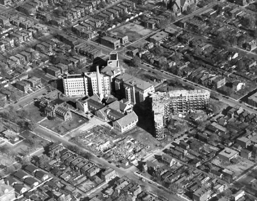
On January 17, the National Park Service listed in the National Register of Historic Places three historic districts in and an amended and expanded historic context for The Ville neighborhood. Due to lack of contiguous historic fabric, The Ville is not eligible for listing as single historic district. All National Register listings are made using the requirements of Historic and Architectural Resources of the Ville Multiple Property Submission (MPS), first created in 1999.

The Herman Dreer House (built 1930) at 4335 Cote Brilliante Avenue is at left; it was listed in the National Register in 2009. Now the rest of its block is within the National Register-listed Marshall School Neighborhood in The Ville Historic District.

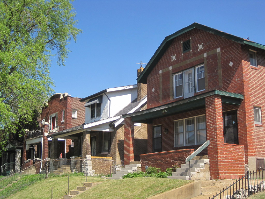
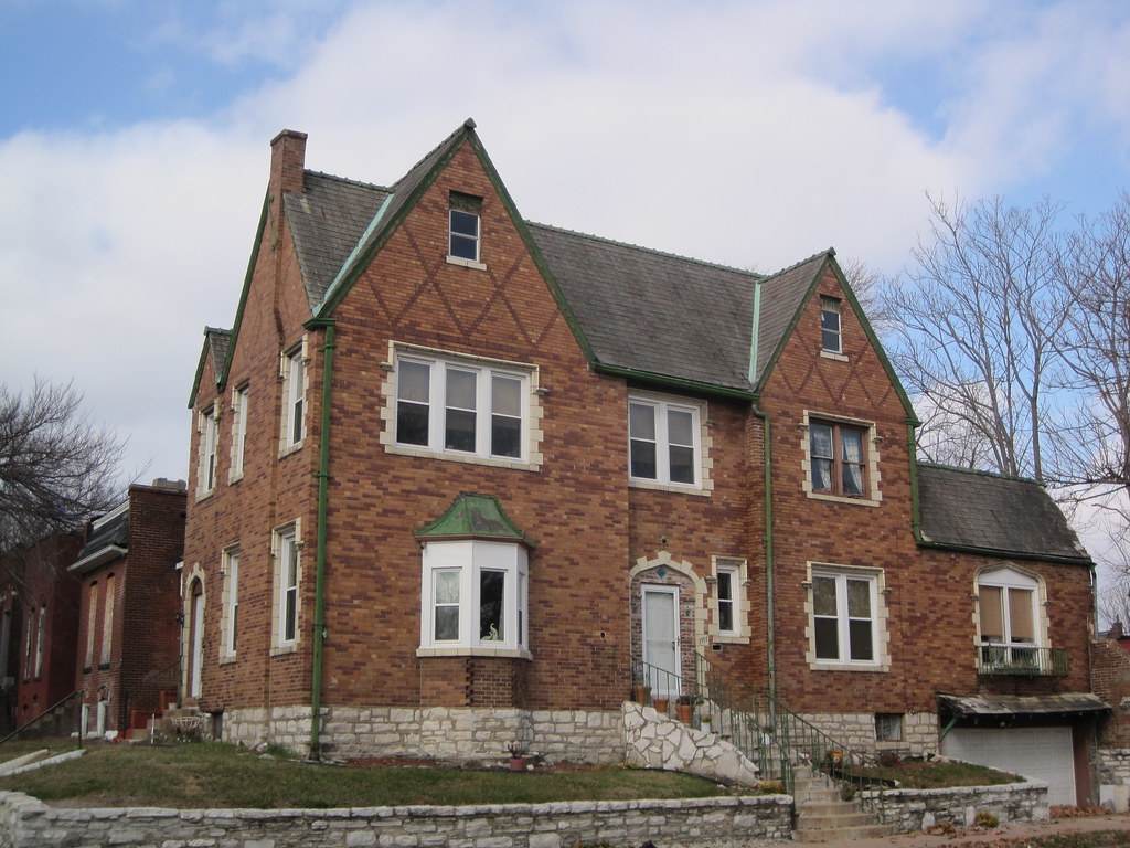
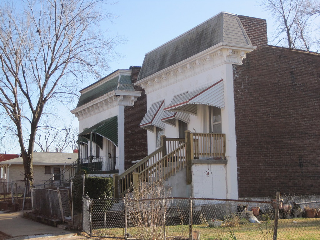
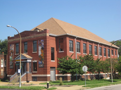
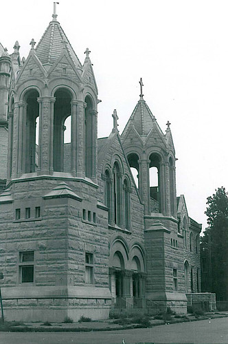
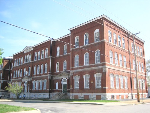
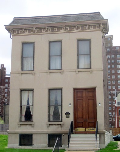
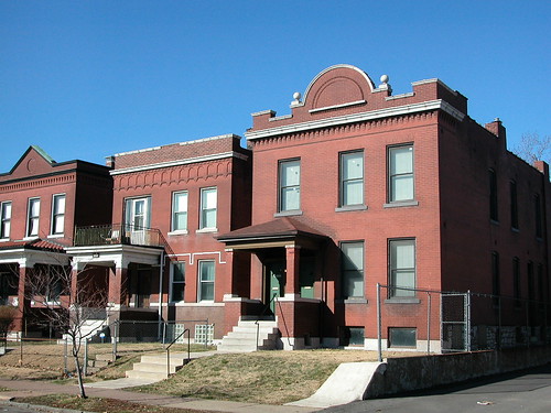
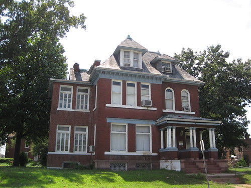
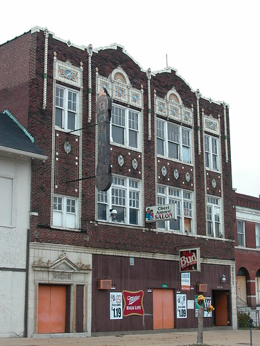
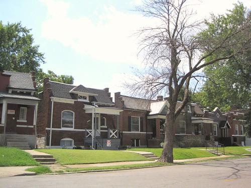
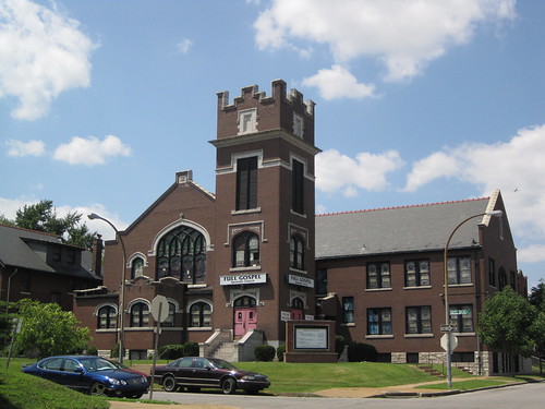
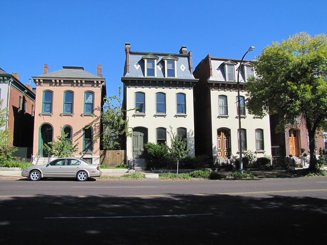
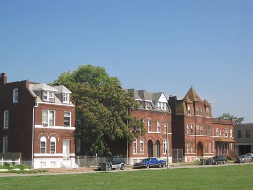
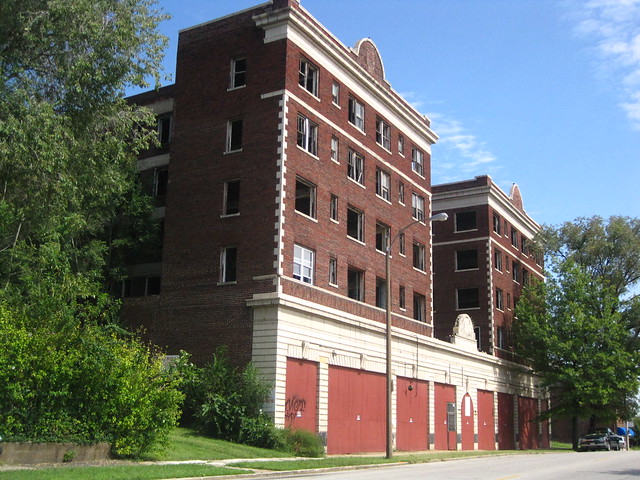
Until last month, The Ville MPS lacked a section that would enable listing of groups of residential and commercial buildings associated with general trends of African-American settlement between 1910 and 1950. Buildings had to be associated with significant institutions or individuals. Most building stock in The Ville is the backdrop for significant twentieth century history — a context that preserves the character of an entire era of significant cultural activity. Listing intact groups of buildings helps preserve the sense of place enjoyed by Annie Malone, Herman Dreer, Charles Henry Turner, Julia Davis and other prominent African-Americans who either lived or worked in the neighborhood in its heyday.

The city’s Cultural Resources Office (CRO) staff rewrote the Historic and Architectural Resources of the Ville MPS document, adding a well-written and must-read section (“Context III: The Ville as the Product of Residential Segregation Policies, 1910-1950”) that documents the larger settlement history as well as “registration requirements” for the building stock long not covered by the document. The Preservation Research Office submitted the three small historic districts that are the first to be nominated under the new section.


View The Ville Survey in a larger map

The three districts are not the only small residential districts eligible in The Ville, but are the only ones identified as eligible in The Heart of the Ville architectural survey conducted in 2009 and 2010. Additional surveys should be funded to identify other potential districts in The Ville. Meantime, there now are 90 more buildings eligible for historic tax credits in The Ville!

Categories
National Register North St. Louis The Ville

The Heart of The Ville Survey

by Lynn Josse and Michael R. Allen

Creating National Register of Historic Places historic district designations often is straightforward work — a consultant delineates the boundary of an eligible area dense with urban building stock. Then there are depleted neighborhoods in north St. Louis, where the levels of demolition make defensible boundaries more difficult. With extensive demolition marring its streetscapes, The Ville is no exception. Yet The Ville has a historic importance as the cultural center of African-American life in St. Louis rivaled only by the lost Mill Creek Valley.

Since 1987, The Ville has been a Local Historic District with restrictions on demolition, but until recently little of it had National Register of Historic Places status. Beyond the great cultural honor, that status makes available federal and state rehabilitation tax credits — the programs that revived Dick Gregory Place in the western end of the neighborhood. Since taking office in 2007, Alderman Sam Moore (D-4th) has pushed to find solutions for historic preservation of The Ville’s buildings, many of which face the wrecking ball in the absence of incentives for their reuse. One of the city’s most important neighborhoods seemed to be disappearing over the last few decades, but finally there may be a change in direction.

This historic view shows Homer G. Phillips Hospital under construction in 1936. Areas to the south and west of the hospital were included in the recent "Heart of the Ville" architectural survey.

Between August 2009 and August 2010, under contract to city government, the Preservation Research Office (PRO) completed the first intensive architectural survey of the heart of St. Louis’ fragile yet historically significant African-American neighborhood The Ville. The “Heart of the Ville” survey was the result of the successful St. Louis Cultural Resources Office (CRO) application for a Historic Preservation Grant to survey the Ville neighborhood, a local historic district with outstanding significance and uneven integrity. PRO evaluated 368 primary resources and 49 secondary resources, all buildings, to form the basis for historic district nominations. As of this writing, three small Ville historic districts are now listed in the National Register of Historic Places based on the survey results. (See subsequent post.)

The Tudor Revival home and residence of African-American physician Dr. Leo Commissiong stands at 4201 Aldine Avenue. Built in 1931 and designed and built by F.L. Whittaker, this house could be individually eligible if more research on Dr. Commissiong established him as a significant individual.
The houses at 4242 and 4246 W. Garfield Avenue are among several raised-basement Italianate-style homes in the survey area. These residences were built circa 1890.

The survey was designed as a cooperative effort between the City of St. Louis CRO and Lynn Josse and Michael Allen at PRO. In November, 2009, PRO signed a contract with the city to provide a reconnaissance survey of 300 properties within the boundaries of the Ville neighborhood. Because this number would include fewer than half of the potentially historic residential and commercial properties within the originally identified survey area, CRO and the contractors targeted a much smaller set of blocks within the Ville. The new boundaries were selected based on the level of threat to the targeted resources.

A base map used by the consultants in the survey report. The cyan lines indicate the districts ultimately created from the survey results.

This survey differed from many others because the neighborhood has already been the subject of intensive study over three decades. In 1983-84, Landmarks Association of St. Louis conducted a reconnaissance survey of the Ville. In 1987, the City of St. Louis designated most of the Ville neighborhood as a local historic district. Two years later, the National Park Service (NPS) rejected certification of the Ville Local Historic District — a process that allowed other neighborhoods to have both local and national designation — due to extensive building loss in parts of the district. Consequently, the Historic and Architectural Resources of the Ville Multiple Property Submission was developed by Landmarks Association of St. Louis and approved by the National Park Service in 1999. The MPS offers three contexts under which individual buildings or groups could be listed in the National Register. The contexts are: “Black Settlement in the Ville, 1865-1910” and “The Ville as a Center for African-American Culture, 1910-1950”. The MPS establishes registration requirements for Institutional Buildings but no other types, stating that this is “the first phase of what is hoped to be a long-term project of evaluating and registering properties in the Ville.”

Categories
National Register North St. Louis St. Louis Place

Early Irish Influence in St. Louis Place

by Lindsey Derrington

Working in conjunction with 5th Ward Alderwoman April Ford-Griffin and the non-profit group Community Renewal and Development, Inc, the Preservation Research Office submitted a National Register nomination for the St. Louis Place Historic District earlier this year. We are happy to report that the document was approved by the Missouri Advisory Council on Historic Preservation this past Friday, May 20th, paving the way for its review by the National Park Service and its ultimate listing on the National Register of Historic Places.

The Griot Museum of Black History occupies the former Sacred Heart Parish School at 25th and St. Louis (1906).

This process often involves streamlining nomination drafts in cooperation with the State Historic Preservation Office (SHPO) in order to more effectively illustrate a district’s significance. We originally argued that St. Louis Place was significant as an example of mid-19th century community planning and as a north-side hub of German and Irish immigrant cultures. However, SHPO staff found that evidence of the Irish presence in the neighborhood has been so drastically diminished that it should be cut from the nomination. In light of the tragic 1986 demolition of the Church of the Sacred Heart, the focal point of St. Louis Place’s Irish community, we have to agree. Yet many landmarks do remain, from the Sacred Heart School (now the Black World History Museum) to the grand mansions along St. Louis Avenue built by some of the city’s most prominent Irish citizens.

Sacred Heart Church, 25th and University Avenue, as it appeared around 1971. Photograph from the Heritage/St. Louis Collection, Landmarks Association of St. Louis.
Categories
Gate District National Register Schools SLPS

Hodgen School “Clearly Eligible” for National Register

by Lindsey Derrington

This article is adapted from a National Register of Historic Places Eligibility Assessment that the Preservation Research Office submitted to the Missouri State Historic Preservation Office. The response from the State Historic Preservation Office is emphatic: “What a waste it would be if this lovely schoolhouse were to be demolished. Hodgen Elementary School is clearly eligible for listing in the National Register of Historic Places under Criterion C for Architecture, and may be eligible under Criterion A for Education as well,” states the response dated March 23, 2011.

Historic View of Hodgen School. Source: St. Louis Post-Dispatch, 1884.

History of Hodgen School

Hodgen Elementary School is located on the southeast corner of Henrietta and California Streets in the Eads Park neighborhood of St. Louis’ Gate District, bounded by Jefferson and South Grand avenues to the east and west and Chouteau Avenue and Interstate 44 to the north and south. Characterized by middle class row houses and multiple-family flats, this area developed in the early 1880s and 1890s as part of the Compton Hill District, today known as the Compton Heights and Fox Park neighborhoods.

View of Hodgen School today, looking southeast from the intersection of California and Henrietta avenues.

Plans for Hodgen Elementary were drawn during the summer of 1883 at the behest of local residents to accommodate the rapidly-growing area’s needs. Otto Wilhelmi, elected Architect and Superintendent of Repairs by the city’s school board earlier that year, was responsible for its design. Hodgen was his first, if not only, design for a new school building for the district, and was named for nationally-renowned surgeon and educator Dr. John Thompson Hodgen who had died in 1882.

Hodgen Elementary was completed for $32,330 in mid-1884. It stood three stories tall with a full basement and contained fourteen rooms, each with access to four large windows to provide students with the maximum amount of light. The school was well-received by the school board and the community. Soon the neighborhood’s burgeoning population necessitated a six room addition that added three bays to both the school’s east and west facades. H. William Kirchner, who had served as school board architect during the term prior to Wilhelmi’s and was elected again in 1886, designed the addition. His brother August H. Kirchner served as school board architect from 1893 to 1897 and in 1894 designed another three-story addition to Hodgen to bring it to its present appearance. This addition added a four bay wing to the building’s east façade and a three bay wing to its west façade at a cost of $15,000. William B. Ittner almost certainly oversaw $103,948 worth of alterations to the school in 1909, though the nature of this work is unknown.

Categories
Housing Midtown National Register

The William Cuthbert Jones House, A Midtown Gem

by Michael R. Allen

The William Cuthbert Jones House.

The William Cuthbert Jones House, located at 3724 Olive Street, is a rare example of a 19th century town house that not only survived the decline of Midtown but has also retained substantially its historic character with few alterations. The limestone-faced two-story brick house in the Italianate style was designed by architect Jerome Bibb Legg in 1886 for William Cuthbert Jones, a prominent attorney and criminal court judge.

The house is a good representative example of both Legg’s many client-driven house designs and of the sort of residences that were built on Olive Street in the 1880s. Compared to larger houses on more prominent streets in the Midtown neighborhood, houses on Olive were relatively smaller and less ornate. The house is also noteworthy as one of a handful of extant local works by Legg, who took on much work elsewhere.

Categories
National Register North St. Louis O'Fallon

O’Fallon Neighborhood to Become a Historic District

Houses on the 4500 block of Fair Avenue, just south of West Florissant Avenue.

by Starr Meek and Lynn Josse

This article first appeared in The Northsider.

The buildings found in the entire O’Fallon neighborhood and in O’Fallon Park should be an official historic district in early 2012. Over the next year, historians from the Preservation Research Office will be found in every part of the O’Fallon neighborhood and in archives all over town. They will be putting together the story of the neighborhood in order to nominate it to the National Register of Historic Places. Alderman Antonio French funded the project for The Acts Partnership in order to increase investment within the neighborhood by enabling property owners to benefit from historic preservation tax credits.

This work takes place at the same time that a similar project is taking place in Penrose, meaning that almost all of the 21st Ward could be included in historic districts in the next year. Currently, Holly Place — the 4500 block of Holly Avenue — is the only historic district in the ward.

A house on Algernon Street facing O'Fallon Park.

“National Register historic districts lead to tremendous benefits for urban neighborhoods,” said team leader and Preservation Research Office Director Michael Allen. “They contribute to a sense of community pride, build identity, and can bring resources and investment.” Unlike local historic districts, the proposed National Register district will not involve any additional restrictions on properties — just benefits such as Missouri’s 25% historic rehabilitation tax credit.

This three-story commercial building on Warne Avenue once housed an upstaird bowling alley.

The O’Fallon neighborhood has a long and interesting history. Subdivision development began as early as 1859 with the subdivision of the White family’s farm. Other major landholders in the area are now familiar names, including Shreve, Vandeventer, Carter, and of course O’Fallon. In 1875, the city purchased portions of John O’Fallon’s estate, dedicating 158 acres as O’Fallon Park in 1875. Amenities were added with the lake in the 1890s and the boat house in 1908.

Houses on Carter Avenue.

The development of O’Fallon Park led to development of the area just south through the O’Fallon Heights, Plymouth Park and Wanstrath Place subdivisions. Early transit lines to the area were limited to parts of Natural Bridge in the 19th century. Streetcar service was later added on Florissant, Lee, Newstead and Fair/Harris avenues. These subdivisions generally were developed between 1890 and 1930 with buildings using prevalent locally-sourced materials like decorative and standard brick, limestone, and clay roof tile. Major buildings include the Boathouse in O’Fallon Park, Holy Rosary Church and Full Gospel Apostolic Church.

To be listed in the National Register of Historic Places, a neighborhood must have significant architecture or history. O’Fallon retains a consistent density and use of common building materials that unites the neighborhood. The entire process will take a little more than a year from project beginning in February to its end next spring.

The Full Gospel Apostolic Church, built in 1913, at Rosalie and Red Bud avenues. Currently The Acts Partnership is raising funding to acquire the church for reuse as a community center.

Oral History Project

As part of the survey and historic district project, the Preservation Research Office is conducting interviews with O’Fallon residents. Our intern Christian Frommelt, a senior anthropology major at Washington University in St. Louis, has a special interest in oral history that we are utilizing this spring. The historians especially want to get stories from long-time residents. Since much of the neighborhood was built a long time ago, the team wants to make sure that current residents are also part of the recorded history of O’Fallon. Team members will collect residents’ stories about the neighborhood at the Acts Partnership office at 4202 Natural Bridge throughout the spring.

Categories
National Register North St. Louis St. Louis Place

St. Louis Place Nominated for Historic District Designation

There are several stone-faced houses in the Second Empire and Italianate styles on the north side of the 2200 block of St. Louis Avenue.

In July, the Preservation Research Office embarked upon an architectural survey of the St. Louis Place neighborhood funded by Alderwoman April Ford-Griffin and overseen by Community Renewal and Development, Inc. By October, we selected boundaries for a historic district and began drafting a National Register of Historic Places nomination for a core area of the neighborhood. That nomination will be submitted to the Missouri State Historic Preservation Office on Monday.

The west side of the 1800 block of Rauschenbach Avenue, facing St. Louis Place Park.
Until recectly home of the Youth and Family Center, the oldest section of the former Freie Gemeinde at 2930 N. 21st Street dates to 1869.

After submission, we will be sharing more of our research and findings here. For now, we are posting a handout we used at last night’s public meeting on the project. The document shows the boundaries and briefly explains the process and benefits of the historic district designation. That document is online here.

After the historic district nomination is completed, Preservation Research Office will be working with Alderwoman Ford-Griffin and Community Renewal and Development to develop a public history component to the project. We have learned a lot about the heritage of the neighborhood’s built and social environment that belongs to its people, and we will share what we know through publications, tours and events.

We Still Need Your Help

If you are a current or former resident or property owner in St. Louis Place, or just someone who has spent time there, you may have information that can aid us as we continue our work. Photographs, especially those taken before 2000, will help us. Your stories about your house, neighborhood businesses and churches and other aspects of St. Louis Place’s past are needed. If you want to share photographs or information with us, contact Michael Allen at michael@preservationresearch.com or 314-920-5680.

Categories
Columbus Square Midtown National Register North St. Louis Northside Regeneration

Cass Bank, Castle Ballroom Nominated to National Register

by Michael R. Allen

On Monday, the St. Louis Preservation Board approved two National Register of Historic Places nominations of historic buildings.

The first nomination is for the Cass Bank and Trust Company Building at 1450 N. 13th Street in the Columbus Square area. The building dates to 1927 and was designed by the prolific Bank Building and Equipment Company. In the last few years, after the departure of long-time tenant Greyhound Lines, the building has been vacant.  The neo-classical, Bedford limestone-clad building replaced the earlier Cass Avenue Bank building at 1501 Cass Avenue built in 1915 and designed by Wedmeyer & Stiegemeyer. One year after completion of the Cass Bank and Trust Company Building, the Chippewa Trust Company completed a similarly-styled two-story building at the southwest corner of Chippewa and Broadway streets also by the Bank Building and Equipment Company.

Melinda Winchester of Lafser & Associates wrote the nomination for Northside Regeneration LLC, but the building is owned by the city’s Land Reutilization Authority (LRA). The nomination states that Northside Regeneration has the building under contract.

The second nomination is for the former Castle Ballroom at 2831-45 Olive Street in midtown. Prepared by PRO’s Lynn Josse, the nomination recognizes the social history of a building best known in recent years for its slather of goldenrod paint. The building was built in 1908 as Cave Hall, a dance hall that replaced popular Uhrig’s Cave when it was closed to build the Coliseum. Later it became the Castle Ballroom, which served African-Americans from the surrounding Mill Creek and Yeatman neighborhoods. When Mill Creek Valley was cleared up to the south side of Olive Street in the 1950s, the Castle Ballroom survived as one of the few remaining traces of the once-vibrant neighborhood.

As part of a Certified Local Government — a local government with a preservation ordinance certified by the State Historic Preservation Office — the board reviews National Register nominations and sends recommendations to the state Missouri Advisory Council on Historic Preservation (MOACHP). MOACHP will consider these nominations at a meeting on November 19, and forward approved nominations to the National Park Service for listing. The most extensive National Register nomination review takes place at the state level.

Categories
Housing National Register Vandeventer

4011 Delmar Apartment Building For Sale

by Michael R. Allen

At 4011 Delmar Boulevard in the Vandeventer neighborhood stands a massive abandoned apartment building. The first floor base, clad in buff terra cotta, supports a H-shaped upper section of red brick with terra cotta quoins, string course under the top floor and cornice.  The side and rear walls have an exposed concrete structural grid.  The building is noteworthy because it is one of the few large apartment buildings in the vicinity — it truly is at a scale that is unusual for this location.

However, when construction began in 1927, the building was part of an anticipated boom of such construction following the tornado of September 1927.  The site of the 4011 Delmar Apartments, as the building was originally known, was cleared after the tornado destroyed the buildings on the site.  After the tornado, some developers thought there was potential to build up the neighborhood at greater density with modern fireproof multi-proof buildings.  The Great Depression shot down that notion, but not before the 4011 was completed in 1928.  Designed by obscure architect Marion Garrison, the 4011 remains an unusual post-tornado achievement.

Now, the 4011 is ripe for development once more.  A sign on the exterior proclaims that it is for sale and includes the number of Frank Ploch, St. Louis Premier Realtors, 314-378-8016.  Gutted down to the shell, the sturdy 72,000 square foot apartment building is ready for renewal at a location that is within short distance from the cultural institutions of Midtown and the street life of the Central West End. The potential of this building to shine again can be witnessed in the revival of another singular large apartment building that fell down on its luck, the Winston Churchill Apartments at Belt and Cabanne in the West End.

The 4011 Delmar is listed in the National Register of Historic Places, and thus is eligible for historic rehabilitation tax credits.  (Read the excellent nomination by Ruth Keenoy, Karen Baxter and Allison Brown here.)

Some photographs of the 4011 in darker days can be found on Sonic Atrophy.

Categories
Housing Mid-Century Modern National Register St. Louis County

Fenton House by Wright Associate Listed in National Register

Photograph from the National Register of Historic Places nomination.

by Michael R. Allen

On July 8, the National Park Service placed the Carney-Keightley House near Fenton in the National Register of Historic Places. Located on Hawkins Road on the boundary line between St. Louis and Jefferson counties, the Carney-Keightley House is a unique local connection to the legacy of Frank Lloyd Wright. Completed in 1948, the house is the only known architectural work solely attributed to Richard Edgar Carney. Carney was a fellow at Taliesin, Wright’s school for architects, and served as Wright’s personal aide from 1952 through 1959.

Jill O’Neal, owner of the Carney-Keightley House, prepared the National Register nomination. O’Neal describes the house as “unpretentious, modest, natural, economical, unassuming, authentic and totally American.” This is not surprising given that Carney designed the house in accordance with Wright’s Usonian principles for house design.  Those principles included compact layout with open living area, placement of the house on a concrete slab, respect for and harmony with the contours of the house site, use of sloped or flat roofs, use of affordable, often mass-produced materials and attention to energy efficiency through careful fenestration. The Carney-Keightley House is only 1,000 square feet and sits on a slab on a wooded site. The house is clad in local stone and redwood and has large windows, screened by the overhangs of the sloped roofs, that emphasize natural light. Carney’s work is a delightfully compact Usonian home that is a totally original work of architecture.

Read the nomination here.