Categories
Architecture Industrial Buildings North St. Louis Riverfront

Kraushaar Brass Manufacturing Company

by Michael R. Allen

I frequently pass by this industrial building at 2509 N. Broadway in the north riverfront industrial corridor, and have long wondered about the distinctive stepped south elevation. On that side, the parapet steps up a full floor above the apparent building height to support a chimney. My first assumption was that the chimney was the remnant of a demolished interconnected taller building. That assumption didn’t seem right, though. Time for research.

The 1909 Sanborn fire insurance map (Volume 3, page 52) shows this building alone, with no building standing to the south. The stepped section chimney is part of the building, which Sanborn shows as being a three-story section of the Kraushaar Brass Manufacturing Company. Building permits indicate that the building at 2509 N. Broadway was built in 1904 at a three story height. Since the building was part of an active brass foundry, a destruction of the top story by fire is possible. Several metal-industry related buildings in the north riverfront areas lost top floors to fire. Early processes often resulted in industrial accidents, and we know that heat rises. However, my guess is as likely as simple decapitation of a floor deemed useless for some reason.

My research on Kraushaar Brass Manufacturing is incomplete. Records show that the company was founded by Charles Frederick Kraushaar, a Prussian immigrant born in 1847 who arrived in St. Louis after 1870. Kraushaar started a brass foundry on this block (city block 330, bounded by Broadway, Warren, 9th and Benton streets) in 1873 that expanded in size rapidly. In 1911, when Kraushaar retired, he resided at 3627 California Avenue in south city. His company made a lot of light fixtures, and its products appear in Missouri state government procurement records.

One mystery solved, dozens more created…

Categories
Downtown East St. Louis, Illinois Green Space I-70 Removal JNEM Laclede's Landing Planning Riverfront

Drawing the Connections

by Michael R. Allen

Robert W. Duffy’s article “To connect the Arch to the city (and the river), find the middle” in the Beacon broadcasts the good news from this weekend: a group of concerned citizens forged a coalition to address the issue of reconnecting downtown St. Louis to the Arch grounds and the riverfront, and vice versa.

The meeting and consensus for forward movement potentially could tie together many disparate strands of thinking:

  • Former Senator Jack Danforth’s call for improving access to the Arch grounds and making the setting more attractive.
  • The notion of removing I-70 downtown advanced by Rick Bonasch, myself and others, which is enabled by construction of a new Mississippi River Bridge north of downtown.
  • The National Park Service’s release of a draft General Management plan for the Jefferson National Expansion Memorial.
  • The call from open space advocates and preservationists to refocus public discussion from the museum prospect on connecting the Arch grounds to surrounding urban fabric.
  • The outpouring of many good ideas in the recent student charrette on the Arch grounds and riverfront.
  • Mayor Slay’s recent attempt to focus planning energy on the St. Louis riverfront.
  • Chivvis Development’s efforts to revitalize Chouteau’s Landing.
  • Plans by Great Rivers Greenway District to develop a South Rivefront Trail that would connect to the North Riverfront Trail in front of the Arch.
  • Plans for new development at the Bottle District and a second phase of Lumiere Place north of downtown.
  • Ongoing efforts to redevelop the North Riverfront Industrial Historic District north of Lumiere Place.
  • Efforts to improve the East St. Louis riverfront, including construction of an architectural museum.Finally, there is the very real prospect that the Obama administration will look for an initial wave of federally-funded public works projects and will push for long-term funding for urban infrastructure projects.

    All of these ideas and plans are in various stages of reality. Most have yet to move beyond talking points and renderings. Isn’t the moment ripe to link these plans together through a master vision for the central St. Louis riverfront? The people who came together on Saturday think so, and will spend the next few months trying to link the many ideas for making the city’s front entrance a beautiful one.

  • Categories
    Historic Boats Historic Preservation Mississippi River Riverfront

    Pinnacle Chief: S.S. Admiral Has "A Few Years Left"

    by Michael R. Allen

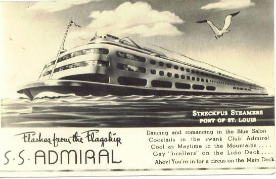
    Yesterday’s article in the St. Louis Post-Dispatch on the fate of the S.S. Admiral (“Boat my move north” by Gail Appleson) reported on both the short-term and long-term fates of the Art Moderne vessel. Pinnacle Entertainment, owner of the boat, plans to move the Admiral to a site just north of the Chain of Rocks Bridge. This move could take place in 2009, if the Missouri Gaming Commission approves.

    The more troubling news comes in a quote from Pinnacle Chief Executive Office Dan Lee. According to Lee, the Admiral is close to needing its 100-year-old-hull (the Art Moderne section was built atop an existing 1907 hull) rebuilt, and Pinnacle has no interest in making that repair. Lee told the Post that re-hulling “wouldn’t be economical” but he thinks that “there are a few more years left on that hull.” How long the S.S. Admiral can survive remains uncertain.

    Categories
    Demolition Hyde Park JNEM North St. Louis Riverfront

    Long Lost: First Home of Bremen Bank

    by Michael R. Allen

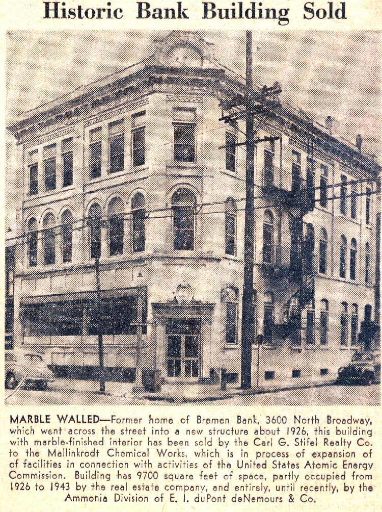
    The following scanned clipping comes from the January 9, 1949 edition of the St. Louis Post-Dispatch:

    Some readers know of the 1927 Bremen Bank building diagonally across the intersection of Broadway and Mallinckrodt streets; that lovely historic building remains the home of the Bremen Bank.

    This clipping is interesting because its caption tells the story of what has happened to large buildings built for specific large tenants when the original tenant moves out. First another large user might come along, with a less prominent use of the space (her, a real estate office). Then comes a second wave of office use, and further depreciation of value. Finally, the property is eyed for a larger development. The story here ends a few months after this blurb appeared in the newspaper. After Mallinckrodt purchased the lovely old bank building, it wrecked it. While the blurb mentions federally-subsidized atomic energy activity, Mallinckrodt actually wrecked the Bremen Bank for a worker parking lot. To this day, the site remains vacant save a small building built on the east end if the parcel in 1994.

    In 1949, such industrial expansion along Broadway north and south of downtown was not uncommon. Such expansion came on the heels of the 1947 city Comprehensive Plan, which streamlined land uses to industrial in formerly mixed-use areas along the riverfront while calling for a zoning plan that would allow such anti-urban uses as surface parking on a major thoroughfare. Alas, that zoning plan remains in place, while the land use plan finally changed in 2005. Also remaining is the notion that industrial sites need to spread outward, surrounded by parking and open land, and not be more integrated into city neighborhoods. A clipping like this demonstrates that there are formidable constants in historic preservation and urban design. Nearly sixty years later, a lot remains the same.

    North Broadway around Bremen Bank, however, does not remain the same. Mallinckrodt’s expansion — much of it for parking — erased most of the pedestrian quality of that street scape. Besides the bank, only a few other small businesses are open there. Interstate 70 forms a barrier between this area and the populated section of the Hyde Park Park neighborhood to the west. The city government officially draws the Old North and Hyde Park boundaries at I-70, further enforcing the separation. Had things progressed differently, the old Bremen Bank could have been retained along with other buildings on Broadway, with Hyde Park connected to its major employer and to the riverfront.

    What is puzzling is that at the same time the 1947 Comprehensive Plan’s call for creating an industrial wall along the river was being drafted, civic leaders were also plotting the construction of the Jefferson National Expansion Memorial downtown in order to improve the central riverfront. Did no one see the conflict between the policies? There was already an organic urban connection to the river, and it could have been enhanced as the city began its loss of industry. Industrial expansion policies — and, I should point out, the Memorial itself — decimated the street grids, neighborhoods and buildings that bound the city to the Mississippi. The long-term consequences of the old policies are haunting us today. And we don’t have as many resources like the Bremen Bank building around to help reconnect us to the riverfront as we started with.

    Categories
    Downtown Green Space JNEM Riverfront

    Clay: Arch Grounds Bill "Technical Placeholder" for Next Congress

    by Michael R. Allen

    Today’s Riverfront Times carries an article by Kristin Hinman, “Shaky Grounds: Congress may consider putting the Arch’s riverfront park in private hands”, in which Congressman William Clay states on the record the intention behind HR 7252, the bill that he introduced in October to cede control of the Jefferson National Expansion Memorial to a private group.

    Clay’s statement is encouraging:

    In a written statement to Riverfront Times, he describes the bill as a “technical placeholder” for the 111th Congress, which begins in January.

    “The potential loss of a portion of a national park, even for a worthy public purpose, is a very serious matter,” Clay writes. “And it will require extensive public input and community engagement before anything happens.”

    The congressman is correct. I am glad that Clay put his intentions on the record and supports a public process for considering changes. Hopefully, when the next Congress convenes, Clay refrains from introducing any bill until the National Park Service draft management plan is reviewed by the public and formally adopted in the spring.

    Categories
    Downtown Green Space JNEM Riverfront

    More Time Needed for Jefferson National Expansion Memorial Planning

    by Michael R. Allen

    I was out of town Friday when KWMU aired my most recent guest commentary:

    More Time Needed for Jefferson National Expansion Memorial Planning

    Categories
    Downtown Mississippi River Riverfront

    Pinnacle Third Quarter Report Mentions Admiral Relocation

    by Michael R. Allen

    Pinnacle’s third quarter earnings report, released yeterday, contains this sentence:

    The Company is evaluating the feasibility, subject to gaming commission and other regulatory approvals, of relocating The Admiral Riverboat Casino to another location within the city of St. Louis.

    Categories
    Downtown Historic Boats Missouri Riverfront

    A is Not for the Admiral

    by Michael R. Allen

    While Missouri Proposition A is not directly about historic preservation, there is a preservation-related consequence: the shuttering of the S.S. Admiral on the St. Louis riverfront. First built in 1907 and rebuilt to jazz-age standards in 1940, the beleaguered Art Moderne boat has lost its engine and much of its original interior, but it retains sophisticated, cool lines on the exterior. Of course, the body of the S.S. Admiral is hidden behind an ugly floating structure on the riverfront side, placing the only clear view from the river channel.

    Currently, Pinnacle Entertainment owns both the Admiral and Lumiere Place uphill. Pinnacle’s ownership prevents local competition as well as provides a close place where patrons can continue gambling after reaching loss limits at Lumiere. It’s a bad system, and I am not arguing that Pinnacle should continue it.

    Personally, I support allowing people to decide what to do with their own money. That support extends both to gamblers looking to lay some money down at a casino as well as casino operators looking to open new casinos. Proposition A doesn’t allow for a free market in casinos. Rather, it acts as a form of protectionism for current operators. The proposition would lift Missouri’s loss limits — the last left in the nation, but would also limit Missouri’s casino licenses to 13. Currently, there are 12 licenses and Pinnacle Entertainment is seeking to secure one for a new casino in Lemay. Obviously, Proposition A is a windfall for Pinnacle and other operators, and a roadblock to competition. I hope that the measure fails and a smarter, competition-oriented policy is adopted. After all, if gamblers will be pouring more money into casinos, they deserve choices.

    Back to the Admiral: If Proposition A passes, Pinnacle won’t need the old boat. Dan Lee, head of Pinnacle, told the St. Louis Post-Dispatch in September that he might move the boat to a new city location temporarily, but eventually ditch it for a new facility that would assume the Admiral’s license. Should that course of events happen, no other operator will be able to buy the Admiral and obtain a gaming license. Any use for the Admiral that does not include gambling probably will fail. Stripped of so many other things, the Admiral has survived. Stripped of a gaming license, the boat won’t have much of a future. The threat to the Admiral is not a good reason to vote against Proposition A, but it will be a consequence of its passage.

    Categories
    Historic Preservation Industrial Buildings Riverfront

    The McPheeters Warehouses: A Total Loss for the City

    by Michael R. Allen

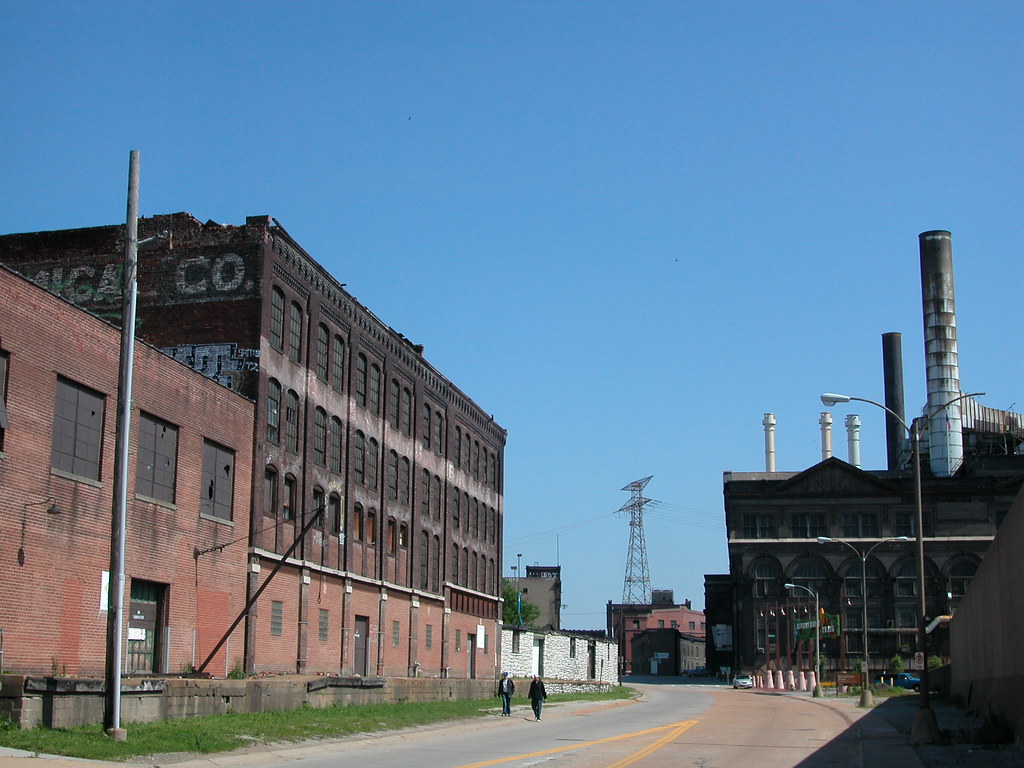
    Looking north on Lewis Street, May 2008.
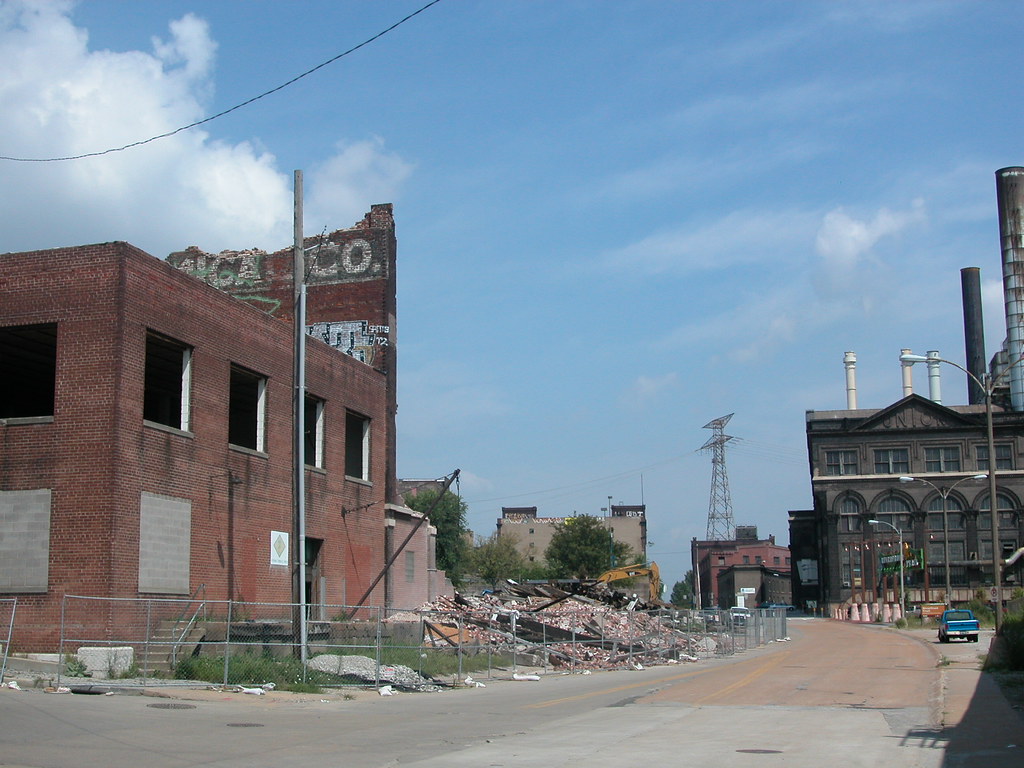
    Looking north on Lewis Street, August 2008.
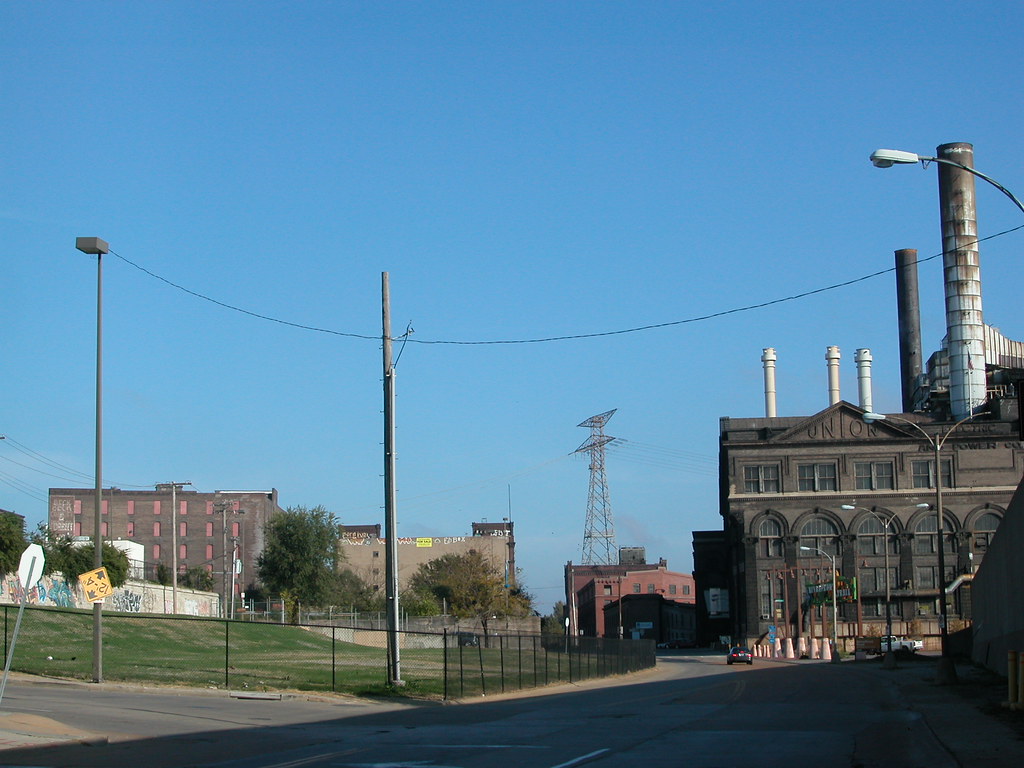
    Looking north on Lewis Street, October 2008.

    I have pushed off writing further on the now-demolished McPheeters warehouses on Lewis Street just because doing so seemed fruitless. After all, there is no way to return the important lost buildings, and little point in aggressively emphasizing the obvious — that the demolition of the warehouses was probably city government’s biggest preservation failure of 2008.

    However, the more that I think about the fine original warehouse, with its adaptable mill method body, or the one-story cold storage building whose true historic significance will never be fully established, I am upset. I think about what the site looks like now, which is worse even from the perspective of the most city-fearing casino patron. I think about what we learned during the demolition: that the central 1881 building was actually built onto the city’s bluff, using a natural limestone wall as part of its foundation (and the source of major water leaching into the building’s timber beams, causing the west wall collapse). I think about how we could have learned from the cold storage building and figured out much about St. Louis shipping, brewing, packing and other industries. We can still learn, of course, but without physical evidence it’s hard. We have lost a lot, and gained nothing.

    The Land Clearance for Redevelopment Authority wrecked the buildings with public funds, but the instigator was Pinnacle Entertainment, owners of the adjacent Lumiere Place casino complex. At the city’s Preservation Board, St. Louis Development Corporation Deputy Director Otis Williams — a man with a very difficult job, mind you — told the Board that Pinnacle feared loss of revenue without enhancement of its surroundings. The old buildings, missing roof and wall sections, had to go in the name of economic development.

    Specious as this case may be on the face, there was truth inside of it. City government ought to take measures within its powers to stabilize the surroundings of businesses and homeowners who have made significant investments. In this case, LCRA was the owner of the McPheeters warehouses, and held the duty to improve the buildings.

    However, there is short-term enhancement and there is long-term enhancement. Charged with the public good, rather than merely carrying out the wishes of private parties, city government has the power to challenge economic logic when it serves a singular interest and when its execution would deprive broader economic and cultural benefit. In the case of the McPheeters warehouses, rehabilitation of the buildings would have been the greater good, and demolition the lowest. All that demolition did was provide instant gratification to a large and stable company that had already made its primary investment.

    In this case, city government should have taken Pinnacle’s demand and raised it. LCRA could have spent comparable funds to demolition cost and used them to stabilize the western wall of the center warehouse, which had partly collapsed, and made some roof repairs to the rest of the complex. I doubt that the budget would have accomplished total stabilization, but it would have effectively mothballed them and prevented their loss.

    Preservation would have been helpful to the developers and non-profit organizations that are trying to spark development in the North Riverfront Historic District. Preservation would have enhanced the scenic ride from the Arch grounds to the start of the north riverfront trail. Preservation would have allowed people to some day live or work right on the river, near downtown, the trail and even Lumiere Place. Preservation would have bridged the visual gap between Laclede’s Landing and the North Riverfront Historic District, abating the impact of Lumiere Place by making it seem less disruptive. Preservation would have kept the second-nature of building materials and embodied energy in place for eventual re-use. As we know, energy and materials are valuable through growing scarcity, and their conservation is both ecologically sound and economically smart.

    Obviously, Pinnacle wanted short-term satisfaction for Lumiere Place managers and guests. City government could have balanced that desire with one encompassing the desires of others, the need to safeguard the city’s cultural resources and the need to enhance and spur future investment as well as safeguarding existing investment. In other words, city government could have brought planning into the discussion. Instead, it capitulated to one company’s short term desire, forever removing a development opportunity for other developers or even that company itself.

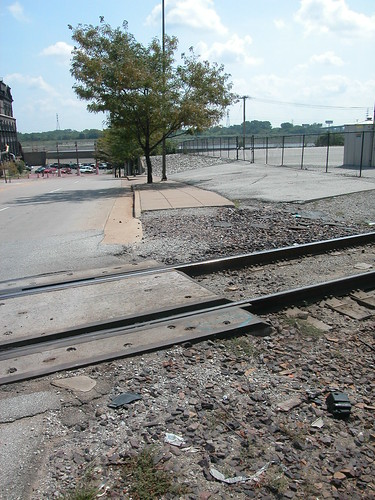
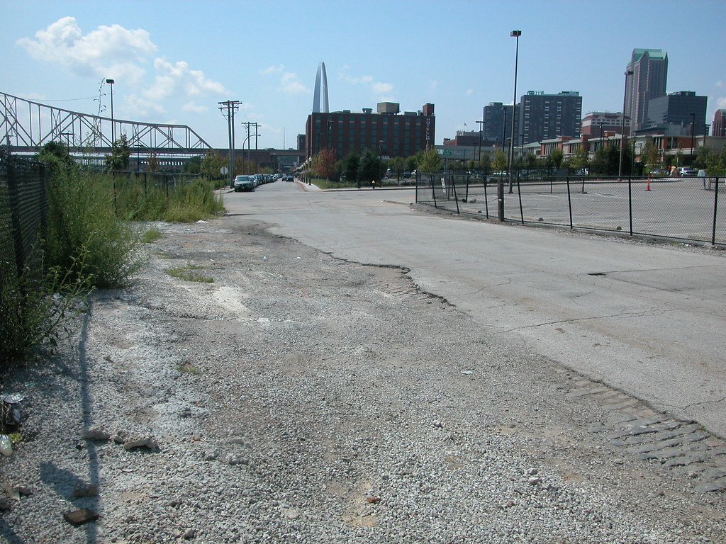
    The photos below, taken during demolition, show that even the short-term effect of the demolition is not gain. While the buildings are gone, the sidewalks and streets around them are broken up, uneven and unsightly. Sidewalk and street repair here would bring public benefit, and do far more to make people think that the area is safe and healthy than demolition. I fail to see how any one’s long-term desires were met by LCRA’s decision to demolish the McPheeters warehouses.
    Categories
    North St. Louis Riverfront

    Mound Marker

    by Michael R. Allen


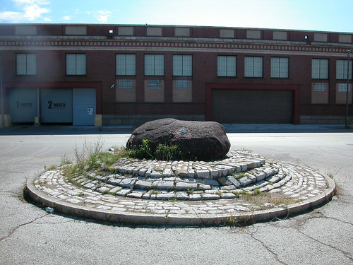
    Perhaps you have seen the rough granite stone ceremoniously placed in the limestone ring at the intersection where Howard, Broadway and Seventh streets meet on the north riverfront. Know what it is? This stone once held a plaque — later stolen, perhaps to be scrapped at the metal yards up the street — commemorating the famous prehistoric Big Mound. The Big Mound stood one block north at the northeast corner of Broadway and Mound Street until 1869, when it was removed to make way for industrial construction. The iconic Big Mound was 30 feet tall and 150 feet wide, and plainly visible from the Mississippi River. That mound and others helped conjure our city’s nickname of “Mound City.”

    The new Mississippi River Bridge will not impact the site of this marker, but it will claim the site of the old mound. Federal funds ensure that archaeological mitigation work will be done, so we may have a chance at making discoveries about the mound. Meanwhile, the Mounds Heritage Trail Route will connect the north riverfront mounds with those in East St. Louis and at Cahokia Mounds. That project will include permanent markers. perhaps the plaque will return.