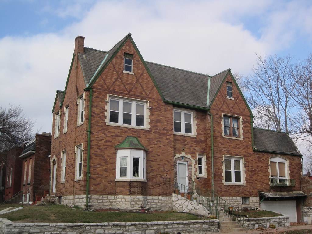
On February 3, the Building Division issued a demolition permit to Transformation Christian Church and Outreach Center for the house at 4205 Page Boulevard in the Vandeventer neighborhood. No doubt the church needs the land for a noble purpose. No doubt also that the house was in good condition at demolition. And no doubt at all that one less house in Vandeventer is one less family in north St. Louis. Buildings fall, people scatter.
Forty years ago today, demolition work started at the conjoined Pruitt and Igoe housing projects. On March 16, 1972, the St. Louis Housing Authority took down half of building A-16 in the Pruitt side of the project through an explosive blast. This was followed by a larger blast that took down all of double-module tower C-15 on April 21, 1972. These two spectacular demolition events led to the ultimate decision to demolish all of Pruitt-Igoe’s remaining 31 towers in 1976 and 1977. Yet on March 16, 1972, the St. Louis Housing Authority was not attempting to kill modernism, high-rise public housing or even Pruitt-Igoe. Instead, the Authority was trying to save these things.
In early 1972, the St. Louis Housing Authority created a task force of local and Department of Housing and Urban Development officials to examine physical interventions that might alleviate the problems at Pruitt-Igoe. The biggest challenge then was vast oversupply of housing units. Fewer than 400 of the over 2,800 units in the 33 towers was occupied. The St. Louis Housing Authority was faced with a need to reduce the unit count and eliminate vacant buildings in order to improve conditions for occupied buildings. Yet the fractional rent collection on the complex made solutions difficult to finance.
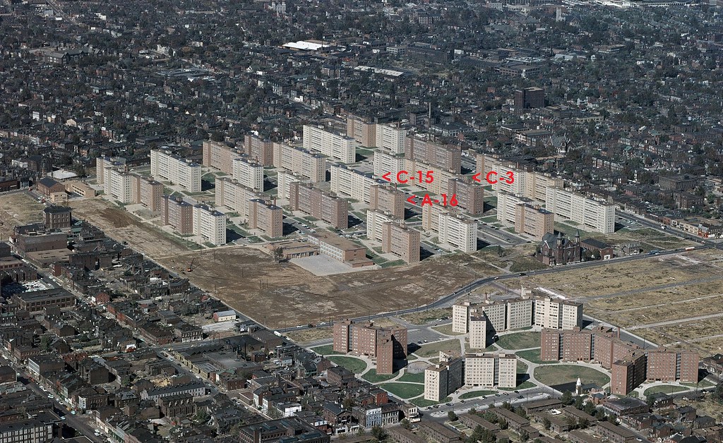
The locations of the three towers slated for blast, amrked on a 1959 U.S. Geological Survey photograph of the Pruitt and Igoe projects.
The task force elected to explore reducing the towers’ heights to four stories — a somewhat ironic move given that early plans had called for a low-rise development. The 1947 city Comprehensive Plan had advocated low-rise garden apartments on the site, and architect Minoru Yamasaki’s first concept for the project consisted of four and six story buildings. The St. Louis Housing Authority, under the leadership of Director Thomas Costello, elected to experiment with reducing floor heights.
However, recognizing the surplus of buildings and the need for experimentation, Costello successfully sought HUD permission to demolish three buildings in the project. These demolitions would allow for experimentation in demolition techniques to assess value engineering of the floor removal, and they also would allow the Authority to create a park in the center of the project. At one point, the Authority even explored retaining the rubble from the wrecked buildings as a sort of bizarre landscape feature.
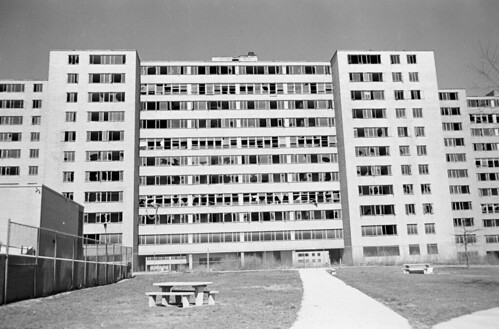
The south face of a vacant single-module tower at Pruitt-Igoe. (Source: State Historical Society of Missouri.)
On the morning of March 16, 1972, Costello obtained a building permit for demolition of three towers, to be taken down by explosive blast. The St. Louis Housing Authority selected three towers at the center of the project, along Dickson Street (the only east-west public thoroughfare on the site, and the dividing line between the Pruitt and Igoe projects). The Authority chose towers A-16 and C-15 south of Dickson, and tower C-3 north of Dickson. C-3 would never be demolished by blast. The towers chosen included one of the 180-foot-wide single module towers, A-16, and two 360-foot-wide double module towers, C-3 and C-15. The Authority estimated the cost of demolishing the three towers at $12,000. Over $35 million in bonded construction debt was still owed on Pruitt and Igoe.
The St. Louis Housing Authority hired Dore Wrecking Company of Kawkawlin, Michigan, to conduct the demolition. St. Louis wreckers had never worked with large-scale explosives. Dore Wrecking in turn subcontracted the explosive work to a colorful firm in Towson, Maryland, named Controlled Demolition, Inc. Jack Loizeaux founded Controlled Demolition in 1947, and the company had experience using explosive methods to take down many buildings around Baltimore. The well-publicized Pruitt-Igoe blasts would make the company famous. Controlled Demolition would become the nation’s top firm for explosive demolition, and its future projects would include the Hudson’s Department Store in Detroit, the Kingdome in Seattle, and parts of Yamasaki’s World Trade Center in New York.
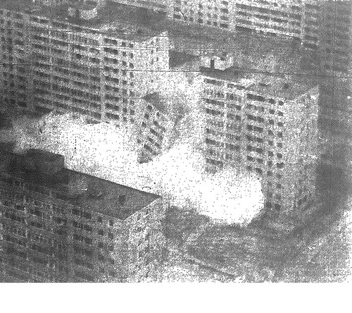
Building A-16 collapsing on March 16, 1972.
For A-16, Controlled Demolition planned to take down only half of the tower by blast. There was electrical equipment in the basement that the St. Louis Housing Authority wished to protect, so the other half would be taken down by crane and wrecking ball. Controlled Demolition placed specially-designed dynamite sticks into holes drilled in the building’s concrete upright columns. The detonation would start at the base of the building, to weaken its support, and travel upward.
On March 16, the demolition event was set for 1:30 p.m. At that time, officials postponed it to 2:15 p.m. That time arrived, and wreckers realized that the blast machine had accidentally went along for a pick-up ride to Lambert International Airport. John D. Loizeaux, president of Controlled Demolition, professed embarrassment at the less than punctual start of demolition. Yet the delays allowed for the blast to start after 3:00 p.m., when Pruitt School sent its elementary students home for the day. The students flocked to the demolition site.
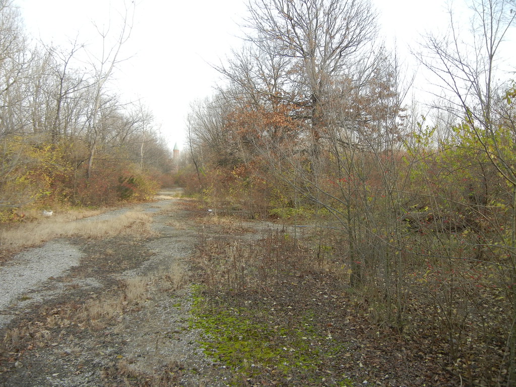
Looking east down Dickson Street in December 2011. The sites of A-16 and C-15 are at right, while the site of C-3 is at left.
The blasts were heard as muffled gunshot-like sounds, and rather than send out a distress call, they were almost easy to miss. Upon the end of the blasts, the west half of A-16 collapsed in a rising clod of debris. Notable was that the building had lead paint used inside, and there had been no abatement. The slabs pancaked into a pile that would require hand wrecking to remove. Building A-16 was only 17 years old upon demolition, and its reinforced concrete structure was resistant to blast.
At the end of demolition, officials were confident in the methods of Controlled Demolition, and scheduled the second and more spectacular blast for April 21. Yet Thomas Costello told the St. Louis Post-Dispatch, “[t]his is only the first step, and there are many more to go. We don’t know what they will be at this time.” Pruitt-Igoe was not dead yet.
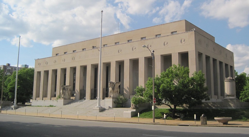
The Soldiers’ Memorial was completed in 1938 as the centerpiece of Memorial Plaza, a municipal landscape devoted to St. Louisans who sacrificed their lives in World War I. Designed by Mauran, Russell & Crowell with Preston J. Bradshaw, the building offers an angular, modernist reduction of a classical Greek temple form. This building and its military museum anchor a historic civic landscape, but public awareness and financial stability have been elusive in recent years.
Now the National Park Service is studying acquiring the Soldiers’ Memorial, which the City of St. Louis has owned since construction. Should the city convey a public building long maintained by local taxpayers to the federal government? Will the National Park Service be able to increase attendance and improve the curatorial practices of the museum? These questions are now on the table.
Thursday, members of the public will have the chance to offer comments on the National Park Service study of acquisition and management of the Soldiers’ Memorial. The following is taken from an announcement posted this week by Ruth Heikkinen, Project Manager, Soldiers’ Memorial Military Museum Special Resource Study:
The National Park Service was directed by Congress in Public Law 110-229 to evaluate the Soldiers’ Memorial as a potential unit of the national park system. For a site to be recommended as a potential new park unit, it must meet the criteria for national significance, be a suitable and feasible addition to the park system, and NPS must be found to be the best option for management. Studies that evaluate these criteria are called special resource studies (SRS).
Public input is an important part the of the SRS process, and we invite your attendance at our public meeting at the Memorial on March 15th from 5-6:30pm (see Meeting Notices at left for more details). We also invite your comments on the Draft SRS (to be posted by March 14th, 2012 …).
We are in the final stretch of the process of securing historic district status for most of the O’Fallon neighborhood. By early May, Preservation Research Office will have submitted the first of two National Register of Historic Places nominations that cover almost all of the historic neighborhood. The O’Fallon Park Historic District will encompass the areas east and south of O’Fallon Park, while the Fairground Park Historic District will encompass an area west of Fairgrounds Park south of Lee Avenue, north of Natural Bridge Avenue, west of Fair Avenue and east of Newstead Avenue.
The historic district designations are sponsored by the Acts Partnership with the assistance of Alderman Antonio D. French (D-21st). Work began last February on a 1,796-building survey that had led to the two historic district nominations currently being drafted.
The decision to split the neighborhood is based on subdivision history and development patterns. The area of O’Fallon west of Fairgrounds Park was first developed after the platting of White Place in 1859, but construction was slow. Additional subdivisions were Mary E. Burson’s Subdivision (1889), Fairground Place (1910), Lucille’s Fairground Park Addition (1912) and several others. Most of the building stock there dates to between 1910 and 1940, somewhat later than the northern part of O’Fallon that started development in the 1890s and largely built out by 1930. Like the northern part of the neighborhood, the area is remarkably intact. Here are a few photographs.
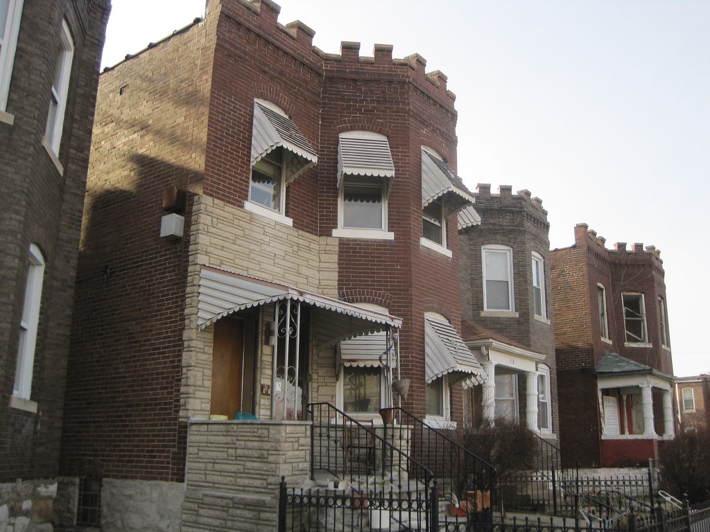
There is a row of castellated two-flats on the east side of the 4100 block of Harris Avenue.The 4100 block of Kossuth Avenue is on the north side of Fairgrounds Park.
The business district on South Grand Boulevard between Arsenal Street and Gravois Road showcases the great range of twentieth century architectural styles, forms and materials employed in St. Louis. From the vintage Standard station at Grand and Connecticut, through blocks of two-part commercial structures and up to the tower of St. Pius V Roman Catholic Church, South Grand has a splendidly polyphonous architectural character. Yet there are few mid-century modern buildings in the mix, showing how little demolition visited the district after its early build-out.
South Grand’s mid-century modern landmark remains the diminutive bank building at 3150 S. Grand, right at Juniata Street on the east side. The stark minimalism of this building, built by the Hamiltonian Federal Savings and Loan Association in 1961, contrast with the classicism prevalent in the terra cotta that adorns buildings across the street, and with the contemporary design of the Commerce Bank to the north.
Out of sight, out of mind? Not brick theft. Brick thieves continue to strike abandoned buildings in north city, although the territory of operation has shifted westward. Two years ago, brick theft was prevalent in JeffVanderLou and St. Louis Place. With many targets hit, and fewer vacant buildings left, those neighborhoods have seen a drop in activity. Today brick thieves are more likely to be working in The Ville, Greater Ville, Fountain Park, Fairgrounds and Lewis Place neighborhoods.
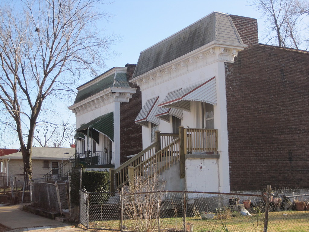
The house at 4477 Page Boulevard.
The thieves are even taking down buildings located on major thoroughfares in north St. Louis. Today I noticed two buildings damaged by obvious illegal demolition activity whose locations are very prominent. The first of these was at 4477 Page Boulevard, just east of Taylor Avenue in Lewis Place. This vacant building may have been marred by fake stone veneer and heavy paint, but its solid structure was intact until very recently. The house stands not far from the campus of Ranken Technical College, and on a block where most buildings are occupied.
On January 17, the National Park Service listed in the National Register of Historic Places three historic districts in and an amended and expanded historic context for The Ville neighborhood. Due to lack of contiguous historic fabric, The Ville is not eligible for listing as single historic district. All National Register listings are made using the requirements of Historic and Architectural Resources of the Ville Multiple Property Submission (MPS), first created in 1999.
The Herman Dreer House (built 1930) at 4335 Cote Brilliante Avenue is at left; it was listed in the National Register in 2009. Now the rest of its block is within the National Register-listed Marshall School Neighborhood in The Ville Historic District.
Until last month, The Ville MPS lacked a section that would enable listing of groups of residential and commercial buildings associated with general trends of African-American settlement between 1910 and 1950. Buildings had to be associated with significant institutions or individuals. Most building stock in The Ville is the backdrop for significant twentieth century history — a context that preserves the character of an entire era of significant cultural activity. Listing intact groups of buildings helps preserve the sense of place enjoyed by Annie Malone, Herman Dreer, Charles Henry Turner, Julia Davis and other prominent African-Americans who either lived or worked in the neighborhood in its heyday.
The city’s Cultural Resources Office (CRO) staff rewrote the Historic and Architectural Resources of the Ville MPS document, adding a well-written and must-read section (“Context III: The Ville as the Product of Residential Segregation Policies, 1910-1950”) that documents the larger settlement history as well as “registration requirements” for the building stock long not covered by the document. The Preservation Research Office submitted the three small historic districts that are the first to be nominated under the new section.
The three districts are not the only small residential districts eligible in The Ville, but are the only ones identified as eligible in The Heart of the Ville architectural survey conducted in 2009 and 2010. Additional surveys should be funded to identify other potential districts in The Ville. Meantime, there now are 90 more buildings eligible for historic tax credits in The Ville!
Creating National Register of Historic Places historic district designations often is straightforward work — a consultant delineates the boundary of an eligible area dense with urban building stock. Then there are depleted neighborhoods in north St. Louis, where the levels of demolition make defensible boundaries more difficult. With extensive demolition marring its streetscapes, The Ville is no exception. Yet The Ville has a historic importance as the cultural center of African-American life in St. Louis rivaled only by the lost Mill Creek Valley.
Since 1987, The Ville has been a Local Historic District with restrictions on demolition, but until recently little of it had National Register of Historic Places status. Beyond the great cultural honor, that status makes available federal and state rehabilitation tax credits — the programs that revived Dick Gregory Place in the western end of the neighborhood. Since taking office in 2007, Alderman Sam Moore (D-4th) has pushed to find solutions for historic preservation of The Ville’s buildings, many of which face the wrecking ball in the absence of incentives for their reuse. One of the city’s most important neighborhoods seemed to be disappearing over the last few decades, but finally there may be a change in direction.
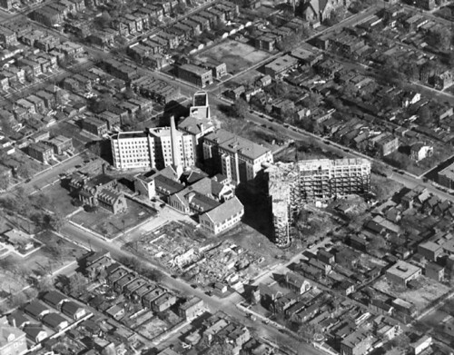
This historic view shows Homer G. Phillips Hospital under construction in 1936. Areas to the south and west of the hospital were included in the recent "Heart of the Ville" architectural survey.
Between August 2009 and August 2010, under contract to city government, the Preservation Research Office (PRO) completed the first intensive architectural survey of the heart of St. Louis’ fragile yet historically significant African-American neighborhood The Ville. The “Heart of the Ville” survey was the result of the successful St. Louis Cultural Resources Office (CRO) application for a Historic Preservation Grant to survey the Ville neighborhood, a local historic district with outstanding significance and uneven integrity. PRO evaluated 368 primary resources and 49 secondary resources, all buildings, to form the basis for historic district nominations. As of this writing, three small Ville historic districts are now listed in the National Register of Historic Places based on the survey results. (See subsequent post.)
The Tudor Revival home and residence of African-American physician Dr. Leo Commissiong stands at 4201 Aldine Avenue. Built in 1931 and designed and built by F.L. Whittaker, this house could be individually eligible if more research on Dr. Commissiong established him as a significant individual.The houses at 4242 and 4246 W. Garfield Avenue are among several raised-basement Italianate-style homes in the survey area. These residences were built circa 1890.
The survey was designed as a cooperative effort between the City of St. Louis CRO and Lynn Josse and Michael Allen at PRO. In November, 2009, PRO signed a contract with the city to provide a reconnaissance survey of 300 properties within the boundaries of the Ville neighborhood. Because this number would include fewer than half of the potentially historic residential and commercial properties within the originally identified survey area, CRO and the contractors targeted a much smaller set of blocks within the Ville. The new boundaries were selected based on the level of threat to the targeted resources.
A base map used by the consultants in the survey report. The cyan lines indicate the districts ultimately created from the survey results.
This survey differed from many others because the neighborhood has already been the subject of intensive study over three decades. In 1983-84, Landmarks Association of St. Louis conducted a reconnaissance survey of the Ville. In 1987, the City of St. Louis designated most of the Ville neighborhood as a local historic district. Two years later, the National Park Service (NPS) rejected certification of the Ville Local Historic District — a process that allowed other neighborhoods to have both local and national designation — due to extensive building loss in parts of the district. Consequently, the Historic and Architectural Resources of the Ville Multiple Property Submission was developed by Landmarks Association of St. Louis and approved by the National Park Service in 1999. The MPS offers three contexts under which individual buildings or groups could be listed in the National Register. The contexts are: “Black Settlement in the Ville, 1865-1910” and “The Ville as a Center for African-American Culture, 1910-1950”. The MPS establishes registration requirements for Institutional Buildings but no other types, stating that this is “the first phase of what is hoped to be a long-term project of evaluating and registering properties in the Ville.”
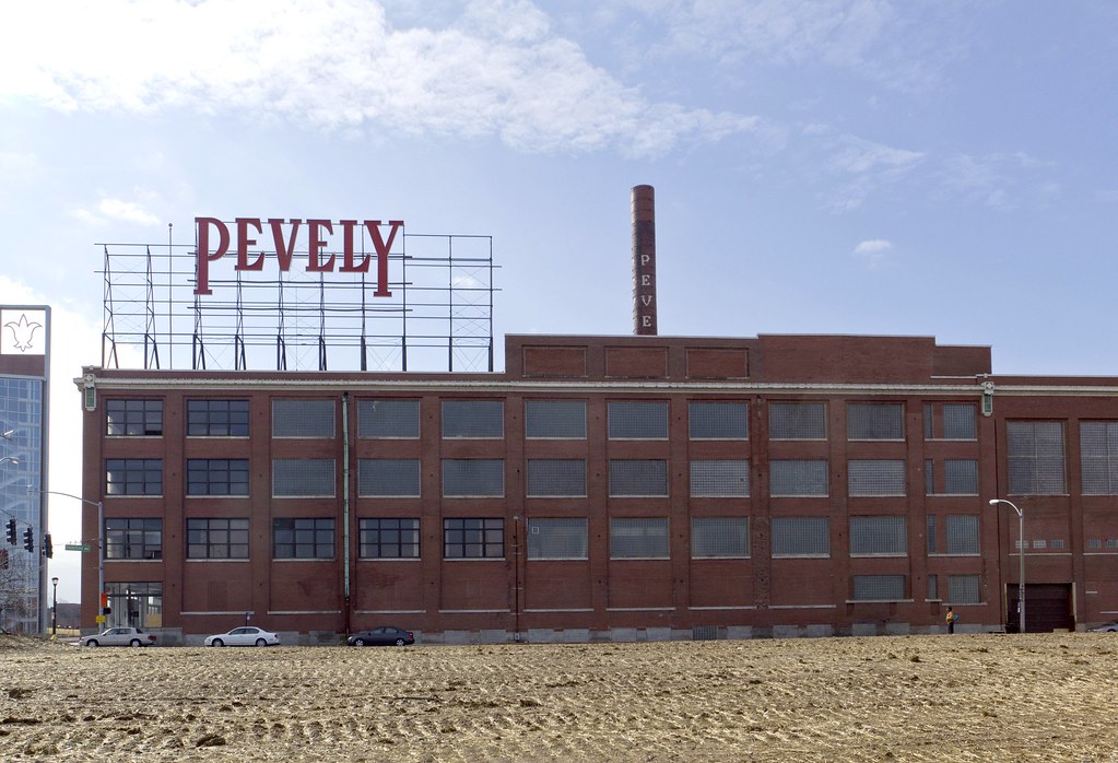
To start: no matter what the result of last night’s Planning Commission meeting, public input counts. If any historic building under threat of demolition is to have a fighting chance in this city, your emails, testimony, and public demonstrations are essential. Tonight, in the case of the Pevely complex, when the long-standing ordinance forbidding its demolition was hardly addressed and when new public testimony was not allowed, prior community support for its preservation was noted numerous times. This support ultimately failed to tip the scales in favor of Pevely, but it was certainly better than having the record state that “there were no emails, there was no one who cared enough to stand up for these buildings.”
Pevely Dairy Plant photograph by Michaela Burwell-Taylor.
That said, the meeting resulted in the overturning of every facet of the Preservation Board’s December 20th decision to deny demolition of the Pevely corner building and smokestack, and of its prior decision to grant demolitions of the milk plant and garage on the condition that St. Louis University apply for a building permit for its new facility first. Instead, the Planning Commission voted almost unanimously to allow the demolition of all four structures. The small measure of “compromise” struck was that the corner office building cannot be demolished until the university applies for a building permit. Only one commissioner, Patrick R. Brown from the office of Mayor Francis Slay, voted against the motions.
The two-hour long meeting was convened at SLU’s behest, for under the city’s preservation ordinance property owners denied demolition permits may appeal that decision to the Planning Commission, which ostensibly judges the “correctness” of the other body’s ruling under city law. Only Cultural Resources Office Director Besty Bradley was permitted to testify in support of the Pevely buildings, while SLU’s attorney, school president Father Lawrence Biondi, and architect Steve Smith of the Lawrence Group argued in favor of demolition. SLU’s representatives repeated many of their earlier arguments from the Preservation Board meeting.
Pevely Dairy Plant photograph by Michaela Burwell-Taylor.
Hyperbolic statements ruled the evening: if SLU doesn’t build this building on this site, it will lose competitiveness, doctors will flee, the university will close its medical school and move to the suburbs. Barnes, its only urban counterpart, has no green space, but SLU needs green space surrounding its new building for walkability and patient use, despite the fact that SLU’s current lawn around the Doisy Center across the street is wholly barren and that similar open green space fronting Grand would be undesirable for medical patients undergoing treatment. The corner Pevely building, currently slated for that green space, would cost too much too rehabilitate, although such rehabilitation would be a mere fraction of the $80 million SLU has for new facilities on the site. When asked by the commission why it rebuffed conditions mandating that it present concrete building plans prior to receiving demolition permits — a seemingly reasonable compromise — SLU’s attorney responded that it was a “psychological issue,” that the university felt it deserved the flexibility. Despite earlier statements to the contrary, SLU now says that the historic smokestack is a hazard, making it clear that it never intended to retain it.
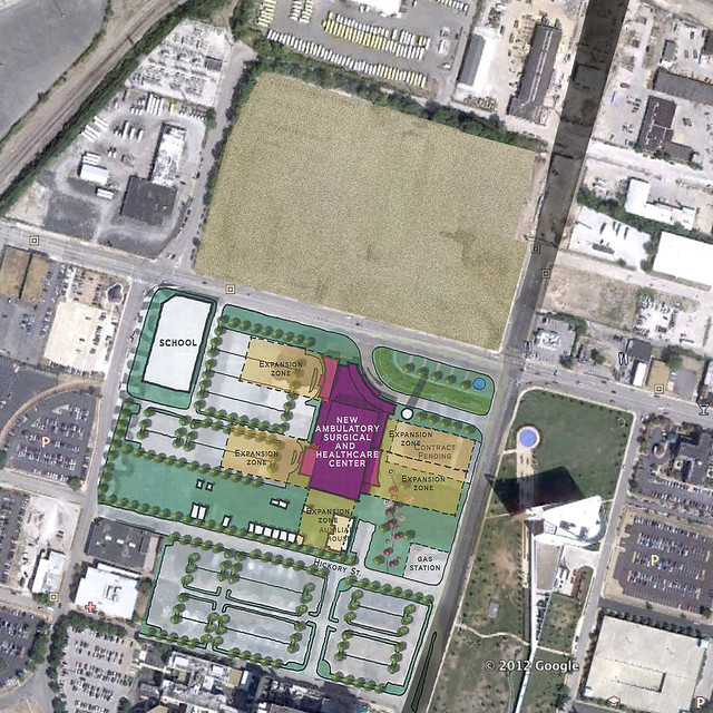
Only fleeting mention was made of the massive lot directly north of the Pevely site on northwest corner of Grand and Chouteau, owned and recently cleared by SLU, a site which would be ideal for the new ambulatory care facility but for which the university has not released plans. None of the discussion focused on whether the Preservation Board had correctly upheld the city’s preservation ordinance, which clearly states that sound National Register-listed buildings such as those in the Pevely complex should not be demolished.
In the end, community members who sought to preserve the Pevely did what they could within the system that we have. Renderings showing how the building could be reused, generated during the design charrette co-sponsored by the Preservation Research Office and the Landmarks Association, were given to the Planning Commission prior to the meeting, as were all emails sent to the Cultural Resources Office and the transcript of public testimony recorded at the Preservation Board meeting. Convincing the Preservation Board was something of a first. We can only build on that experience for the future.
Across Chouteau Avenue from the Pevely Dairy Plant, St. Louis University has cleared several older industrial buildings. In recent days, the straw-strewn vacant lot has been awash with birds picking out the grass seeds. This prominent location, elevated above Grand Avenue to the east, now will sit idle for the time being. St. Louis University, a non-profit corporation, will not pay real estate taxes on this valuable central corridor site. Until developed, the site is producing absolutely nothing in economic good for the city.
Jeremy Claggett posted an article at nextSTL that shows how the university’s proposed ambulatory care center could occupy this newly-cleared land mass. Construction could start immediately, and the value of the Pevely Dairy Plant would increase with the investment across the street.
In the early twentieth century, urban planning became a function of city government in order to curb rampant private misuse. At its best, municipal planning ensures thoughtful lands stewardship remains an enforceable public good. This happens through a priori guidance — comprehensive planning. Commissions’ denying demolition permits serves as a negative force that can prevent careless losses of historic buildings with cultural and economic value, but such denials do not constitute effective urban planning.
St. Louis University’s land acquisitions around the medical center demonstrate that in the absence of strong municipal planning, the university has created its own comprehensive plan. That plan may lead to job creation and provision of some public goods, like ambulatory care, but it remains a plan to achieve private institutional goals. The university’s wishes for future development of the corner of Grand and Chouteau may coincide with the public good, but they are not responsive to it.
At present, the public good is manifest through citizen power brought to public meetings at the Preservation Board, Board of Aldermen and other venues. Citizens have asserted that the public good is not served by allowing demolition of the Pevely Dairy when the university has enough land to build ten ambulatory care centers and still leave the historic dairy plant standing. All people are saying is that the university’s planning should be subsumed to the interests of the entire city.
The interests of the city are not served by the university’s land-banking, nor by the university’s wanton demolition of buildings listed in the National Register of Historic Places (a not-easy-to-obtain federal designation created in 1966 that represents the public interest). The absurdity of taking down the Pevely Plant when there is a giant, fresh moonscape across the street is clear to the public, the majority of Preservation Board members and seemingly to Mayor Francis Slay. That’s a glaring point of contest, though. The larger issue remains more diffuse: St. Louis University’s planning for the medical center area is happening without the presence of assertive municipal comprehensive planning. The Pevely Dairy demolition won’t be the last battle here.