Today we publish the first part of a nine-part series on the evolution of the Gateway Mall, that ribbon of park space that runs between Market and Chestnut streets and from the Jefferson National Expansion memorial westward to Twenty-Second Street downtown. This article began its life as a lecture that I delivered to the Friends of Tower Grove Park on February 3, 2008, and was published in its entirety in the NewsLetter of the Society of Architectural Historians, Missouri Valley chapter in Spring 2011.
Looking east down the Gateway Mall in 1970. (Collection of Landmarks Association of St. Louis.)
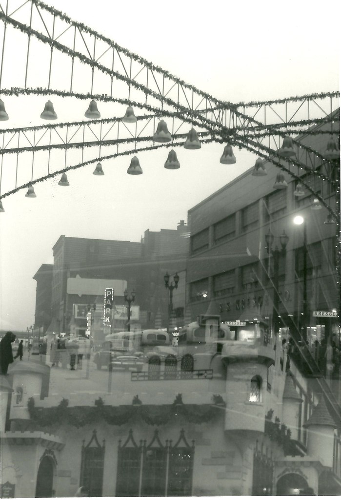
Let’s review: The Gateway Mall is a line of parks that runs between Chestnut and Market Streets from Memorial Drive west to 22nd Street. Right?
Other than the handful of destination blocks, few St. Louisans could readily identify the visual characteristics that define the Gateway Mall. Descriptions of the mall, like the one that I just offered, typically revert to geography. The mall’s boundaries are street names. The mall’s identity lies in what surrounds it, and not in inherent qualities that the user of Forest or Tower Grove parks offers to someone unfamiliar with those spaces. Reliance on a geographic description of the Gateway Mall is quite gentle, because to enumerate what the mall contains hardly portrays an attractive green space.
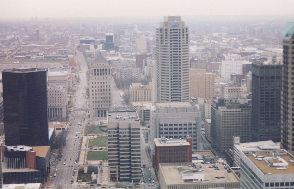
Can you spot the park mall in this aerial phtograph of downtown? (Photograph by Rob Powers, builtstlouis.net, circa 2004.)
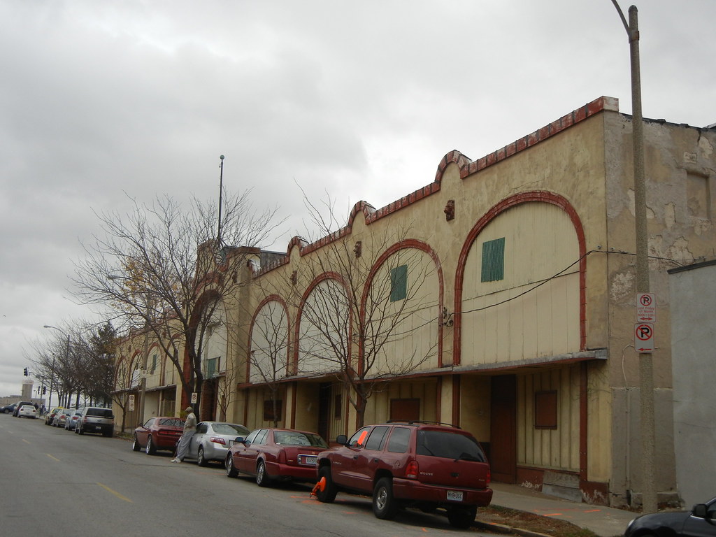
We have a jumble of mismatched blocks, from the passive formal parks across the street from City Hall to the postmodern ruins of Kiener Plaza to the sunken garden between the Old Courthouse and the Arch. We have monumental blocks like Aloe Plaza and the Richard Serra sculpture block that lose all of the drama of monumentality by being placed alongside interceding dull blocks of dead park space. We have interruptions like the Civil Courts and the Old Courthouse, a fairly pleasant juxtaposition if only there were not a poorly-wrought 1980s standing between the two. Some blocks are wide, some are narrow. Some are standard length and others form smaller super-blocks. The whole mall is almost hinged around the Civil Courts building, where Market Street bends slightly southwest. That bend precludes true symmetry.
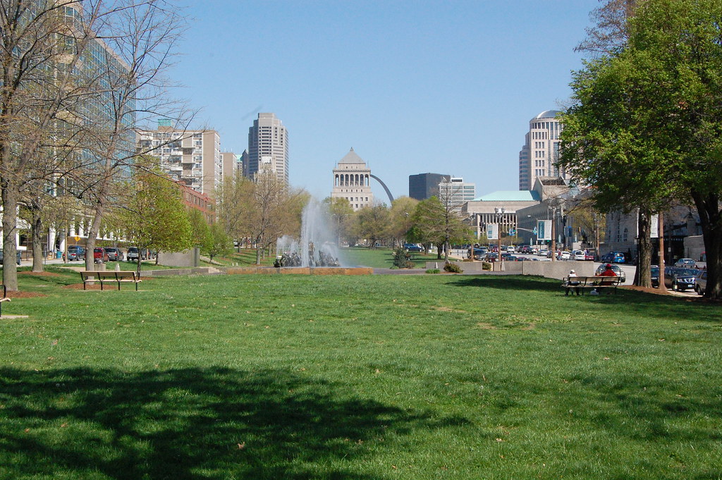
The view east from 20th Street. Here the view is pretty much coherent.
So what do we have? Currently, we have a green space running through downtown named the Gateway Mall. Is it a park? Landscape historian Tom Turner writes in his book City as Landscape: “If the space has no boundary, it should not be called a park. And if it has a boundary, the boundary should have a defined purpose.”
The Gateway Mall has no historic boundary. That is, its boundaries have shifted under various plans. Originally, it would have extended between Grand and 12th (now Tucker). Later plans had it extending east to meet the Arch. Nowadays, it does start at the western edge of the Arch grounds but ends rather haphazardly past 21st street. The terminus is a chain link fence separating and irregularly shaped block from a highway ramp.
The start of the new year puts us two and a half months out from the deadline for the Pruitt Igoe Now ideas competition. The competition brief and submission requirements are posted at pruittigoenow.org.
The competition takes as its starting point imagined futures that involve the remaining 33 vacant acres of the former Pruitt and Igoe housing projects. Submissions need not be architectural, and need not include a building program for the 33 acres. Essentially, entrants are creating their own programs and geographic boundaries. Pruitt Igoe Now’s organizers hope that submissions consider the larger geographic context of the site as well as the backdrop of land abandonment in the city.
In November, competition co-manager and Preservation Research Office Director Michael R. Allen published an essay on the competition process in Next American City, entitled “What Remains”.
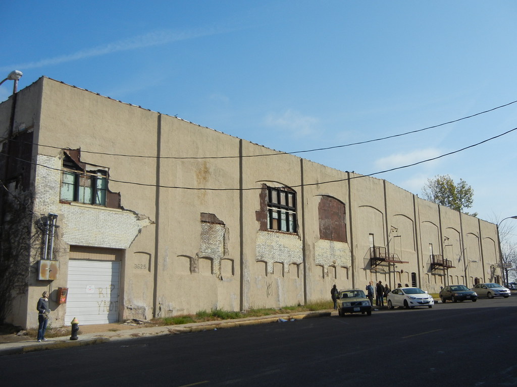
On December 12, the Building Division issued a demolition permit for the distinctive four smokestacks at the former Scullin Steel works near Ellendale Avenue and the River Des Peres. While the Scullin plant is tucked away south of the St. Louis Marketplace, the stacks are visible in many directions and are prominent landmarks for those driving down Interstate 44.
The Scullin works closed in 1981, and much of the site of the plant was remade as the largely failing St. Louis Marketplace. The casting building to which the stacks are attached is still in use, but the stacks have not been used since the plant closed. However they are in sound structural condition and occupy very little of the site.
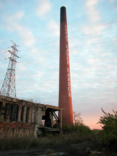
The smokestack at Carondelet Coke, built in 1953 by Great Lakes Carbon Corporation, was demolished last year.
Perhaps the smokestacks seem fairly expendable. Certainly, their utility has lapsed, and their location is remote. Yet the problem here is short-changing the future. As the River Des Peres’s life evolves in the 21st century, public access and improvements of the banks seems likely. Some day there may be paths along the river in this stretch similar to those found in the southern bend. What traces of the industrial heritage of Scullin will remain to inform users of that trail of the land’s industrial history?
The city’s Preservation Board unanimously voted to uphold denial of demolition of the landmark Pevely Dairy smokestack at Grand and Chouteau, and St. Louis University (owner of the stack) agreed to preserve it. That is some public recognition of smokestacks as cultural resources that provide visual delight in the cityscape. Yet many stacks, like those at Scullin, evade such care under the city’s preservation ordinance.
Last year, the robust mid-century stack at the old Carondelet Coke works was demolished. That smokestack had some noticeable defects in its masonry, and was part of a planned site reuse that seems to be less than certain. Yet some day a South Riverfront Trail will pass directly through the site, with perhaps an interpretive sign board marking the site’s past instead of a tangible and delightful architectural link. So it shall be at Scullin as well.
Undated photograph showing the view down Cherokee Street east from Iowa Avenue. Preservation Research Office Collection.
These two photographs from our collection show two eastward views from the late 1940s down Cherokee Street around Christmas time. Amid the wreaths decorating street lights are an array of shoppers and so many projecting store signs that a count seems impossible. These photographs really make clear how much signs and marquees are visually interesting and worthy parts of the historic built environment, unfortunately now discouraged or effectively outlawed in commercial districts by zoning and local historic district ordinances. (Apparently turning on a stopped historic clock on Cherokee Street is even controversial to the city government, despite the clock’s clear role in the physical fabric.) An exact date for these two photographs, taken on the same roll of film, has not been determined but visual information likely set the year between 1945 and 1950.
Also present is the tension between modes of transportation. The streetcar, whose sign reads “Jefferson Line” in the photograph above, is dominant in the center of the street, but parked automobiles outnumber the streetcars and their rider capacity. Soon they would be the only motor vehicles on Cherokee Street.
Above, we see the Casa Loma Ballroom at left in its present appearance, which dates to reconstruction following a fire in 1940. The Dau Furniture Company marquee at left projects from a lavishly-detailed terra cotta front on the building at 2720 Cherokee (1926, Wedemeyer & Nelson). To its right is part of the former Cherokee Brewery. Almost every building in this scene still remains.
Undated photograph showing the view down Cherokee Street east from Ohio Avenue. Preservation Research Office Collection.
To the east at Ohio Avenue, the view is even more abundant with blade signs touting various stores and companies on Cherokee Street. The northeast corner building, now home to Los Caminos gallery, was the the home of the South Side Journal. Frank X. Bick founded the newspaper in 1932, and it is now part of the Suburban Journals with an office in West County. Other signs include those for Fairchild’s and Stone Bros. attached the a now-vacant building once operated by Anheuser-Busch as the Kaiserhoff, and one in the far background for Ziegenhein Bros. Livery & Undertaking Company. Visible diagonally across the street from Ziegehein Bros.’ building is the sign of 905 Liquors, housed at Cherokee and Texas in what became the home of Globe Drugs. At the time this photograph was taken, murals by artist J.B. Turnbull adorned the walls of that particular location of 905.
This photograph captures the reflection of a Christmas castle and part of the Stix, Baer & Fuller Grand Leader store building (1906, Mauran Russell & Garden; 1919, Mauran, Russell & Crowell) spread across Washington Avenue. The view is looking southeast from Sixth Street, and the procession of buildings on the south side of the street is pretty clear despite the visual accident. The view down Washington is terminated by the elevated lanes of Interstate 70, completed in 1964, so the date of this photograph — unmarked and unrecorded — is 1964.
At right, we have the S.S. Kresge store at Broadway and Washington, which opened in its streamline-slipcovered building 1939. Across the street and to the east is a surface parking lot where the B. Nugent & Brother Dry Goods Store had stood until just a few years prior. That lot gets a view of the side wall of the J. Kennard & Sons Carpet Company Building (1901, Isaac Taylor), which otherwise presented elevations articulated and adorned in the manner of the Italian Renaissance. That building would later be expanded by the Edison Brothers Company after they moved their headquarters there. The Nugent site would give rise to the studious but dour modernist mass of the 500 Broadway Building (Smith-Entzeroth, 1970).
Further east, this photograph includes a rare glimpse of a seven-story commercial building that once stood at the southeast corner of Fourth and Washington that was once home to Trorlicht-Duncker Carpet Company. That building was demolished in 1966 to make way for the northernmost of the three-story Mansion House Center office buildings (Schwarz & Van Hoefen, 1967).
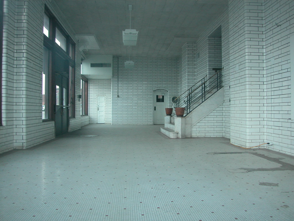
The lobby of the Pevely Dairy plant's main building.
Inside of the Pevely Dairy plant’s office building at the southwest corner of Grand and Chouteau avenues is one of the city’s loveliest factory lobbies. The white tile walls, largely white tile floor and white ceiling make for a gleaming and modern space. Both milk itself and the advances in sanitary dairy plant technology — namely, enameled masonry wall surfaces — are echoed in the design of this space. Here Pevely Dairy maintained a retail operation and soda fountain. The lobby led to offices and other spaces in the building, including a room where a bit of local radio history happened.
From 1953 until 1979, Pevely sponsored one of St. Louis’ last live radio shows, the Pevely Playhouse Party. Charismatic bandleader Russ David hosted the program, which ran on KSD until 1969 and then on WEW for its last decade. During its run, the program broadcast live on weekdays from 12:15 until 2:00 p.m. David and his band, which played jazz and dance music, broadcast from an auditorium inside of the Pevely Dairy office building — a room whose walls were lined with white tile! (See photographs here and here.)
The Pevely Dairy plant's main building. View from the south.
Today the Preservation Board will consider St. Louis University’s appeal of a denied demolition permit for the Pevely plant. The Cultural Resources Office recommends upholding denial of permits to demolish the main building and the smokestack, the two character-defining parts of the plant complex. While the Board deliberates, members will be applying the city’s demolition review ordinance. The Pevely Playhouse Party probably won’t come up in the discussion, nor should it. Still, the Pevely Playhouse Party shows that our buildings have many lives, and are significant to different people for different reasons.
by Kevin Belford, Christian Frommelt and Michael R. Allen
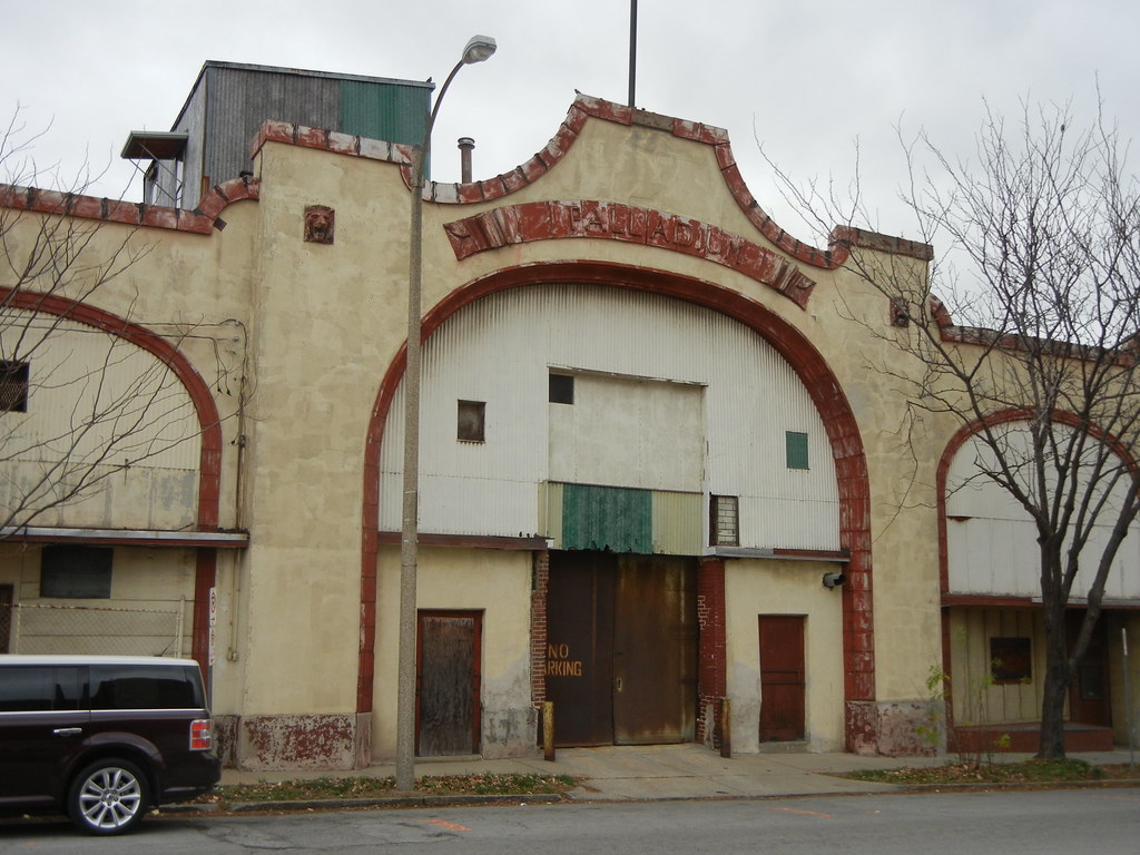
The Palladium Ballroom is located in the Grand Center Arts and Entertainment District of St. Louis. With Delmar Boulevard to the South, Enright Avenue to the North, and Grand Avenue to the East, the Palladium is one of a fraction of historic entertainment buildings which have remained since the early twentieth century, and one of the few remaining entertainment venues in St. Louis which provided both music for social dancing and floor shows to watch.
The former main entrance to the Palladium on Enright Avenue.
Appearing on the scene in the final days of ragtime and the earliest days of the jazz age, the Palladium was host to St. Louis’ early jazz bands. Continuing into the war years it was the Club Plantation, St. Louis’ gangster-run jazz and swing night club like the famous Cotton Club in Harlem, New York City. From its construction in 1913 through the early 1950s, the building has been associated with important musicians involved in both local and national development of dance, jazz and swing music.
The Grand Amusement Company obtained a building permit for The Palladium on August 18, 1913. The permit shows a construction cost of $35,000 for a two-story building with stores and skating rink. The dimensions reported were 152 feet by 220 feet. The permit also noted iron girders, a composition roof, terra cotta cornices and steam heat. Charles N. Lund was the contractor, and his office address was the same as the owner’s: 415 Burlington Building. James S. Lee was the architect, and his office was located at 6038 Delmar Avenue. Little is known about Lee.
Polk
The Grand Amusement Company opened the Palladium Rink as a roller skating rink on December 29, 1913. Soon after the opening, the company initiated what would become a strong association with local and national music and dance acts with a Sunshine Society’s Benefit Ball on January 19, 1914. Thomas Allan Rector and Irmgard Blebiger were the feature attraction and showcased, “the Argentine Tango, the Brazillian Maxixe, the Vienna ‘Hesitation’ waltz, and other modern steps.” 1000 couples were expected to attend the ball to dance throughout the evening to Gene Rodemich’s Orchestra, the first St. Louis jazz band to have its music recorded. After 13 continuous seasons, the rink was scheduled to reopen on September 9, 1926 after floor resurfacing, renewing skates, and comprehensive redecorating. New programming included Wednesday and Thursday party and club nights, Friday ladies’ nights, and a special feature each Saturday.
The building at 3618 Enright remained the Palladium Roller Skating Rink until 1940 when the Plantation Club night club, which had existed on the west end of the block at 911 North Vandeventer since 1931, replaced the roller skating rink. Almost certainly modeled after the successful Cotton Club, which opened in Harlem, New York in 1920, the Plantation Club offered the best working conditions and wages for blacks while also being the first venue to offer top black entertainment to a whites-only clientele. The St. Louis gangster, Tony Scarpelli owned the Club Plantation. The club operated as a set-ups nightclub, meaning they sold food and provided ice, soft drinks, and glasses and the customers brought their own liquor. This way they could stay open later than the 1 o’clock curfew for taverns– a liquor law work-around.
The northern (primary) elevation of the Palladium.
Scarpelli and other owners altered the building to fit changing uses. The city issued a substantial permit for alterations to the building to the Palladium Amusement Company on July 20, 1922. The cost of these unknown alterations was $3,200 with Lund serving as contractor. Additional permits for significant alterations date to 1933 and 1940. These are all interior remodeling projects.
Album cover for the Harry Edison Quartet's "Vogue."
As a 1942 Billboard review remarks, increased soldier and defense worker patronage provided for booming business and that year the venue installed air-conditioning units and booked a summer schedule. The Plantation Club also avoided the 1:30 am curfew through its set-up-only policy and drew its largest numbers in the early hours of the morning, offering shows at 11 pm, 1 am, and 3 am. Jeter-Pillars Orchestra, a well-established local band that included Harry “Sweets” Edison and Clark Terry, served to be the usual featured band, but top names in jazz and pop of the time, such as Jimmie Lunceford, the Mills Brothers, Nat King Cole, Ella Fitzgerald, Benny Carter, and others also regularly performed at the Plantation Club in conjunction with national dance acts and floor shows.
At the Club Plantation, two extraordinary young musicians joined the Jeter-Pillars Orchestra, bassist Jimmy Blanton and guitarist Charlie Christian. In 1939, Duke Ellington dropped by the club and hired away Blanton who, more than anyone else in jazz, made the string bass a solo instrument. In September of 1939, record producer John Hammond heard Christian playing with the Jeter-Pillars band and recommended him to Benny Goodman. The Jeter-Pillars Orchestra also saw in its ranks, Jimmy Forrest who recorded the hit single, Night Train.
"Make Believe" by Jeter-Pillars Club Plantation Orchestra.
By 1942, the Jeter-Pillars Orchestra became the most popular band in St. Louis with local radio shows on WIL and KMOX, and being featured on the national radio program, The Fitch Bandwagon. Popular St. Louis bandleader, Eddie Johnson talked about his memories of the Club Plantation,â€
I had a band that was twelve pieces. I had a chance to work with all these top bands in the country, like McKinney’s Cotton Pickers, Fate Marable, Duke Ellington … I opened the Plantation Club back in 1931, that’s when I had a fellow called Tab Smith in my band.
Advertisement for the Club Plantation.
In the interview, Johnson named a number of other St. Louis clubs from the 1930s, such as the Dance Box, the Chauffers’ Club, and the Finance Building but none of those landmarks remain today. The Jeter-Pillars Orchestra backed many popular national talents when they came to town including Louis Jordan. The biographies of Dizzy Gillespie and Miles Davis talk of the Club Plantation and the St. Louis jazz bands of George Hudson and the visiting orchestra of Billy Eckstine’s. Davis was eighteen years old and sat in with Eckstine and local trumpet man Clark Terry was in Hudson’s band. Terry remembered the Plantation orchestras as having the best local talent and being known nationally for their excellent musicianship:
We played the Club Plantation and all the acts from Nat King Cole to Ella Fitzgerald, Sarah Vaughan, the Nicholas Brothers – all acts came to the Club Plantation because it was a very, very popular place. They brought their music and we would play their music better than anybody ever played it. They would hear the music played like they’d never heard it played before. They would go all over the country, “Man, you got to go out to St. Louis and have that George Hudson band play your music. You’ll never ever hear it played like that.” So that’s how the band got their reputation. It was a great band.
The Club Plantation occupied the building at 3617 Delmar Boulevard until the early 1950s. A significant building permit dates to April 7, 1949, and encompasses alterations to a “bowling alley.” The owner reported was Nat Gordon, and the cost was $7,500. It is likely that the stucco cladding was part of these alterations since no other permit seems to correspond with that work. The city issued permits for small alterations to the Palladium until 1962, with one permit dating to May 27, 1952 with a reported cost of $8,000 possibly corresponding to major interior alterations.
The Club Plantation entrance was on the east end of the now-stucco-clad south (Delmar) elevation of the Palladium.
While various taverns and bars have passed in and out of the building’s storefronts, it is Veteran’s Village Clothing, which occupied the space between 1963 and 2006, that has kept the building in use and extant. In 2011, the owner of the thrift store passed away and the store was closed. Currently, the building is vacant. Recently, the Veterans Administration expressed interest in purchasing the building for expansion of the John Cochran Veterans Hospital to the north across Enright. Yet the Veterans Administration has not purchased the building yet, and its actions are subject to public input and the National Historic Preservation Act. Whether the Palladium remains standing as a reminder of St. Louis’ rich 20th century musical heritage ultimately is our choice as a city. Will we take action to keep it standing?
Stonebrook under construction in 1959. Photograph courtesy of Eva C. Kirkpatrick.
On January 14, 2011, Harris Armstrong’s Stonebrook (1959) was listed in the National Register of Historic Places. This article is based on the author’s section of the nomination; Andrew Raimist contributed sections on Armstrong and his residential work not included here.
Near the tiny village of Antonia in Jefferson County, Missouri, just north of Highway M and hidden in the forested hills, is Stonebrook. This small house is an excellent, unique work designed by St. Louis architect Harris Armstrong but whose origin is equally due to naturalists Kemps and Eva Kirkpatrick. Armstrong (1899-1973), whose reputation as a master of Modern architecture is well-established nationally, designed the house for the Kirkpatricks after they purchased the Stonebrook Forest in order to protect its wooded wildflower preserve. Due to the compact size, limited budget and design economy, Stonebrook was a singular achievement for the master architect. Yet Stonebrook’s design principles are also found in Armstrong’s larger, more costly residential designs.
A National Register of Historic Places dedication event was held at Stonebook on October 9, 2011.
Overall, Stonebrook is a very simple wooden house evocative of rural Swiss and Swedish residences. The house departs from Armstrong’s documented body of Modern residential designs in size as well as extent of owner involvement in design and construction. The Kirkpatricks had purchased the land to protect Stonebrook Forest and needed to live on the property for financial reasons. Their limited budget of $20,000 was first rebuffed by the great architect but quickly seized as a challenge. Stonebrook shows the same deliberate attention to design and sensitivity to site as his larger residential designs.
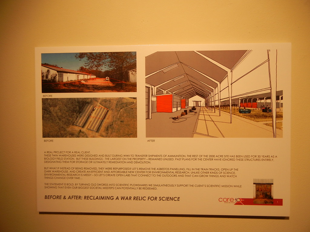
This imagined reuse for World War II ammunition sheds is included in the exhibit.
You are invited to attend an exclusive viewing of the exhibit <em>Sustainability and the Built Environment of the St. Louis Region</em> at the St Louis Artists Guild. Join exhibit organizers Dana Gray and Richard Reilly for lively conversation and artistic critique of artwork examining where we stand, as a culture of consumption, and where we may be headed in the future.
Also on view are photographic images by artist, Chris Jordan, from his series Running the Numbers. You will have an opportunity to learn about artists and designers juried in the exhibit, and perhaps see even yourself as an artist and agent of social change!
The St. Louis Artists’ Guild, is located on Big Bend, just north of Clayton Road, in Oak Knoll Park, St. Louis, MO 63105.
The Sustainability exhibit will be on view through January 6, 2012. St. Louis Artists’ Guild Gallery Hours: Open Tues. – Sun. Noon to 4 pm Closed Mondays & Holidays. Admission is Free! Holiday Hours: The Artists’ Guild will be closed December 24 to January 2. Regular Gallery Hours resume on Tuesday, January 3.
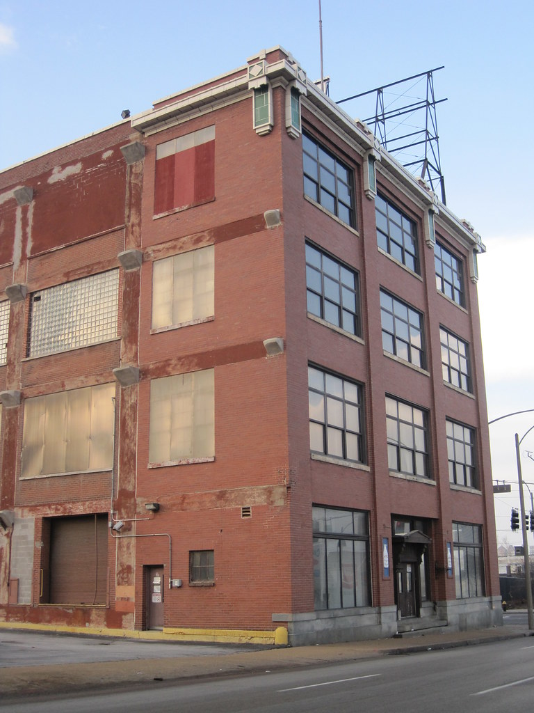
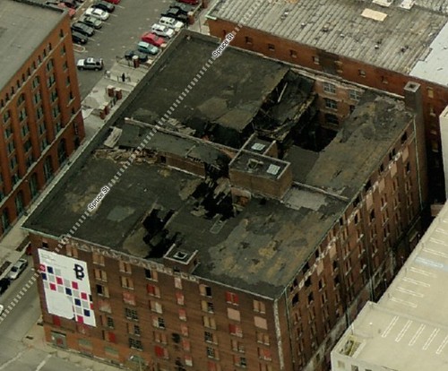
Last Monday, the Preservation Board denied developer Kevin McGowan’s appeal of a denied demolition permit for the Cupples Station warehouse now known as Building 7. At the meeting, Cultural Resources Office Director Betsy Bradley, who denied the demolition permit, recommended that McGowan focus on stabilization of the damaged warehouse’s walls. Architect Paul Hohmann, who has worked on many rehabilitation projects that have involved structurally-damaged buildings, testified at the meeting that it might be feasible to brace the walls from the exterior. Such work could keep the building standing, allow the closed streets around the building to be reopened, and cost not much more than the estimates $675,000 demolition cost.
An aerial view of Cupples Station Building 7 from Bing, dated 2010.
At the Preservation Board, attorney Bill Kuehling represented City Treasurer Larry Williams, and offered the dubious proposal in which the Treasurer’s Office would repay the $1.4 million that McGowan owes Montgomery Bank only if the building were demolished. Ostensibly the Treasurer is trying to protect its revenue from the hulking parking garage adjacent to Cupples 7, but inoffer its plan it is calling for the demolition of an official City Landmark. That a city official would ask a city board to not follow a city ordinance’s directions is absurd.
However more absurd were assertions by McGowan’s attorney Jerry Altman that stabilization of Cupples 7 would cost at least $8 million and would necessarily involve structural reconstruction and a new roof. That is not what the city is demanding, and sets up a false dichomtomy between expensive reconstruction and demolition. The middle path is simple, and probably costs less than the money the Treasurer wants to loan McGowan — maybe even closer to the over $300,000 that McGowan owes the city in unpaid property taxes. This is where leadership from the city, especially Mayor Francis Slay, could set a path toward a reasonable plan for stabilization of Cupples 7.
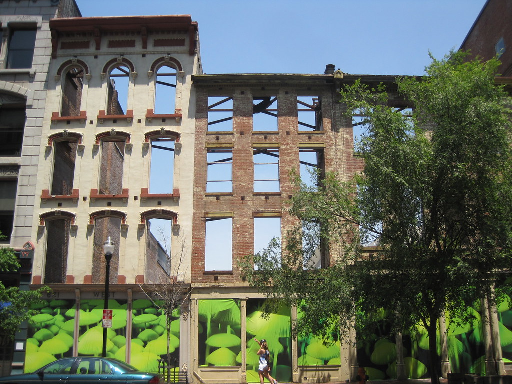
615-21 Main Street in Louisville.
In Louisville, city leaders required developers to safeguard three small, threatened facades on Main Street. The three 19th-century buildings at 615-21 Main Street are part of a cohesive 19th century block face, and their loss would have created a huge visual break. When developers proposed to build the Office for Metropolitan Architecture-designed Museum Plaza behind the buildings, the city made the developers stabilize the cultural resources they had purchased for the larger project.
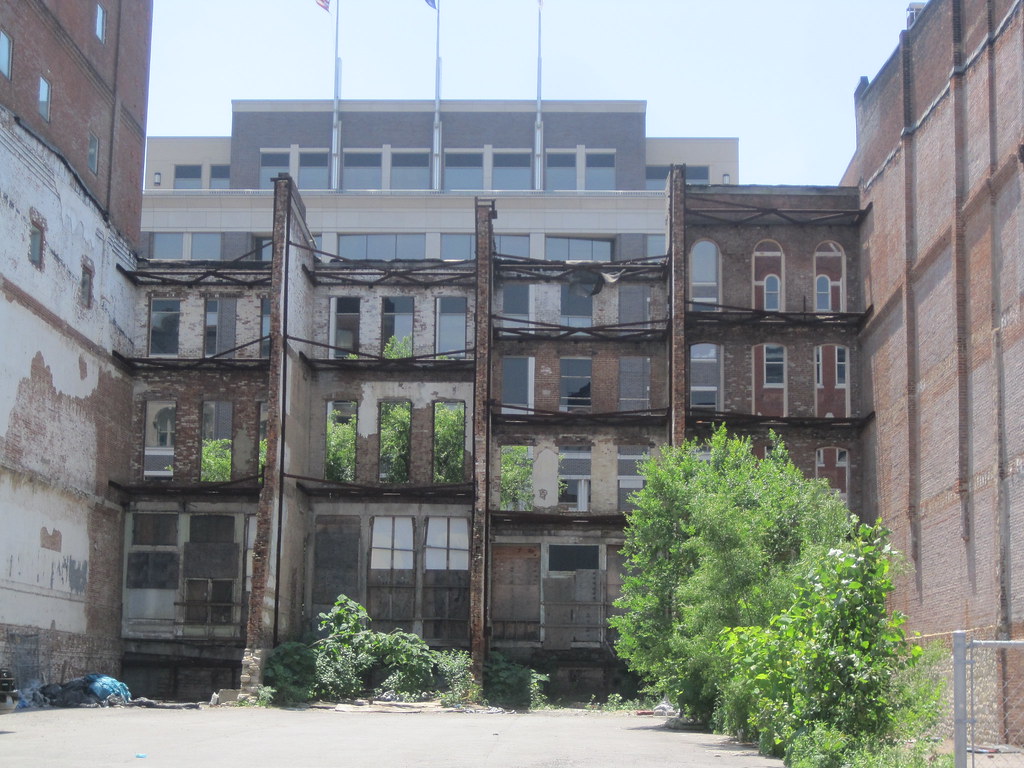
The facades are freestanding with some bracing behind.
Now that Museum Plaza is dead, at the least the city ensured these facades are retained for future development and the Main Street corridor’s architectural character remains intact. The developers even bragged about the stabilization when they announced that the project was over. Despite the cancellation of Museum Plaza, which would have brought world-class contemporary design to Louisville, the city still has a cultural achievement.
The back side of the stabilized facades.
In the case of the facades, parts of the side walls and foundations are retained to provide backing support. The stabilization work consists of steel members placed between these walls and the facade to provide simple and effective bracing. The project was straightforward — as stabilization always is.
For the moment, the storefront openings on these three facades have become an open-air gallery for artist Chris Doyle, who has installed photographs from his project Scenes from the Underglow. Behind the facades is temporary surface parking — a functional use that is screened from Main Street. In the next decade, something new and creative will rise in that space. Cupples 7 is not quite as easy a project, but unlike the Louisville buildings it has the benefit of being freestanding and not connected to other buildings.
Louisville’s city government recently forged a compromise with another developer that will stabilize facades on historic Whiskey Row. Damaged buildings will be demolished, but the facades will be retained to maintain integrity of the streetscape. Again, that’s a a pretty simple undertaking, and one that will benefit future generations as well as the property’s developer. That’s what happens when city government makes historic preservation both a priority and — most importantly — a practice.