Categories
Central West End Parking

Central West End View from 1953

by Michael R. Allen

This view of the Central West End dates to 1953 and was taken by the City Plan Commission to show the parking facilities available in the vicinity of Barnes Hospital. The photographer took the photograph from the twelfth floor of McMillan Hospital and aimed north up Euclid Avenue (left). In the foreground is the depressed railroad tracks now used by MetroLink.

Categories
Downtown Green Space

Ballpark Farms

by Michael R. Allen

Today’s announcement that the St. Louis Cardinals will build out the Ballpark Village site with a softball field and parking lot in time for this year’s All-Star Game is no big surprise. We all knew that Ballpark Village development was behind schedule, that the recession would stall the project further and that the Cardinals would hastily concoct some beautification plan before the All-Star Game. Yet this is definitely not what we wanted to show the world this year — a surface parking lot instead of an urban development under construction.

The softball field, however, is a good idea that echoes one offered by Rick Bonasch in a blog post on STL Rising dated March 27, 2008:

What about bringing the site to grade, removing the Ballpark Village Parking Lot, planting sod, and building one or two small diamonds for amateur games?

Sometimes good ideas take time to be adopted. One year isn’t bad in St. Louis!

The problem is the huge amount of surface parking that will be built on the site. While a softball field is whimsical, attractive and useful, a parking lot is the ultimate sign of the failure of civic imagination. Transitional uses can be helpful to an urban environment if they offer an activity as people await a development project. A new surface parking lot is not helpful to a downtown that has shed its stagnation for a new life as a vibrant cosmopolitan center.

I propose an alternative for the remainder of the Ballpark Village site that will represent the imagination that we all know St. Louis has. Here is my crude rendering of Ballpark Farms

Instead of a sea of asphalt, how about bumper crops of turnips, corn, greens and tomatoes growing in a new downtown farm? Ballpark Farms would offer more green space, an activity node, and educational possibilities for young fans. (High fencing around crops is required, though, to prevent trampling.) Ballpark Farms would show All Star Game attendees that St. Louis is good at coming up with creative, productive plans for its vacant land — that even a patch of downtown dirt is an opportunity we know how to seize.

Categories
Downtown Green Space I-70 Removal JNEM Planning

Landmarks Association Comment on JNEM Management Plan Calls for Better Connections

Landmarks Association of St. Louis submitted the following comment on the draft General Management Plan for the Jefferson National Expansion Memorial to the National Park Service:

Landmarks Association of St. Louis, Inc. was founded in 1959 with a mission to “promote, preserve and enhance St. Louis’ architectural heritage and encourage sound planning and good contemporary design.” Both facets of our mission statement compel our comment on the draft General Management Plan (GMP) for the Jefferson National Expansion Memorial (JNEM).

Generally, we find that the GMP includes many strong and useful ideas for a future design program that would preserve the unique modern landscape of the Arch grounds while transforming the connections between the landscape and surrounding urban fabric. Landmarks Association commends the National Park Service (NPS) on recognizing the extent to which the condition of the existing connections are a hindrance to both JNEM and downtown St. Louis. We are supportive of many of the ideas common to all of the Alternatives under consideration, including streetscape unification plans, improvements to interpretive programming and museum exhibits, increased visitor activities, improved pedestrian access and encouragement of development of the east riverfront.

True to our mission, Landmarks Association makes the following recommendations for the final GMP to clarify preservation of the Arch grounds and expand the range of possible options for improving connectivity:

1. The NPS should allow removal of I-70 in the GMP. The presence of I-70 at the western edge of the Arch grounds is the biggest obstacle to pedestrian access, at the Old Courthouse, Washington Avenue and other major entrance points. With the projected opening in 2012 of a new Mississippi River Bridge carrying I-70, the elevated and depressed lanes that sever the Arch grounds from downtown will no longer be necessary interstate lanes. One possibility at that time would be exploring a merger of I-70 and Memorial Drive into an attractive at-grade boulevard that would carry through traffic while creating a softer, pedestrian-friendly western edge to the Arch grounds. This idea could be explored through a design competition and traffic study. The current GMP alternatives would not allow exploration of this idea. The final GMP should include removal of I-70 within the parameters of a design competition.

2. The GMP should contain other options for a design competition. The NPS has included in the GMP alternatives a detailed and comprehensive understanding of the problems and opportunities of improved access to the Arch grounds. The preferred alternative calls for a major design competition for resolution of these issues, but we think that NPS has already created a framework for practical, incremental solutions. We think that a major design competition has the potential to generate design ideas incompatible with a landscape designated as a National Historic Landmark containing an iconic work of modern architecture. Division of the competition into phases based on specific areas where there are access problems could allow for an incremental implementation that resolves design problems faster and preserves the integrity of the JNEM landscape. An incremental approach would also allow time to build needed alliances with public and private entities that control infrastructure crucial to improved access but not contained within JNEM. The GMP should not bind the process to a single major design competition.

3. Site history must be part of program expansion. The St. Louis riverfront was the entry point into the city for nearly 200 years. The riverfront’s architectural, commercial and cultural history is key to understanding the significance of the JNEM site, and current interpretive program could be expanded to better tell that story. Architectural elements and artifacts from the riverfront could be prominently displayed in existing or new JNEM cultural facilities or made part of new construction.

4. The GMP should improve access and connections at all sides of the Arch grounds. The current GMP alternatives are weighted toward improvement of access at the western side of the grounds. Improved access at both the south and north ends of the grounds could forge connections between JNEM and the Chouteau’s Landing and Laclede’s Landing areas, both of whose development have suffered from circulation problems. The north end of the Arch grounds are adjacent to the historic Eads Bridge and its MetroLink station, but currently access and visibility of those resources from JNEM is impaired. The central riverfront is unattractive and lacks adequate pedestrian access. We strongly feel that preservation of the cobblestone levee is crucial to the integrity of the riverfront, but feel that parking is an inappropriate use of that levee. While not directly under NPS control, the riverfront offers possibilities for destination-type activity ranging from heritage education to restaurants or other venues on boats and moored structures. Improving activity on the levee itself is key to drawing JNEM visitors to the river itself.

Categories
Hyde Park North St. Louis

Grand Avenue Water Tower in 1957

This view looking east at the Grand Avenue Water Tower dates to February 1957 and was taken by the City Plan Commission.

Categories
Demolition Hyde Park North St. Louis

Treasurer’s Office Takes Down More of Hyde Park History

by Michael R. Allen

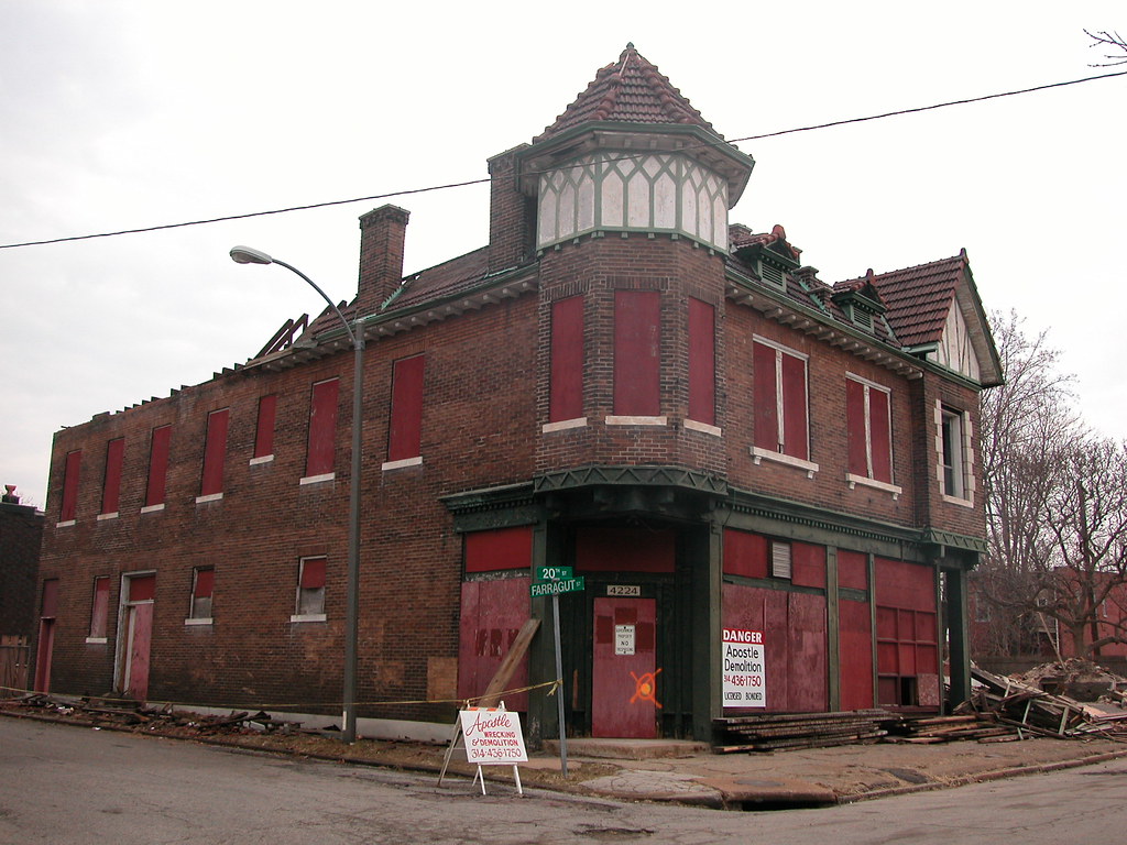
Did you ever see this lovely building at the southeast corner of 20th and Farragut streets? Too late now. While you soon can park on top of the site in a city-funded parking lot, you won’t be able to ever look at this corner store in Hyde Park again. Demolition of this building and two others on north 20th street between Penrose and Farragut — all contributing resources top the Hyde Park Historic District — started in February and wrapped up this week.

How did demolition pass by the Cultural Resources Office and the Preservation Board? As is often the case, the Building Division issued an emergency demolition order (on December 16, 2008) that trumped preservation review. Never mind that these buildings were sound under both the city’s preservation ordinance and public safety laws. The Building Division deemed that their sound condition somehow was an imminent danger to public safety. Or, perhaps, imminent danger to the neighboring occupant of the old Penrose Police Station at 1901 Penrose: the parking meter division of the City Treasurer’s Office.

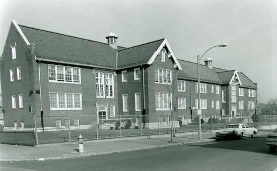
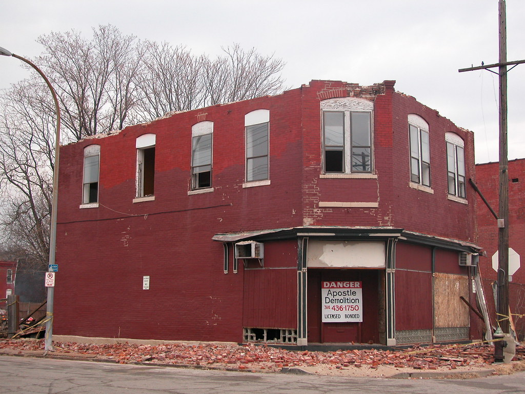
The building at the northwest corner of Penrose and 20th streets.

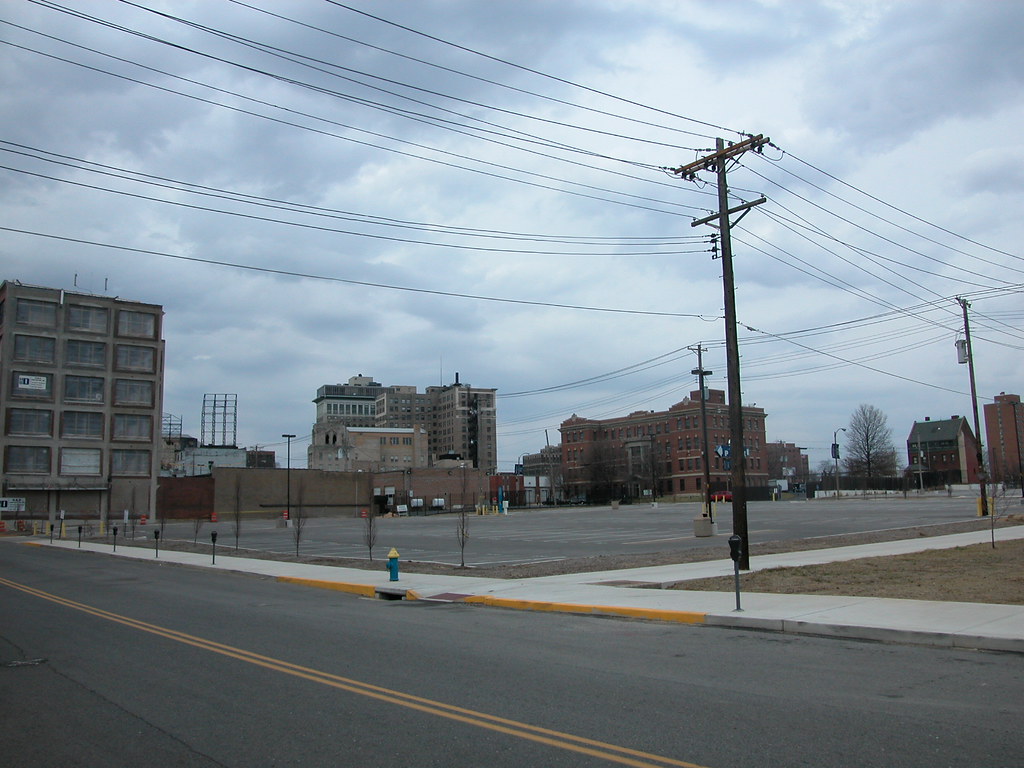
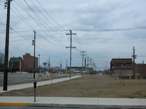
The City Treasurer’s Office has owned the lots on which the buildings sat for years. While these buildings could have been sold to tax-paying developers, the Treasurer’s Office decided to instead wreck them, remove taxable improvements from the land and keep the land under city ownership. Perhaps there is an ultimate development plan (hopefully not a parking lot, which would be absurd). For now, though, there is just another vacant lot in an area where there seem to be more vacant lots than buildings.

The lost buildings formed a remarkable group worthy of protection, and I regret never photographing them until demolition had commenced. The corner storefront at 20th and Penrose dated to 1895 and, while not overly ornamented, had a handsome cast iron storefront and chamfered corner. I don’t recall much about the house across the alley to the north, but its history was interlocked with its lavish neighbor to the north, shown in the first photograph above. That house, located at 4220 N. 20th, was home of Charles A. Roettger, who developed the storefront at 4222-24 N. 20th in 1907. According to its permit, the new building cost $9,800 to build — no small sum then.

To design this building, Roettger employed a distinguished north St. Louis architect, Otto J. Boehmer. Boehmer designed the perpendicular Gothic sanctuary of Friedens United Church of Christ (1908) nearby at the southwest corner of 19th & Newhouse streets. Boehmer also resided at 3500 Palm Street in Lindell Park from 1914 through 1933 — the house now occupied by former mayor Freeman Bosley, Jr., son of the alderman who represents the site of the new parking lot. The contractor for the new building was also a north side of German ancestry: Leo Motzel of 2217 College Avenue.

The corner storefront was a masterpiece of vernacular use of the Tudor Revival style. The corner turret, tiled roof with its false dormers, half-timbering and copper cornices are all fine decorative elements that created one of Hyde Park’s most picturesque corner stores. The building housed Frank C. Roettger’s (Charles’ brother) meat shop at the corner for decades following its construction. Another early tenant was Flora Loewenthal’s cigar shop at 4222 N. 20th.

The city directory listings name tenant after tenant in these buildings. The names shift from German-American to African-American at some point, until the word “vacant” pops up. Reading the names in the city directory and thinking about the loss of the buildings, one tracks not simply a loss of architectural stock, but a loss of life — lost names, lost uses and lost activity.

Categories
North St. Louis Storefront Addition

Storefront Addition: Hudson’s Embassy

by Michael R. Allen

I don’t have much to write about the architectural character of the storefront addition located at 3818 Page Boulevard. The building, with a storefront dating to 1924, could definitely have more of its historical character. That’s obvious. What I want to point out is how cool the name “Hudson’s Embassy” is for a record store, and how there is a certain thrill I get from looking at the proud lettering announcing the store’s name to passers by like myself. Hudson’s Embassy was one of many “one stop” retail/wholesale record dealers that emerged in the 1960s to sell records from labels like Atlantic and Stax to department stores and radio deejays alike. The store is a link with a golden era of American urban music — it ought to have a proud sign.

Categories
Historic Preservation Schools SLPS

SAB Approves Superintendent’s Recommended Facilities Plan

by Michael R. Allen

Last night, the Special Administrative Board unanimously approved the Facilities Management Plan recommended by St. Louis Public Schools Superintendent Kelvin Adams. The recommendations call for 17 school closures and the possible demolition of Mann School in Tower Grove South. (The summary and list are available here.) Adams first presented his recommendations to the SAB on February 26.

At last night’s meeting, three individuals spoke on behalf of Mann School during the public comment period, but the SAB ignored the pleas to keep the school open. However, the plan approved by the SAB would not close Mann until 2011 with a decision made next year, providing time for community input and reversal of the recommendations. Tower Grove South residents including the Block Captains association as well as Alderwoman Jennifer Florida (D-15th) oppose closing Mann and any plan that would call for its demolition.

Categories
Art Events

Houska Benefit for ReVitalize St. Louis

From Gayle Van Dyke of ReVitalize St. Louis:

Local artist Charlie Houska recently created and donated a unique painting of a St. Louis cityscape to a local non-profit. To benefit that non-profit [ReVitalize St. Louis], he is going to be signing limited edition giclée prints this evening. Details are below. These high-quality prints are $40 each and can be pre-ordered online or purchased and picked up at the Reception. There will be very cool $10
t-shirts available too.

Charlie Houska Artist Reception and Signing
Friday, March 13th
5:00 to 8:00 PM
at Blu CitySpaces
210 N. 17th Street, 63103

RSVPs to 314-495-2681 are appreciated.

Anyone wanting to purchase online, visit www.bigbigtour.org
for details.

By the way, if you haven’t had an opportunity to see the hip, contemporary condos at Blu CitySpaces, the 12th floor will be open for viewing during the reception.

I’ll be there and hope to see many of you there too!

Categories
Historic Preservation Schools SLPS South St. Louis Tower Grove South

The Fate of Mann School

by Michael R. Allen

Photograph of Mann School in 1989 from Landmarks Association of St. Louis‘ survey of St. Louis Public Schools buidlings.

St. Louis Public Schools Superintendent Kelvin Adams relieved many city residents with his closure recommendations, which number 17 as opposed to the 29 schools proposed by a team of consultants hired by the district in January. However, Adams raised the threat to Mann School at 4047 Juniata in Tower Grove South, which Admas is proposing not only for closure but also for possible demolition and replacement with a new building.

This recommendation is actually the one point where Adams is actually pushing a more severe threat to the district’s historic architecture than did the old-building-fearing consultants from MGT of America. MGT proposed closing Mann along with Shenandoah and Sherman schools, with all three south side elementaries combined at a new super-school in Tower Grove East. Adams wants Shenandoah to remain open, but is proposing a merger of Mann and Sherman in a new building he thinks could be built on the Mann site. A final decision would be made next year, but the crucial step is taken tonight when the facilities management plan is ratified.

The Mann site must be the most poorly-suited site in the district for construction of a new school building. When Mann was built in 1901 to designs by William Ittner, the ornate Jacobethen revival school was a compact two-story building on a compact site. Unlike those of other Ittner schools, the Mann site was not expansive and landscaped; it was small and paved, used for playground space. The school was in close proximity to buildings across the alley and across the street, in a siting beautifully urban. A 1916 addition that doubled Mann’s size maintained the relationship of the school to the neighborhood. (Paul Hohmann has great photographs in a recent blog post at Vanishing STL.)

Now, the school is landlocked in one of the city’s most stable and densely populated neighborhoods. Furthermore, the elementary school is doing well — enrollment is around 80%, the student base is 52% ESOL so south city’s immigrants are well-served, and 12 different organizations provide services at the school to students neighborhood children. This is a model neighborhood school. In fact, the state of Mann sounds a lot like the vision that members of the Special Administrative Board have for other elementary schools in the district.

Tonight (Thursday, March 12), the Special Administrative Board has a chance to save that model school. The Board will approve a facilities plan and closure list at its meeting, 6:00 p.m. at the Gateway Schools complex gymnasium, 1200 N. Jefferson. the public may address the Board at this meeting.

The largest step that the SAB could take would be removing Mann from the closure list altogether to safeguard its success and connection to the neighborhood. However, under any circumstances, demolition of Mann School should not be an option in the facilities plan. The SAB must amend Adams’ recommendations to prohibit demolition of Mann or any other historic school building — a condition now placed by the SAB in all sales contracts to private owners. Besides, rehabbing Mann or Sherman, or both, would be far more economical than building new.

This building, listed in the National Register of Historic Places in 1992 for architectural significance, is a unique gem in a strong urban setting. The site is too small for a new school. The school is doing well. Why force an awkward fit, lose a great building and tamper with a stable neighborhood?

Categories
Demolition DeVille Motor Hotel land use Midtown Streets Urbanism

Dead Zone

by Michael R. Allen

Over the weekend, I had the opportunity to spend some time at the site on Locust Street where the livery stable demolished by St. Louis University in 2007 once stood. The site would be located at the northwest corner of Locust and Josephine Baker Avenue, except that the university requested that Josephine Baker be removed.

The occasion was the filming of This Was the Future, a short documentary on the efforts to save the DeVille Motor Hotel (more on that film later). For the film, interview subjects were invited to select a site where a historic building once stood that is now an empty hole in a vibrant area. While it is hard to choose from some of the harsh empty lots we have in this city, I settled on what has to be one of the worst urban planning disasters in recent years.

The two-story livery stable building was a bridge between the emergent renewal in the Locust Street Business District and the more established revitalization of Grand Center. Grand Center’s motto is “the intersection of art and life,” an acknowledgment of the power of crossroads. Here stood a building that was a crossroads, and now we have an asphalt chasm, and not even a literal crossroads since one of the two streets here is now gone.

Even as a warehouse, the livery stable exuded more life than the parking lot on a busy night. On a Saturday afternoon, not a single car was parked on the lot, and few were parked at nearby meters. Clearly, the lot is there for special events. However, trading the potential of daily urban activity in a rehabilitated building for the occasional overuse of a parking lot makes no sense in a central city location. Not at all.

The side effect of the livery stable debacle is the spatial segregation (through building density) of Grand Center from the emergent area on Locust and of Renaissance Place (through removal of Josephine Baker) from St. Louis University and Locust Street. Human-scale urban renewal has finally come to Midtown on Locust Street and at Renaissance Place, and a potential connection between those successes is lost, and replaced with a land use that not only divides but is totally alien to the surrounding urban fabric. We could have done so much better.